Our 3km walk to the railway station was showery and quite blustery. Considering the lovely weather of late we were in two minds if we were doing the right thing going for a walk today but the train was on time, so well done Northern, it makes a change.
Our journey to Clitheroe would take us 1 1/2 hrs. The train stopped at every station including some places I’d never heard of before like Langho and Ramsgreave and Wilpshire.
Nearing Blackburn the clagg was really low and rain had started to come in through the partially opened carriage window. I thought to myself, well at worst we can visit the castle instead of getting a soaking.
As it turned out, when we arrived in Clitheroe it was just spitting. We needed jackets but not over trousers thankfully as it was very humid. Also, thankfully it wasn’t windy here like it was at home.
We set off west from the station through a sheltered housing complex and then turned right onto Kirkmoor rd where at the first bend we passed through kissing gate across 3 fields to join the River Ribble. On route we stopped for a chat with a farmer and a photo of his MF 5455 with mower attachment.
MF 5455 4wd
Down a set of steps at the river you get a great view of Waddow Hall. You certainly get the wow factor from it’s imposing position it but it is a Commonwealth training centre and not a hotel or country club. How they manage to maintain such a massive building I don’t know but they seem to. The Hall dates back to the 17th century built by the Tempest Family in the Tudor period and remained theirs until 1657 when Richard Tempest died in debter's prison. Obviously some massive upheaval happened here and it would be an interesting project to find out more.* Added. It would seem that Richard Tempest was a bit of a gambler and lost everything, ending up in debter's prison where he died.
Waddow Hall
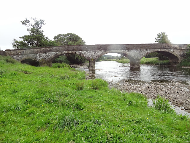
The river here is wide but not very deep and ideal for canoeing or pack rafting, or like us just walking beside. After the rain this morning the grass was wet and it didn’t take long for us to wish we had brought gaiters. The bottom of our trousers were wet through.Brungerley Bridge was soon reached and it’s a typical Georgian stone bridge of this area with 3 archways. It replaced an earlier wooden bridge which was destroyed in a flood around 1814 and replaced in 1816. This bridge has extending stone water spouts to drain surface water. Spotted by Sheila. It also has inscription on a stone on the western parapet at midspan.
Brungerley Bridge
Up the nicely constructed steps, through the wall stile and across the road we joined the path through Brungerley park and the Sculpture Trail which came to being in 1993 and has 20 sculptures by different artists. On route there are a few dead end paths caused by erosion but they are in the main signposted with diversions.
The choice is yours at this point, you can stay with the river or alternatively go through the old Cross Hill quarry which is now a nature reserve.
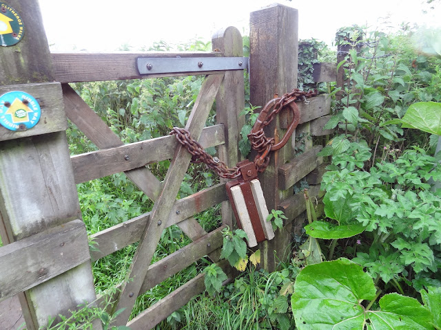
We chose to stay river side and follow the path down to Bradford Bridge. We passed numerous sculpture varying from tiled paths to wood carvings, all very good. The trail is through old woodland so we didn't realise it was raining quite hard until we came out onto the river bank through a small gate with a massively over engineering closing system.
In front of us we could see the working buildings of the massive Hanson cement works, which used to be Castle cement and Ribblesdale Cement before that. It opened in 1937.
The sound from the operations could be heard as we walked but it was more background noise rather than off putting. Whether that can be said from other locations i'm not sure.
The rain was now sweeping in horizontal and we sheltered for a short while under the trees. I took some pictures and didn't notice that the rain had landed on the camera lens until later, so sorry for any images with blurred round dots.
The rain eased a little so we set off towards Bradford Bridge. This again is similar to Brungerley Bridge in looks with its stone arches, but this one is Victorian and has 4 arches. It is also known as Horrocksford Bridge and was built between 1888 and 1891. Its a very narrow construction and is the cause of numerous accidents.
Bradford Bridge (with rain spots)
The river bank is followed closely upstream, through lush fields and open views. The river has a couple of places where stepping stones give access to the opposite bank. Today though the central stones were well under water, so you would have to be a bit mad to try it. Further up we came to a stile at a pump house that also had a large bore overflow pipe, probably from the quarry behind the trees.
Beyond here the path eventually leaves the river at a sharp bend and continues slightly upwards through Bond Hurst Wood. This is also part of the Ribble Way.
On the rhs we have the fence line of the quarry works. When it takes a 90 degree right turn the Ribble way carries on North East. The path following the fence line turns South East and is the one we needed but at this time of year it wasn't obvious due to the long grass and could easily be missed if engrossed in conversation.
The path undulates through fields of stock and as long as you follow the fence line it brings you out on a side road in Chatburn.
Ten very nice new houses are currently under construction on the side road. Turn left at the road and head downhill in Chatburn village. Cross the first main road which has a traffic slowing scheme in operation. Past a very nice local butchers, past two pubs the Black Bull and the Brown Cow. Both looked nice places but only the Brown Cow was open this Wednesday Lunchtime.
The easily missed path turning SE.
Its ok boys were just passing through, no need to get up.
We headed for the church and a quick look around its interior then outside to one of its numerous benches for lunch with a view. At this point the sun appeared and a bit of blue sky opened up to the NE.
Chatburn folk should be very proud of their village, its pretty, clean, well managed and a pleasure to walk through. Long may it remain so.
Post lunch we headed off down the footpath to Grindleton which is located between the Church and the school. Across well managed playing fields and kids park we crossed a stile heading through stock fields to pick up the Ribble again.
There were some odd signs saying Private, but they also had way marker badges on them so i presume the paths are now permitted routes but it can be a little confusing to newby's like us.
We were now headed downstream on the Ribble as far as Grindleton metal bridge which we crossed so that we could pick up the path on the opposite bank to which we had come. I can't find much about this metal bridge but i guess just like the previous 2 bridges it was washed away and replaced with a metal one at the turn of the twentieth century. (i could be wrong of course).
To get to the bank was a bit of a detour up the road to the first road turning on the left, past Skin House, where a small lane, Ribble Avenue on the left leads past some lovely houses through a gate and to the bank.
Cross over a small footbridge and head up towards the gates of a treatment works where the path goes left and becomes an obvious trod riverside. A number of stiles are crossed but the path is an obvious one and leads back to Bradford Bridge. The sun was now full on and the humidity high. With this mornings rain, steam was rising from the fields and roads and it was just like being in a sauna.
The lower trouser legs were removed and remained that way for the rest of the day.
There is no path on the north river bank beyond Bradford Bridge to Brungerley Bridge which is a real shame. This meant we had to repeat this section of river on our route back to Clitheroe.
Just after crossing Bradford Bridge we stopped to chat to a couple who were doing the Ribble Way complete and were then carrying on up the Pennine Way. Today though they were only heading for Sawley and accommodation. I hope they make the whole route, it will be a fantastic walk.
What we missed earlier due to the clagg was Pendle Hill, Browsholme Moor, Waddington Fell and the Howgills to the North. Now, with the clagg gone and the sun shinning they were all clear and amazing open views.
We made it back to the station at Clitheroe with 25 minutes to spare. The train runs hourly back to Manchester. We had walked 14.20km Clitheroe and back and a further 6km from home to station and back, so 20.20km total. My knee was sore and when we stopped it was a struggle to get moving. It proved to us how you quickly loose fitness and the need we have to get out more.
Chatburn Church
Grindleton Bridge
Ribble Avenue.
Sun's out, shorts on.
Meadow Cranes-bill.
Clearing Skies
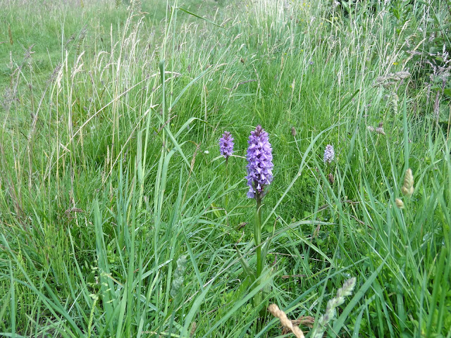
I think these are Military Orchids.
Young Goosander
Pendle Hill beyond Clitheroe.
Clitheroe Castle
Route, starting and finishing at Clitheroe station 14.2km.


