The Vault Regulars

Thursday, April 27, 2017

Firepot dehydrated food

A new range of outdoor dehydrated foods to try. Looks good energy provider.
 On my list for next purchase.
Click here to view the range.


Tuesday, April 25, 2017

Alpine tour 2 tent. GeerTop/Hillman. Model JT16010

Ever since i owned a Vaude Odyssee Winter 2 tent i have regretted selling it. For stability and wind resistance it has been 2nd to non in the order of tents i have owned. It did go to a very good home so from that respect i have no problems.

Our current 2 man tent is the Kuiu and it's an almost perfect tent. The problem it has and i have written about it numerous times here on the blog is the door design. The noisy flapping in strong windy conditions has now become a must fix or this tent will end up being only a low level summer tent which would be an absolute shame.
Deep down i have this feeling that this tent was never field tested in Alaska where it was supposed to have been designed for or the testers didn't test it enough.
I think i have found a fix for it and i have made more mods to it but the shine has gone off it for us.

Looking around at other tents and knowing how the Vaude coped with mountainous windy conditions i had that shape of tent in mind.
My instinct told me to look at the following tents.

  1. Terra Nova Voyager
  2. Snugpack Scorpion 2.
  3. Vaude Terra 
  4. Vango Mirage
  5. Lightwave G15 or T20
All similarly designed tents, similar weights but dissimilar prices.  I decided that i fancied the Voyager. Decision Made.
Then i saw a few Fjallraven tents and wondered if the Abisko Lite 2 would be a better choice as its not too dissimilar to the excellent Hilleberg Nallo.
I spent the next few days emailing Fjallraven with multiple questions and in the end decided that although its a superb tent it wasn't the one for above tree line in a gale. So it was out with that idea.

Back to plan A.

I went to the next stage and started reading reviews, watching youtube videos and reading numerous forums about the above tents. From there i discounted the Lightwave, the Vango and the Vaude Terra.
The Snugpack was much cheaper £200, about half the price of the Voyager's £380, but the voyager was 1/2 kilo lighter. Was the extra money worth the weight difference when the tent was divided by 2 people.
I decided it wasn't. So the Snugpack Scorpion 2 won the day.

Or did it!

Well no.
I almost clicked the spend button when on the Amazon page at the bottom, a row of similar products appeared "that you might be interested in" and within those photographs was this similar looking tent to the Voyager. I had never heard of it, called the GeerTop Tour 2.
I checked out as much as i could and then bought it. £134.00, great service from the supplier, delivered in 4 days. One site in the US was selling it for $419.00
It was available in red, not dissimilar to Hilleberg red and also yellow. I didn't want yellow as it attracts too many insects.

Package size 16cm dia x 42cm long, weight 2.3kg. (not too different from the Voyager)but both can be reduced.

Un-bagged and packed very well.
GeerTop Tour 2 Inner.

GeerTop Tour 2 fly
First Impressions.

  1. Cheap price £134.00 and delivery free.
  2. Excellent delivery service.
  3. Well packed and presented.
  4. Ripstop fly fabric.
  5. Strong groundsheet
  6. No faulty stitching
  7. Strong webbing
  8. Seams taped sealed.
  9. Not top quality guy lines and adjusters
  10. One way door zip on outer. 
  11. Good quality, lightweight pegs.
Impressive start and now to erect it.

  1. 3 poles, 2 same size, 1 shorter front pole with central angle.
  2. Easy slide mesh sleeves for all 3 poles.
  3. Poles locate into brass ring fittings at the ground.
  4. Simple to erect, there's nothing to confuse.
  5. Plastic clips, (std industry quality) joining the inner to the poles.
  6. 3 tie points where the poles cross over each other.
  7. Fly locates at each pegging point with a snap connector and grosgrain adjustment to tension the fly.
  8. 1 front and 1 rear air vent. Closable.
  9. Inner door with choice of solid or mesh closure. 
  10. 2 pockets for small gear
  11. Light clip.

I was pleased with it and looking around it at ways to get it even better, i decided that the guy lines would be too flexible for above tree line and also the aluminium guy tensioners just wouldn't hack it. I changed these to 2mm dyneema cord and tensioned them with ClamCleat locks.

The pegs supplied would have coped adequately but i had some lighter and stronger pegs already in my collection and so changed them.
I added a couple of clips to hold the poles where they crossed each other but that was about it.
The tent bag could be reduced in size and weight, especially sharing it between 2 people.
Nothing else needed doing.

Just to be on the safe side i decided to seam seal all the seams on the outside of the fly. This would add some extra strength and seal any sewing holes.


Tent Specification as supplied.

Fly - Ripstop nylon 20 denier 360T 8000mm waterproof Silicon coated, seam taped.
Inner - 210T breathable polyester with high density fine nylon mesh. (Midge proof)
Groundsheet - 210T PU waterproof coated, 8000mm taped seams.

Poles. Aviation Aluminium 7071 T6, 8.5mm diameter. Gold Anodised.
Pegs as supplied. Dur-aluminium 7075 T6. V shaped. 10grams each.

So who are GeerTop?
It seems that they are middlemen based in Hong kong and have warehouses in numerous cities around the world. Hence how the delivery was so quick, it came from GeerTop UK.
The name on the tent itself is Hillman and i'm pretty sure the tent was made in Korea or Vietnam * see update below. where lots of the well known tent brands in UK and USA are made.
Its difficult to pin point exactly as this tent is branded differently by numerous companies in numerous countries.
All i can say is that this tent looks good value for money. I cannot pinpoint anything on it that gives me the impression that it won't be just as good as the TN Voyager or the Snugpack Scorpion.

Here is a link to the website where i must admit i quite like the GeerTop 1 man tent with the inner but i have 2 good 1 man tents so thats a no no. Honest.
Click Here

Update. It is made in China, Now found the manufacturer's site. The link which I originally put here has now been deleted due to the product being replaced.

Monday, April 24, 2017

Bits and Bob's

Over the winter period we managed to acquire some new items that may or may not add weight enhance our backpacking kit.
We had both equipment and clothing to try out. Clothing will take more than one outing or local plod to do a meaningful review, but equipment either works or it doesn't. So thought i would pass on my findings.

Readers will know that my preferred stove kit is the Caldera Cone with the 12 - 10 stove. I find it so reliable especially when conditions are at there worst. To light the stove i tend to use a fire starter, steel and magnesium alloy bar. But i do take a gas lighter and waterproof matches as well. They weigh so little but can be a God send.

The trouble with meths as against gas is that you need to point the lighter downwards and the popular cigarette lighter flame normally turns upwards or goes out when inverted. Both these issues are solved when i purchased the Coney Lighter.

Coney Lighter.

The Coney is a gas refillable lighter with a rubberised feel. They are also available with a clear tank if you prefer and are also sold/badged with the name Zenga. Cost £4 from Amazon.

Size is 50mm tall and 15mm diameter.
The flame burns as a jet and with some power.
The red slider button is a flame lock or gas lock safety device which should be kept locked when not in use to prevent gas escaping.
It has a spring shut lid and is water resistant.

After it's first outing it proved to be perfect in the wind, lighting the stove each time without any bother.
It's flame can be a little difficult to see in bright conditions with it being a slim jet but you get used to it.
The lid is a proper pain and can get in the way when in inverted position. The image above shows the lid in its maximum open position. It would be better if it opened 180 degrees instead of just 90 degrees.
I tried to make it open wider when i got home but it wasn't possible due to the spring closure. I eventually decided to remove the lid completely which is an easy operation to do.

All in all this is a good lighter and perfect for lighting cold meths/alcohol stoves. This will be staying in the cooking kit. A good buy.

Power pack for iphone.

 Like it or not phones are leaving stand alone GPS devices behind.
Why bother to carry 2 devices.
Phones are faster at locking onto satellites.
Phones are lighter.
You can access all your offline maps from people like the Ordnance Survey, for example.
You can access your digital mapping supplied by the ever growing band of companies.
You can take photographs, video's, live video's for social media and believe it or not you can actually talk to people when you have a signal, send messages and do blogging.
So many Apps now enhance the phone that it's use is without question a benefit.

The problem with phones though is that the battery can run down pretty quickly and with the trend now of not having a replaceable battery we need an alternative for more than one day.

Note.
Nobody should rely on electronic equipment 100%. Always have a backup map and compass and know how to use it. I'm quite sure that today's youngsters will be gradually forgetting how to.

There are absolutely lots of power packs for phones on the market but many still rely on a cable to connect the phone to the power. We came across the one above which just allows the phone to slide into place onto a lightening connector. It can stay attached all the time if you so wish.
It adds a further 5500 mAh and on our 3 day trip we used 75% with lots of phone usage as mentioned above.
For something like the TGO Challenge where it is necessary to call HQ every few days and also occasional use as a GPS, i think this would last the whole trip starting from full charge.

Obviously you have the additional weight of 146 grams, but it's a cross we have to bear as lithium ion batteries are not lightweight. Having said that i don't think 146 grams is OTT.
The power pack also has an additional std usb port so that you can charge a separate non Apple related piece of kit. (cable needed)
When on long hikes its worth keeping the phone on Aircraft mode to stop auto backup and auto update from happening.
At £20 we consider this a very good buy.

Piddle pot. (my terminology)

When it's dark, raining and windy and you wake up bursting for a call of nature the last thing you want to do is get out of the tent to pay a call.
Lads can generally find lots of items to piddle into but for the ladies it seems to be a bit more difficult.
The She-Wee came out a few years ago but i have it on good authority that it was poor at best.
I then read about this piece of kit and thought i would get one and give it a try as its so cheap.
It proved so good we got a second one.
It expands and holds 3/4Litre. It has a leakproof secure lid. Suitable to both men and women.
Weight empty, 50grams.
Cost £2.20

Backpacking Tip.

Most of us i guess use dehydrated food when on multi day hikes. Each pouch requiring a different amount of water to rehydrate it. I usually end up doing a bit of guesswork as too how much say 325ml is for example. Then i end up with something that looks like soup or concrete depending how good or bad my guess was.
So we bought a water bottle with capacity markings on the side. I know you may be thinking, "thats obvious", but how many of us actually do have accurate measures for something as important as food on the move.
We bought ours from Sports Direct for £4. (not on the internet). Although it says on the bottle that the measurements are approximate, checking at home has proven them to be accurate.


Monday, April 10, 2017

Small Water to Swindale. Backpacking Day 3.

We were woken at 11.00pm, the wind had risen dramatically, it was dark, howling and the door of the tent was taking a battering. Fortunately it wasn't raining. I wrestled with myself on whether to get out and turn the tent 90 degrees.
I decided it was better to do it now than leave it, so out into the dark we went.
Turning the tent worked and we managed to drop off to sleep quite quickly.

We woke at around 3.00am to the door flapping loudly again. The wind had changed direction. Then it changed again. The problem was that Small Water lies in a steep sided bowl and the strong wind was simply swirling around us.

We drifted in and out of sleep until 7.00am when we decided enough was enough and packed up.
It was so windy it just wasn't worth making a brew or having breakfast. We would wait until we get down to Mardale car park.
Cold at Small Water.
After such a beautiful day yesterday it was a bit of a shock how cold it was today. Waterproofs on we set off. Looking back, the tops were mist covered but there was still blue skies and a promising sun in front.
taking one last look at our pitch spot we realised how stupid we had been to pitch there. Yes it was relatively flat, yes it had a good water source but if it had rained heavily we could have been swept into the tarn or at best have a river flowing under the tent. If the tarn had risen a couple of feet as it could have done, we would have been paddling. We were very lucky.

Just at the bottom of nan Bield pass we chatted to a fellow on his way up. He was going to walk over Harter Fell and come back down via Gatescarth Pass. We mentioned how windy is was at the top and what a poor night we had had.

At Mardale car park it was busy even though it was still early. We didn't stop for a brew but carried on the walk. We supplemented our hunger with some dry fruit and nuts washed down with icy cold water.
Now we were down lower it seemed like a completely different day. Hardly any wind and quite warm.
Fifteen minutes walk along the road and our turn off along The Old Corpse Rd came into view. The sign says Swindale Head 2 miles. It may be right but it seemed like a long 2 miles.
The route is steep to start with passing a couple of old ruins before it levels out crossing between Mardale and Swindale commons. One good thing about a short steep climb is the fantastic views you get.


 Mardale now gone under.
 View across to Riggindale.

 So its only 2 miles, Mmm?
Rowantreethwaite Beck waterfalls. (great name that)
 The Head of Haweswater
 Shepherds Huts or rest stops on the Old Corpse Road.
 High Raise and Kidsty Pike in the Background.
 Dropping down to Swindale Head.

The last corpse to "use" the road was in 1736 when John Holme was carried from Mardale to be interred at Shap. What a fantastic last journey.

The route drops down adjacent to a tributary of Swindale Beck. It's very boggy and especially so as we approached Swindale Head Farm. The path needs a maintenance crew urgently.
Here we met the valley road, its very quiet, peaceful and a pleasure to walk. Much new work has been completed on the Beck to promote Salmon and Trout and other Flora and Fauna.
It's been a big project, worth a read here.
Green Swindale
So that brings an end to our 3 day leisurely backpack. Our new gear got a testing and we learnt quite a bit. Walking poles became a must have, something i cannot believe i just said. But they helped the knee a great deal.
Tired, hungry but still smiling. 

Route Day 3.
In total we did 31.3km and 1,267 metres (4156 ft) of Ascent.


Sunday, April 9, 2017

Measand Beck to Small Water, backpack day 2.

The day started with a wake up call from Sheila at about 6.30am. The sun 's up she said. I'm not I said. But it didn't matter, once Sheila's up that's it. The trouble is her normal get up time is around 5.30am whereas mine is, well much later.
The sun was up but it wasn't great as sunrises go, the cloud was all wrong. It was warm though, and very still.

I got a brew going whilst still in my sleeping bag, and then decided it was too nice outside and so clambered over the stove, tripping and knocking it all over. Very, very lucky that the near boiling water went under the tent and not in it and also the meths was just about to burn dry. A lucky escape and a mental note made not to do it again.

Packing up the tent was a delight as it was perfectly dry and no condensation to wipe up. The day perfect, blue sky, almost cloudless and still. We set off at 9.15.

Crossing the bridge over Measand Beck the map shows a good path inclining left up onto Low Kop.
The map doesn't show the path made by quad bikes which goes slightly right from the bridge along the original footpath from Measand End to Four Stones Hill and swings left passing the old quarry.
However the inclining path does not exist on the ground, we used GPS to pin point where it should be and made our way up what is very steep and very rough ground. We eventually joined up with the quad bike track just before Low Kop.
The track then is extremely boggy all the way to High Kop and Wether Hill.
 Time for Breakfast
 Approaching the bridge over Measand Beck on a perfect day.
 The higher reaches from Skreel Side with some nice camp spots.

Quad bike erosion, all too much of it. This is High Kop looking towards Wether Hill.

  Once we hit Wether Hill and the watershed down to Martindale the views were stunning. We were so lucky. We saw our first soul here, a young lad jogging. Then 2 ladies fell running and a solo chat with a hellish pace on him. 

 The High Street path, an old Roman Road linking the forts of Brougham near Penrith with Ambleside is 2000 years old and is in bad shape, very boggy. I doubt the Roman Emperor would be
happy with it today. 
The rise up from Wether Hill to Red Crag and then to Raise is a long steady climb, good for getting the legs working.
The views are so good it needed a better camera than i had to really pick out the detail.
 Views from Red Crag of the Helvellyn Range.
Skylarks were following us and their cheery song enhanced the day. Reaching Raise had us stopping for a drink, it was really warming up nicely. Within 5 minutes of us reaching Raise, about 10 people came and went with a quick hello, nice day.
I pointed out Kidsty Pike to Sheila as from Raise it looks nothing and getting to the cairn is an easy plod. High Street on the other hand looks enormous, that great whale back of a hill filling the foreground. How they ever managed to run horses here is amazing. 
View from Raise looking west.
 Kidsty Pike, left. High Street beyond.
 High Street from Kidsty Pike.
 Kidsty Pike from a more impressive angle
 Approaching High Street
Wonderful view down Riggindale

 We followed the wall up to the summit of High Street, passing numbers of people going both ways. Dogs barking, phones ringing, it was like being in Manchester. So busy. 
It's a hard pull up to the trig point, which we did in sections of 40 steps, then stop, etc etc.
Getting to the summit meant more people, more dogs, more phones. We enjoyed a few minutes looking at the panorama of mountains and then moved off for Mardale Ill Bell.
 High Street Trig point. 828 Metres.
 View west from High Street.

 On the new path to Mardale Ill Bell.
View south from Mardale Ill Bell. Frostwick, Ill Bell and Yoke at the back.

 The path down to Nan Bield Pass is in good order and the crowds were starting to thin out. There are so many routes to get up onto High Street. The wind started to pick up and it was getting a touch chilly. Not complaining though, it was still a gorgeous day.
 Mardale Ill Bell top with Haweswater behind.
At Nan Bield Pass with our overnight destination in sight. Small Water.

 The pass has been improved since the last time i was here, it must have taken months to get all the stones in place. Great job.
A lady and i assume daughter stopped us for a chat. Nobody else had packs as large as ours. All day walkers. She lived in Askham, which is a nice place to live with lots of walking options. 

Down at Small Water we made our way around to the east side where a good green patch had looked inviting on our descent. It proved to be an ok spot. We brewed up and then got the tent up to get out of the wind. 
Camp spot to the right of small water where the sun is shinning.
I was close to having a swim but changed my mind once i got my feet into the water. It was a bit chilly to say the least. I settled just for a wash.
Tea was nice, we had Chicken Biryani and Morrocan Cous Cous with Chicken from Food on the Move. Both meals really tasty and can recommend them. Then for afters we had Birds Custard. great camping food.
We didn't get much of a sunset but the wind had picked up quite a bit, as it stated to get dark the temperature plummeted with the clear sky's. It was bed time.
 Overnight spot. Leave no trace camping.
A bit nippy for a swim.
 Wind picking up.

Our Route day 2.

Thursday, April 6, 2017

Swindale to Haweswater. Backpack day1.

After a cracking breakfast in The Abbey Cafe on the main street in Shap we made our way to Swindale, the start of what was hoped to be a leisurely 3 day backpack.

Swindale is now a quiet Cumbrian valley, a little bit like "the place that time forgot". You cannot drive down the dead end road anymore and in some ways this adds a charm to the place. If you want to walk the fells beyond Swindale Head then you have a fair walk to get to the start.

We however, were heading for an overnight camp somewhere along Measand Beck on the west side of Haweswater leaving the walk down Swindale for our return leg.

It was raining, of course it was, Sheila and I were out walking, so it was bound to rain. It had been raining since before we left the motorway on the way up.
We sat in the car at the said parking spot and watched the outside world come and go in the mist. A few sighs and a realisation that this rain was no shower made the decision that we might as well get going.

We had a few new pieces of kit to try out, for starters Sheila had her new over trousers, the right leg length this time, a new shell jacket a pair of trail shoes, an iPhone charger and rucksack. I had a new rucksack, a pair of over trousers and a water filter to try.

Our path started at NY521141 and it was more like a stream than a path, very slippery in places but otherwise clear.
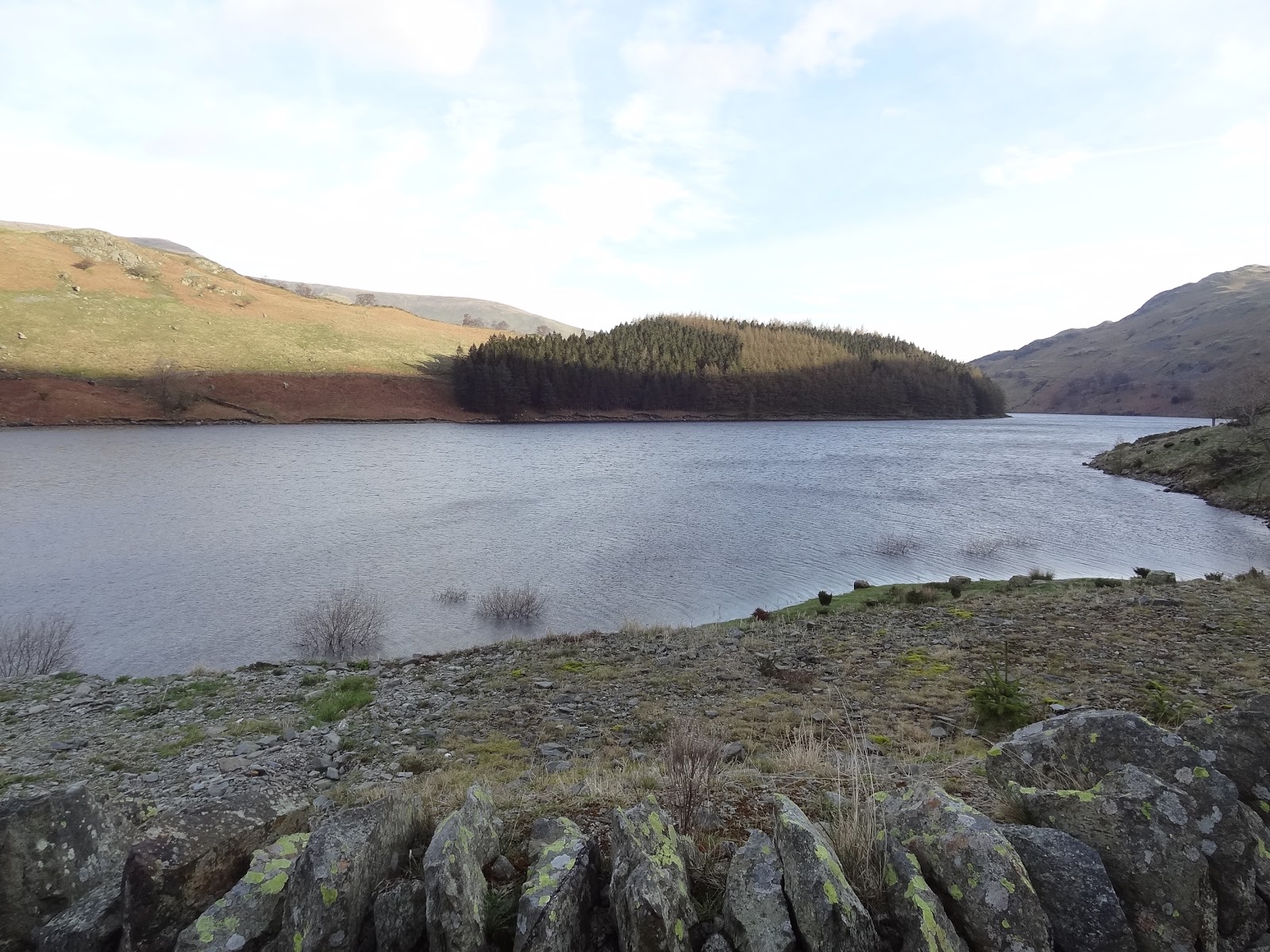
 The start, Swindale
Clear did i say, well it was clear until it disappeared on the ground at around 300 metres and then joined lots of paths not marked on the map. We stood atop an outcrop and surveyed the many routes.
As we were in no rush we decided to head up or along to Scalebarrow Tarn but it wasn't anything to shout about so headed back on track to the gate in the wall.
Heading for Scalebarrow Tarn.
From the wall, the route down to Naddle Farm is a pleasant one, even in the rain, many deciduous trees line the route and also the views start to open up to Haweswater. As we chatted i spotted movement out of the corner of my eye, it was a Red Squirrel. It stayed still on a bough and i had time to get the camera out. It was a bit far away and the camera doesn't have a view finder so i pointed, zoomed and shot. The result is far from great but at least i got a picture.

Across the ford my map reader said we need to take a left just past the buildings but we couldn't find a path. Naddle Farm is now the home of the RSPB and what a delightful place, however, re-checking the map the route definitely shows a left turn between the buildings, so back we went and found our gate nicely hidden from view by a very large trailer and a load of fence posts. Squeezing past we just about opened the gate to get through.
Boy was it a boggy path. It leads to the Haweswater - Mardale road where we were hoping to cross over the dam outflow by a bridge marked on the map.
The problem was that nobody had told the Waterboard that we wanted to go that way and the gate was locked, the deer fence high and rickety and the path a bit overgrown and unused. We made our way to the Dam end but again progress was blocked with chains and padlocks.

 The road back down towards Bampton was our only way to get across to the other side of the dam. The good thing was that whilst looking over the surrounding walls we spotted a Deer. Was the Deer fence there to keep them in or to keep them out? I guess the later and obviously it wasn't working.

At the bridge over Haweswater Beck a finger post and footpath leads into Burnbanks and so saved us a longer road walk. The path is a good one, lots of fungi and birdlife.
Haweswater Beck at Naddle Bridge.
Burnbanks is a non descript sort of place with nothing to keep you there. I suppose its a very nice place to live though as long as the dam holds. I wonder what the house insurance costs. Anyway i digress. 

Through Burnbanks it only takes a few minutes before your on the reservoir footpath proper. A very well made cast iron sign indicates the way. The rain was now intermittent but the path was still flooded meaning that waterproof gear would have to stay on a bit longer. 
The last time i walked this path was when i did the Coast to Coast but in the opposite direction.

Here we met the only people to be seen today, 2 ladies doing the circular route whilst the men folk did the high level option. The rain stopped, the path improved, at last waterproofs were removed. 
Blue sky started to appear and the atmosphere improved too. Its amazing what a bit of sun does for your well being. 

Before getting to Measand Beck we could hear the force of the water. We were lucky that it had rained so much, the force was with us. It's a truly wonderful Beck with many falls throughout it's length and a worthy walk to do it end to end. 
I have walked it before but it was many years ago, i didn't keep records then so i guess it must be 30 years ago. 

We were wild camping,  spending the night here or there abouts and i had a good grid ref. given to me by fellow backpacker and blogger Robin. Thanks ever so much. We went to have a look at the spot but decided that because of the good weather forecast we would prefer a view of the reservoir, especially hoping for a good sunset or sunrise being projected onto the water. 
We picked a good spot, i will email the GR if anyone is interested. (Al, you know where we mean)

 Reservoir track and the rain has stopped.
 Tail of Measand Beck
 Stopping Point with a view.
First job after getting the tent up was collecting and filtering water. I was trying the Soldier Filter for the first time in anger. I have to say its the worst filter i have ever used, almost useless, definitely hopeless for a backpackers needs. 
The outlet pipe that is connected to a plastic elbow which then fits into the body of the filter continuously falls out. Can be easily dropped into the water. The filter body has to be perfectly upright to pump the water through otherwise it lets air into the system.
I cannot get close to recommending anyone buy this. So it was back to my old reliable Delios.
 Late afternoon sunshine.

Dusk and getting cold. 
Food wise, for this evenings meal we had wet food which we needed to use as it's best before date had past. Pasta Bolognese. It filled a space, thats about it. 
The evening was leisurely, doing a crossword, drinking coffee and thoroughly enjoying the peace and quiet, the views to die for and the calm windless evening with no midges.
The lights came on in Bampton and the Haweswater Hotel. It was time for bed and looking forward to tomorrow.

Our route, day 1. Not long, just 7.5km with 304m of Ascent.
The knee did good which was a bonus.

Find it Here

About Me

My other blog. beneathwhosefeet.wordpress.com