The Vault Regulars

Tuesday, January 27, 2015

Rivington Round

I met 3 others, Martin, Viv and Neil at the visitor centre near Lower Rivington Reservoir. This was one of Martin's planned morning rambles of around 5 miles that I had kindly been invited to take part.
As the day was forecast to be reasonable and no rain I did expect to maybe see a few more faces but it wasn't to be. Just the 4 of us.
For me, this was to be my first undulating walk since my knee troubles and I'm pleased to report that all went well. In fact it turn out to be a good day as my Satmap Active 10 also worked faultlessly.
After a quick brew we donned our packs and away we went.
There was plenty to chat as it had been a while since I had last met up with Martin and Viv especially.
Martin's planned future visits will make his blog well worth a visit over the coming months and once again the sofa will be gathering dust.
Our Route. 8km.
Start and finish was from the Visitor Centre at SD628 138.

Reaching Rivington Hall we branched off passing the old tithe barn,  i was a bit surprised to find that scaffolding was still in place. I'm pretty sure that it was like this the last time I passed last year.

We were slowed down a bit by a larger group of younger plodders but soon our directions went in different ways. It was a bit muddy prior to reaching the good track that leads up to the Pigeon tower and along the old walled gardens planted years ago by workers of Lord Leverhulme.
It would seem that work has begun tidying them up.

Approaching Rivington Pike the wind picked up quite a bit and it had a cutting bite to it. We took some shelter on the leeward side but there was no lingering today. There was to be no coffee and prawn sandwiches at the top this time although Martin handed out the choccy brownies to ensure we had enough energy to make it back down. There was a suggestion that we would stop for a brew once we got out of the wind but this took a while to come to fruition.

As happens when you get to the top of the hill we marched back down again. Well slid to be precise. Still plenty of mud around.

On entering the folly of Liverpool Castle on the shores of Rivington Reservoir we found a sheltered spot for a brew.
The folly is a smaller replica of the old Liverpool Castle which was demolished years ago. Today its just a sad ruin.

Info from Wiki for those readers who may not know the park..
Lever Park is a designed landscape between the open moorland and the chain reservoirs which incorporates the village and buildings of Rivington into the overall design and is "one of the largest and most impressive examples of landscape design in Edwardian England". It is of national importance and historical significance but has been neglected and has deteriorated.[59] Situated on the east bank of the Lower Rivington reservoir, the park is named after William Lever, Lord Leverhulme,[60] who bought the estate in 1900 and donated 364 acres (1.47 km2)[61] of land to the people of his native Bolton as a public park. Under the terms of a compulsory purchase order, William Lever was allowed to continue with plans to lay out Lever Park at his own expense, and he maintained it during his lifetime. The park opened in 1904 and contained a boating lake, a zoo, tree-lined avenues and a network of footpaths. A folly, Rivington Castle, was built as a scale replica of Liverpool Castle at Coblowe Hillock near the Lower Rivington Reservoir.[62] Lodges were built at the entrances to the estate, including Stone House Lodge at the main driveway.

A replica of Liverpool Castle in Lever Park
Roynton Cottage, originally a single-storey wooden bungalow, and its extensive gardens were the private property of William Lever, which he used for weekend visits and entertaining, high on the hillside below Rivington Pike.[60][63] The bungalow was destroyed in an arson attack by suffragetteEdith Rigby, on 8 July 1913.[64] Its replacement was built of stone. Thomas Mawson designed the 45-acre (180,000 m2) gardens between 1905 and 1922.[65] The private gardens contained terraces and a pool, a Japanese lake and pagoda, Italian-style gardens, a seven-arched bridge and the Pigeon Tower with Lady Leverhulme's sewing room on the top floor.[66]
After Lever's death Roynton Cottage was acquired by the Bolton brewer, John Magee. During the Second World War the bungalow was requisitioned to be used as a billet for troops, and nissen huts were erected in the grounds. After the war the site was acquired by Liverpool Corporation, who decided to demolish the building.
In 1974 the park and gardens passed to the North West Water Authority from Liverpool Corporation, and to United Utilities on privatisation, and are maintained as a public country park for the people of Bolton, protected by rights afforded by the Liverpool Corporation Act 1902 ensuring “Free and uninterrupted enjoyment by the public”.[67] The listed historic landscape of Lever Park now forms part of Rivington County Park and is used for recreation.

Leaving the castle and following the shore line we spotted a tiny wood mouse crossing our path. It was quite easy to catch and photograph before spotting a second one which found a hole beside a tree root and disappeared. These we tiny wee things and we put the captured mouse back beside the hole where it too disappeared.

We took a longer detour back to the visitor centre but all told it was only 8km. It was certainly very pleasant to be out again in good company.

 View across Rivington.
 The Pigeon Tower
 Rivington Pike. 362Metres.
 On the way up.
 Winter Hill
 Viv and Winter Hill Masts
 Lower Rivington Reservoir
On the way down.
 In the replica of Liverpool Castle
Cute tiny Wood Mouse

Thanks Martin for arranging the walk. I look forward to the next one.


Sunday, January 18, 2015

Winter has arrived. Just.

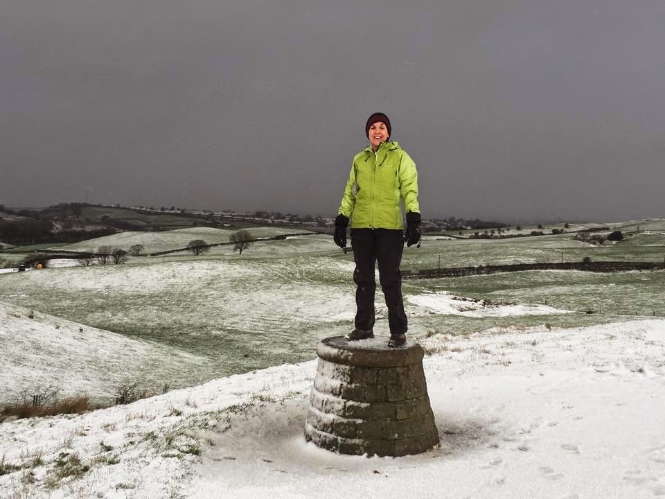
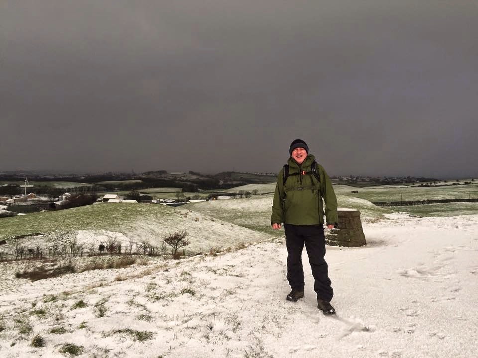
Yesterday brought a stormy day. Not particularly high winds but snow laden clouds, snow showers and a chill. In comparison to other parts of the UK we were not having it too bad.
We had some fantastic skies to watch change minute by minute as well as watching the route of the falling snow as it enveloped the surrounding countryside. I don’t think it really got light all day.

The physio on Friday was pleased with the progress I was making with the knee but insisted that I shouldn't do more than about a 5 mile walk this weekend.
We had to go and pick up our meat order from a local farm and coupled with a visit to Tandle Hill park would just about make it 5 miles through nice scenery.
Considering that we had a light snow covering we were suprised that we saw so few people out enjoying the conditions.
So although it wasn't anything special, here are a few photos of our bimble. Taken with iPhone 6 and very small file size..


I tried but couldn’t push it over.


Monday, January 12, 2015

Wired for sound or just a knees up?

The day has finally come where I admit defeat. All my efforts to try and improve my knee problem have come to nothing.
I've tried almost everything that an ordinary man in the street can do and after 6 weeks of pain decided enough is enough.
I have today had a consultation with a Physiotherapist.
I have had my leg stretched, bent, twisted, plied with electricity, and wrapped in hot towels.
The verdict right now is that I don't have anything long term seriously wrong. It seems I have a problem with the medial meniscus. This stops the femur from moving side to side. He also shocked me a bit when he noticed there is some muscle wasting. He also wants to check out my Superfeet insoles to see if they are doing me any good.
The physio hurt quite a lot and the exercises I have to do hurt as well. I hope he is right in his diagnosis.
So I have to go back for further bouts of leg pulling, lol,. Next visit Wednesday. Cannot wait.
Those of a nervous disposition should look away now.


Wednesday, January 7, 2015

Mountain Equipment Arclight jacket Review.

The Mountain Equipment Arclight jacket was my replacement jacket for the failed Montane Minimus mountain Jacket I reviewed here.

In some ways i have Mark to thank for his comment on my Montane post for me buying this jacket. With my own cash i may add.

This is not going to be a comparative post because the two jackets are completely different. The Montane being Pertex shield +, whereas the Mountain Equipment Arclight is Polartec Neoshell.

The ME Arclight is a shell jacket in the more traditional mould. To the untrained eye it could be forgiven if you thought it was Gore- tex or similar membraned jacket. It feels somewhat similar especially internally but the outside is softer unlike most Gore-tex. Obviously a great deal of thought went into the term “Softshell”.

So what is Polartec Neoshell?
It’s another relatively new material, as the term “neo” suggests, on the market from the people we have known for years who have made superb fleeces. It’s classed in the Ultra Breathable range of outdoor jackets.
Neoshell has oleophobic properties within the membrane and not glued on top of it as with Gore-tex. No, i had no idea what oleophobic was and found out that it is similar to the coatings that you can find on tablet screens like ipad to stop oil and grease from soaking into the screen and what makes removing the stain easy with a screen cloth. However, you need to look after the coating because certain chemicals can remove it, in which case just like the screen will deteriorate the jacket.

Its claimed that this is the first breathable, fully waterproof, temperature regulating fabric ever, but i’m not sure about that because i know that Aclimatise were working with a fabric stating the same message.
Have a look here. I had a prototype on test from Brenig ages ago.

Info from Polartec Neoshell web page.
(Check out Polartec site for more info here if you want to read all about it)

The fabric is stretchy and the cut is not too athletic although they have cut it to avoid a baggy fit. I am told by a good contact that ME have relaxed the fit generally.

Let's leave the fabric data behind and take a look at the jacket.
The colour of mine is Raven or in customer speak, Grey.
It is also available in Gecko (Green) or Cayenne (Red).
Specified weight (Size L 520grams, Medium 490 grams.
Actual weight for size medium 465 grams.(My scales)

RRP is £260. I have found prices to vary wildly on this jacket and I actually paid £118 for mine. For some reason the price also varies at differing outlets depending on colour. Look around for the best deals if you are thinking of getting one. I got mine from Hill and Dale. it was on a special offer at the time and i happened to be in the right place at the right time.

The Hood.
                 It is huge. I think it is the biggest hood i have ever had on a jacket. Its so big i could almost camp in it. It is obviously designed with a helmet in mind, but what helmet i am not sure. It will probably fit most if not all helmets for climbing, cycling, snow sports and probably the Grenadier Guards.

Adjustment.
Nothing unusal about the adjustment. It has one rear shock cord volume adjuster and separate shock cord adjusters either side of the face which close the hood off around the face. They use the small ellipse cord grips to retain tension.
The rear adjuster worked well and where the shock cord enters the hood the hole is protected by a flap on the outer fabric.
I have always found that shock cord wicks water which enviably creeps into the lining. I am amazed after all these years of design that a better way of adjusting the volume has never come onto the market. It’s as though everybody are waiting for someone else to develop it instead of themselves and then jump on the bandwagon.

The side adjusters are quite poor. The amount of adjustment is limited to around 50mm each side and once you reach that limit, if it doesn’t suit your face then it’s no good pulling any harder because that is the full adjustment.
The chord does not go across the front of the hood but is restrained adjacent to the peak on each side. I have found that i could not secure the front tight enough to make what i want, and that’s as near to a watertight seal as i can get. I still have tiny gaps where the material bunches up at the sides.
The shock cord is 2mm diameter and has far too much stretch for my liking. I can adjust each side single handedly by just pulling the two cords simultaneously downwards. I am fearful of pulling the cord out if i try to hard. Trying to squeeze open the chord grips is impossible with gloves on and not too easy without.

The peak on the hood is firm and wired. It does not flap around in the wind. I am in two minds about the angle of the peak. Some people may like it or like me some may think it is a little too steep.
Yes, the peak should keep rain and wind out of the eyes and it certainly does this well but i have found it can cover my eyes to the point where i have to keep moving it up or pulling on the back of the hood to see out front.
The easiest way to describe it is to say look at a Household cavalry hat peak. The angle is very similar to this and not at all like the peak on a baseball cap. This angle of peak is there to ensure soldiers hold their heads up, backpackers get a stiff neck.

Household cavalry hat peak.


Baseball cap peak.
In my opinion the right angle for a peak is in between the two.

The hood can be folded up and secured in place at the collar. To comfortably wear it with the hood folded you need to fully release the 3 hood shock cords. It does sit neatly when you do this.
The hood does move with the head when in full adjustment and the height and cut of the front of the jacket sits just under the nose and so provides maximum protection.


ME Arclight Jacket. OS map outline can be seen in the pocket.
Fold down hood
Zips.
The front main zip is a 2 way moulded YKK Aquaguard.
The 2 pocket zips are single way moulded YKK Aquaguard.
The pit zips are 2 way water resistant YKK Aquaguard with laminated and bonded entry.
The inside pocket is single way non water resistant YKK zip.

With the exception of the inner zip they all have zip pull toggles. I found the inner zip to be awkward to grip with gloves on and so fitted my own pull toggle.
I found the main zip and the two pocket zips to be very notchy and i don’t particularly like them, the pit zip and inner zip run smooth.

"A" line pocket zip and main zip

Behind the main zip is a flap to allow water run off if any rain does penetrate the zip. It stays closed at the bottom with a press stud. I must admit that i do hate this concept. Manufacturers now use the zip as a fashion feature, a colour mix. To me fashion is a secondary consideration, i prefer a storm flap over the zip, just like the Bergen from Rab. But i think i am losing the battle.
There is a good chin or nose guard on the top of the main zip.
There is no inner protection to the pocket zips or drain if water gets in.

Pit Zips. 
Now when i see or read Pit Zips i straight away think this jacket doesn’t breathe too well. I can 100% dash any concept of that thought. This is very breathable material. The under arm venting offers additional air movement if required. I have kept the zips half open for most of the time and so far i havn’t had any water ingress through them.

Pit Zip
Pockets.
There are 2 well positioned outer “A" line pockets  and they do not interfere with the rucksack straps. A rucksack hip belt also does not interfere.
They are a very good size pocket with excellent depth and take an OS map with ease. (See photo above showing folded OS map in situ.)
The 2 pockets are outside of the ‘Membrane” and so any water that gets through the zip should not get through to the body.
 The inner pocket measures 12 x 20.5 cm of useable space and is mesh.
Inner mesh pocket with pull tab.

I was a little surprised to see Mountain Equipment’s honesty (I’m not saying they are dis-honest btw) in that they put a notice in the pockets to say that although the zips are water resistant it is possible for water to get through and not to put sensitive items in them in bad weather. I appreciated that, a refreshing change.


Cuffs. Hems and toggles.

I am really impressed with the cuffs. The cut of the cuff is such that the top side is longer than the underside. This allows good water run off and reduces the amount of water ingress that can creep under the hem.
The sleeves also have a pre-shaped triangular opening which i have found excellent for getting over the top of my glove cuff. I have never seen this before on a jacket.
Cuff shape.

The length of the articulated sleeve is just right for me and long enough to cover my outstretched hand. The cuff can be fastened over my clenched hand which i like to do instead of wearing gloves  and the cuff is secured with an adjust to fit velcro tab.
I find the velcro on the sleeve a little to narrow and numerous times i have not secured it right first time. I would prefer a 25mm wide strip here rather than the 15mm.

The bottom hem has a draw cord. In fact it has two. I really liked this idea and again this is the first time i have come across this configuration. The front and back hems can be tightened or loosened independently of each other. The cords located at the sides are also separate outside of the jacket so there are no side loops that can and do easily snag.
The cord and cord grips are the same type as the hood.
The rear hem drops lower than the front and covers the bottom well.

Lower hem individual draw cords for front and rear hems.

Drop down rear tail.

Inside.
All seams are taped sealed. As can be seen on the image of the roll down hood.

Cut.
Not overly athletic but not baggy either. Slightly longer than some lightweight jackets.


The above photograph was taken after i returned home from a walk in the rain and wearing a rucksack. For some reason the area where the rucksack straps had put pressure on the shoulders and across the back showed signs of wetting. Maybe the area under the rucksack didn’t have chance to allow water run off but its something i will keep my eye on. No wetting through the fabric took place i add, just the outer shell material.

Likes.
Breathability
Waterproof
DWR (from new)
Feel of the fabric.
Small pack size.

Dislikes.
Notchy zippers.
Overly large hood. (Unless you regularly wear a helmet and then it will be perfect)

Conclusion.
This is one of the best materials i have ever tried so far. The breathability and waterproofing are both excellent, exactly what waterproof and breathable should be. I found that if i put items in the pockets like the OS map or my phone then i got condensation on the items. The movement of hot body vapour is so good.
With a material so good at transferring heat to the outside why block the route by clogging up pockets, it doesn’t make sense. For me the pockets could be eliminated. I certainly will not be putting anything in them from now on.
It does have an initial cold feel for about 20 minutes. Combine it with an insulating layer in really cold temps.
An excellent mountain jacket for all typical UK weathers.
Longer term review to come.

Similar products worth considering.
Rab Myriad.
66º North Snaefell
Montane Further Faster Neo.

Or if you have lots of Christmas money left then:-
Jottnar Bergelmir


Monday, January 5, 2015

Blackstone Edge and Green Withins Reservoir


Start and finish was the car park next to The White House restaurant, which is on the A58 just left of Blackstone Edge Reservoir. SD 968178

Yesterday (Saturday) i tried out the knee again doing a local walk of around 6-7km. Having returned home with nothing detrimental we decided that we would try a “Proper” walk and see how that goes.
The forecast overnight was pretty chilly with frost and temperatures falling to -3C.

Driving to the start point was easy enough once i had defrosted the car which seemed to take ages, all the roads had been gritted. 5 other vehicles were already in the car park when we arrived at about 9.50am.

It was certainly chilly around the ears as we donned our boots and jackets but it was a clear day in the majority of directions except over Manchester which was misty.

We crossed the A58 and headed for the trig point on Blackstone Edge. The grass was crispy white and all the puddles left by the recent rain had frozen into beautiful shapes and patterns. In front of us was a guy walking his dog. His breath clearly seen against a blue backdrop.
The sun was low to the SSW, we needed sun glasses on.
Starting along Blackstone Edge
We followed a water collection channel instead of going straight up onto the moor and this led us round to the Roman Rd. The outcrops of the edge were looking splendid silhouetted against the low sun.
We followed the Roman Rd as far as the Aiggin Stone, a centuries old marker for travellers at this important moorland cross roads.
 The Roman Road
 The Aiggin Stone

 Blackstone Edge Top.
 The walk up to Blackstone edge was fine due to all the mud and peat bog being frozen. I was cautious as i didn’t want to slip or do any ice dancing and stress out my knee. It was a constant worry.
It was so good to be out again though especially on a day like today.
At the trig point we stopped for a few minutes enjoying the scenery. No wind, unusual for this location. We had the top to ourselves and with no others in view.
We though this frozen pool resembled a skeletal foot.
Approaching the trig point.

OS trig point number S4502
 The view North.

 Now that we had gained the highest point the low sun made it even harder to see the path. We had the massive mast on the south side of the M62 in our sights. Our route would follow the Pennine Way to the bridge across the M62 but we would go east just before the crossing.

A few walkers crossed our paths along this stretch. Like us they were well wrapped up. The pennine way here has been paved and although it is better than negotiating the otherwise deep peat bogs today the slabs were slippery.

Approaching the M62 is quite strange as the traffic noise can be heard from some way off but its not until you are almost upon the road that you see the motorway. The planners did a good job here hiding it. Sheila actually asked me “So where is the motorway” when only a hundred yards away from it. It runs through quite a deep cut.
 Windy Hill communications mast into the sun.
 Green Withins Reservoir from Blackstone Edge
 First sign of the M62
 Pennine Way footbridge across the M62 Motorway.

From here we headed for Green Withins reservoir. I picked up a good path heading in the general direction but quickly realised it was a mistake. I inadvertently had picked the county boundary path. A quick about turn had us back at the bridge entrance and the correct path following a water channel.
Along this embankment we heard engines and moved out of the way as 8/9 off road bikes passed us.
The embankment  was deeply rutted in parts and so its obvious this is a regular route for them. Further along a sign came into view which says, …..well you can read it yourselves below. 
Obviously no one from Yorkshire water is trying very hard.


Approaching midday it was glorious. Any ground other than north facing had started to melt. Green Withins looked wonderful with the blue sky reflecting on the water. We stood and watched the motor bikes climb straight up the hillside beyond the reservoir and saw the deep black scars they left in doing so.
Green Withins reservoir
Reservoir overflow
We spotted quite a few nice wild camp sites in this area and made a mental note.

Leaving the reservoir at the North end we followed the drain east for a couple of hundred yards to a footbridge. In a sunny spot we stopped for lunch. Beneath the footbridge were stalagmites and stalactites. I did take a photo but it wasn’t good enough to post.
Whilst having lunch i checked my Satmap Active 10 GPS to see what the stats were so far. Guess what! It had recorded the first 970 metres of the walk and then nothing. The batteries were full and the button lock was on so why it decided to just stop is beyond me. Once again the Accolade for the Naffest GPS goes to Satmap.

Our onward route was NE skirting below Flint Hill. We met a couple of older chaps who were ankle deep in bog and they commented “So there is a path then”. 
Just where the path joins Rishworth Drain we noticed the hill fog moving swiftly over Blackstone Edge. Fortunately it wasn't a thick blanket and soon dispersed as it reached our position.


We crossed the pack horse route which we left at previously at the Aiggin stone and followed the ditch round until we came to the A58. From here we had about 1/2 mile back to the car park which was now so busy. There must have been 100 cars parked everywhere.
 Following Rishworth drain heading for the A58
Boundary stone.
Route 10.5km and took just over 3 hours. A good walk to get the knee going again.


Find it Here

About Me

My other blog. beneathwhosefeet.wordpress.com