No I'm not writing a rude post, it just happens to be the name of an area in the Bolton suburbs.
I believe the name is ancient and came about from the shape of the land. Someone had a strange imagination.

The area is surrounded by water, the River Irwell, The Croal and the Manchester Bury Bolton canal.
The area is still derelict today although it has been a SSSI since 1988. I will explain more later in the post.
Our route today started in Little Lever at a tiny car park adjacent to the Manchester, Bury Bolton Canal. (In short the MBBC). SD76319 06762.
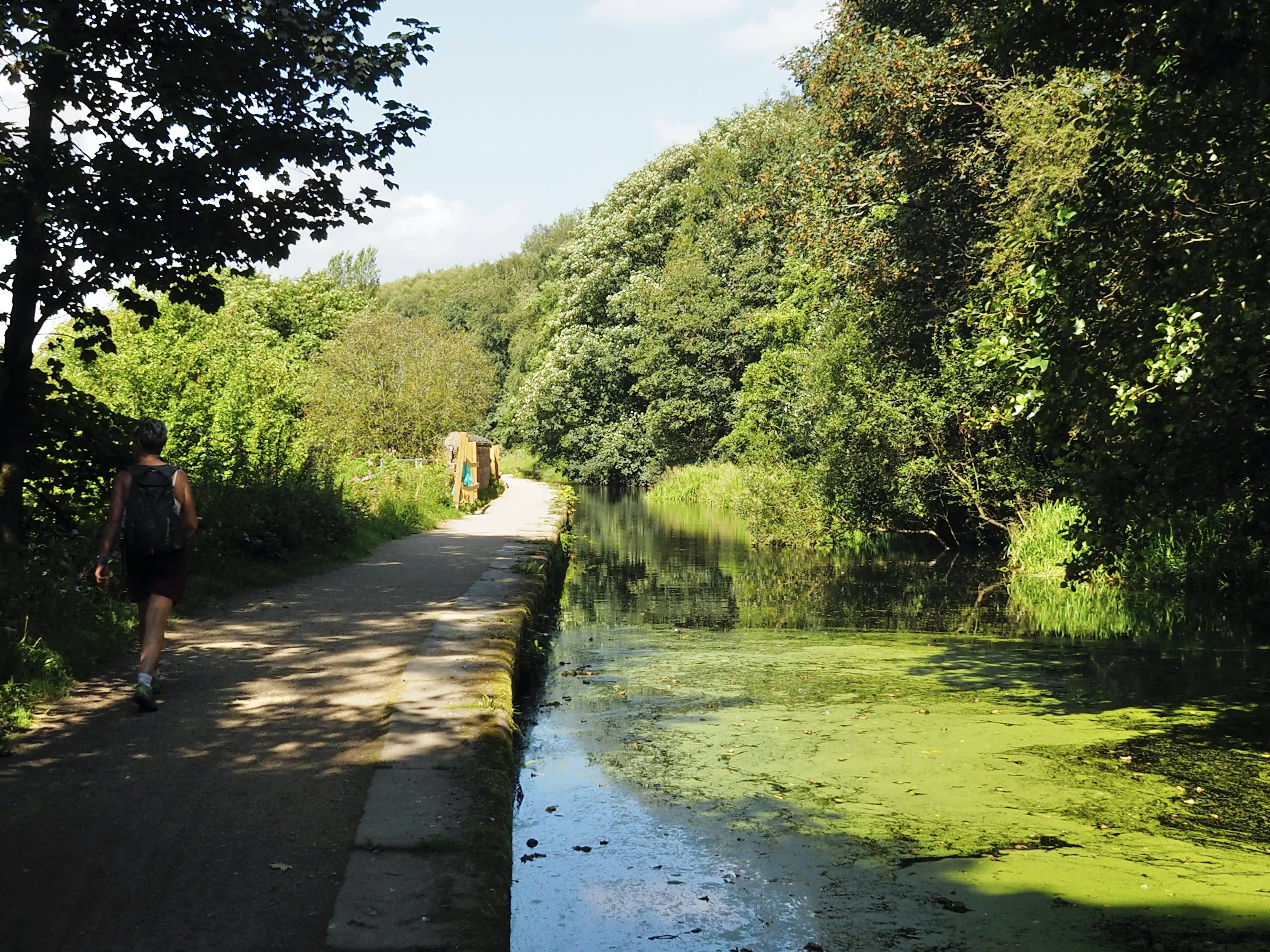
Across the old colliery bridge and we were on the tow path. The MBBC is no longer in use and much of the canal is being reclaimed by nature or worse still, some parts have been filled in.
Our first section was in water although full of weed and algae.

The MBBC was built in 1797 from Bolton and Bury to Oldfield Rd in Salford and then it progressed to join the River Irwell just outside of Manchester in 1808. One of the local landowners Matthew Fletcher who was a mining engineer and a coal mine owner was the technical advisor and the bill received the Royal assent in 1791. He was also involved in the Wet Earth Colliery which was the first deep colliery in the Irwell Valley. The name "Fletcher" may ring a bell to some people as this is the name of the short canal adjacent to the MBBC at Clifton.
Back to the towpath, we spotted our first glimpse of the River Irwell, far below the escarpment and through the trees, the water sparkling in the sunshine.

Finding one of the original canal steam cranes was a great surprise for us. This crane is the symbol used by the canal restoration society and can be seen on numerous badges along the canal route. It is located at Mount Sion. This crane is in surprisingly good condition except for its boiler. The mechanical parts look like they would work with a bit of servicing. It was made in Leeds by J. Smith and sons. It sports the serial number 3184. The crane was used to unload mainly coal which came from Ladyshore colliery and drop them down 20ft to the Mount Sion Bleach works which today makes paper.


An unusual feature for any canal came into view, a green lake. This feeds the canal but I am told by a local boatman that the lake is not navigable. The lake is not named on the OS map but I'm sure locals will have one for it. It is fed from numerous springs found on the far side. There are no sluice gates that we could see and both canal and lake appear to be on the same level.


** For many years the area surrounding Nob End was the site of many bleaching works and paper manufactures. Until the middle of the 18th century the bleaching process took several weeks to complete; the material had to be soaked several times in an acid of fermented sour milk, tentered on hooks to absorb sunshine and dew, boiled in alkali made from plant ashes. It could take months to bleach cotton and linen as it was so dependent on the weather and the supply of milk. Sulphuric acid became much in demand by the bleaching trade as a substitute for sour milk which had been the only acid liquor or ‘sour’ available. It was also essential in the manufacture of chemical bleaches once chlorine had been discovered. The dying industry needed it to render indigo soluble and in the preparation of mordents and the calico printing industry for producing citric acid and as a sour.
Sodium carbonate or washing soda was being manufactured here in the 19th century by the Leblanc process, a process which produced vast quantities of alkali waste material.
By the end of the 19th century the works had been demolished, but the waste remained, slowly weathering to allow plant growth. In the 1950’s the site was found to contain a large population of plants normally only found on calcareous soils.
Today the site is a protected area containing no natural landforms, created by the dumping of this chemical waste.
Known locally as the ‘Vats’ or ‘Vat Wastes’.
One of only four known surviving Leblanc waste sites in the world, all within a few miles of this site. This 8.8ha site is the largest and most species rich. The plateau of the waste tip is approximately 10m above the level of the rivers and at this point most of this depth is comprised of alkali waste.
** Thanks to Phil Sharples for this information.
Our Route. Starting at the flag and walked in a clockwise direction.10.40km and 3,1/2hrs.

Interesting and varied walk. It looks as though Nature is well on the way to covering much of that infrastructure completely, so good to have a look before that happens.
ReplyDeleteHi Conrad. Thanks. I hope the friends of the canal can raise enough funding to get it back into operation. It would be a fantastic narrow boat trip.
DeleteFabulous pictures and a wonderful description Alan. Jo
ReplyDeleteThanks Jo. Hey you are becoming a regular. Before you know it you will be writing your own stories.
ReplyDelete