I stuck my head out from under the condensation and looked upon a beautiful red morning.
This is supposed to be bad news for shepherds, i hoped it was good news for us.
It was 6.15am or thereabouts and getting up had to be done.
Others were starting to stir and i could see the steam from Laura’s boiling water rising over her MSR Hubba tent.
Before packing up the tent i gave it a good wipe down to remove as much condensation as possible. It always amazes me how much water a J cloth will soak up.
Away we went at roughly 7.30 am following the SUW.

Remains of Dryhope Tower.

Tower info board.
Another lovely day, calm and what cloud there was, high and scattered.
The rise was so far gentle and easy walking although a field full of inquisitive young bulls had Laura a little ponderous. Fortunately the path skirted round them.
Along the path to the bridge over Hawkshaw Cleuch we heard Curlew, Snipe and Oyster catchers and occasionally caught a glimpse.
Crossing the Douglas burn the advance party was heading up the SUW but Mike with the map put the reins on and we headed past the old Blackhouse Tower and farm buildings towards the forestry.




The rise was so far gentle and easy walking although a field full of inquisitive young bulls had Laura a little ponderous. Fortunately the path skirted round them.
Along the path to the bridge over Hawkshaw Cleuch we heard Curlew, Snipe and Oyster catchers and occasionally caught a glimpse.
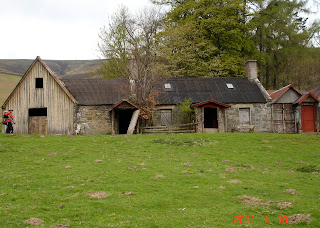
Crossing the Douglas burn the advance party was heading up the SUW but Mike with the map put the reins on and we headed past the old Blackhouse Tower and farm buildings towards the forestry.

Blackhouse farm with old tower
Once we hit the forestry path Mike announced that this was were it all goes wrong.
Forestry are notorious at moving footpaths and planting new trees across them or chopping down lumber without re-instating the paths.
It did happen. Mike said we take the 2nd path left. We did. Mike said this is wrong. It was!
We backtracked and took the first which was the original second if you get the drift of all this.
Onward and upward through boggy ground and high tussocks until we came out into the open at Whiteknowe head. Hooray.
The fence line was in front of us and the path crossed the fence 1/2 mile ahead. It was the longest, boggiest 1/2 mile i have done for a while and it took an age. Many times i thought i was going to disappear into the morass of peat.


We did a slight detour having achieved the fence line crossing point but quickly picked up the track contouring south of Stake Law. It was good to find running clear streams all along here.
Gaining the ridge, the decision was taken to head down into Glen Sax avoiding the ascent to Birkscairn Hill and into Peebles along the old drove road.
This was taken in light of the pending bus departure. As it turned out the descent was quite arduous and it may have been quicker to use the drove road.

On the way down to Glen Sax
Lunch was had when we crossed over the Glensax burn and the path down through the estate was easy but hard on the feet with the small sharp stones.

Smoke in the valley. Had Mike left the car running in Peebles?
The smoke turned out to be the burning of mass coppicing. Hope this isn’t bad news. Are things starting to turn we wondered.

The bothy in Glensax, locked and not part of the MBA.

The start of civilisation, on the large Haystoun Estate said you are now in Peebles. A nice walk through the estate grounds brings you to the main road and the car park in centre of the town.
We were 1/2 hour early for the bus connection and time to get a coffee before our goodbye’s to Laura and Louise and our drive back to Moffat.


A couple of critters along the estate path. I didn’t get a photo of Laura with the cows!
This leg was 12.5 miles and 1635ft of up’s although the downs were definitely harder than the up’s in this case.
I had been a wonderful trip. Thanks for the laughs, the company and everything else.
The photo’s of the 3 days can be found here.
The maps of the trip are on Mikes blog which is here