Back came the reply. Yes, meet you outside the Big Wellie at Tyndrum at 9.30am. That's roughly about 277 miles from home. That wasn't what i was actually thinking, but kind to be invited anyway even if it was a bit tongue in cheek. He was on a TGO challengers reunion weekend.
So we set the alarm and when it went off we just turned over. We could hear the rain on the open bedroom window. An hour later we decided to make the effort whatever the weather and get out there.
"Where are we going", Sheila said, as if i had a plan.
I decided to go to Thieveley Pike on Todmorden Moor, a walk which i had never done before, but start it from Shawforth where i knew there was a good car park and just about the right distance for a days walk.
We had been driving for about 10 minutes when something jumped into my brain about tea bags. "Did you pick up the green tea bags" i asked Sheila. You can guess the reply. "No i thought you did."
So we had a flask of hot water and no teabags. I don't mind hot water to be honest but Sheila said we will buy some when we pass a shop. Which we did. In fact it was a bit of bargain too, 100 green tea bags for £2.
It wasn't raining as we parked up but just as i opened the boot to put on my walking boots and gaiters it started to tipple. Typical. Waterproofs from the off.
It was dark, the edges off the clouds tinged with light from a sun we probably wouldn't see today. The roads were flowing and the spray had to be avoided as we crossed the main road to a landrover track leading to Higher Hogshead and Green Brow, 2 hill farms. Crossing the open fellside with its coarse grass and ruts full of water. It was a good job we had put gaiters on which by now were also covered with overtrousers.
Fortunately as we approached the ridge line which is also the county boundary and part of the Rossendale Way, the cloud base was high so although it was lashing it down we had decent visibility. That was apart from the areas which were getting the worst of the rain.

(View South, Whitworth in the foreground and Manchester Town Centre behind)

(Zoom shot taken from same place as previous image) Manchester looks a bit wet.
Our route followed the boundary line North. Many of the boundary stones still prominent. We splodged along the path or watercourse as it was today, until we met with the A681. All the way we had the incessant banging from shotguns. The noise carries so far. There were many cars up in the quarries behind the Astronomy Centre or Observatory which ever you prefer. The shotguns we guess was from a clay pidgeon shoot.
 (One of the many boundary stones. T for Todmorden i presume and the other side was S but i'm not sure what the S is.)

The rain got harder and the camera was put away, the surroundings disappeared for a few minutes and then re-appeared as the wind swept the rain cloud across the moor. We stood and watched one area bright then disappear in a blanket of grey.
We came to a really high stile which we crossed to reach the A681. It's not a particular busy road on a Sunday and so we had no problems walking the few hundred yards along it before we picked up the footpath across Todmorden Moor.
Up until then we had seen no one. Here at the lay bye there were a few cars parked with folk still sat inside them as though they were thinking "Do we have to go out in that and look at them two daft beggers looking at us, they looked soaked".
I checked the map as numerous paths and tracks criss crossed, we headed for Hill Top farm. Then we spotted a rare sight of what looked like a Boar. Unusual to see one just wandering along a quarry road. Maybe the shooters scared it off the moor.

On reaching Hill Top Farm the path goes through the farm yard. Just as we entered and closed the gate we spotted a big German Shepherd dog. It ran over to us followed by 3 yapping Jack Russell terriers.
It was a scary moment but thankfully the German Shepherd was really nice and friendly and the terriers just yapped. The owner came out and called them back and apologised. We had a bit of banter and then went on our way through the mud and what ever else you find in farm yards.
Once again we got battered with a heavy downpour. The weather was being quite capricious today. We came across a group of horses which were stood like statues against the wall. even as we walked past they hardly moved a muscle.


The rain got harder and the camera was put away, the surroundings disappeared for a few minutes and then re-appeared as the wind swept the rain cloud across the moor. We stood and watched one area bright then disappear in a blanket of grey.
We came to a really high stile which we crossed to reach the A681. It's not a particular busy road on a Sunday and so we had no problems walking the few hundred yards along it before we picked up the footpath across Todmorden Moor.
Up until then we had seen no one. Here at the lay bye there were a few cars parked with folk still sat inside them as though they were thinking "Do we have to go out in that and look at them two daft beggers looking at us, they looked soaked".
I checked the map as numerous paths and tracks criss crossed, we headed for Hill Top farm. Then we spotted a rare sight of what looked like a Boar. Unusual to see one just wandering along a quarry road. Maybe the shooters scared it off the moor.

On reaching Hill Top Farm the path goes through the farm yard. Just as we entered and closed the gate we spotted a big German Shepherd dog. It ran over to us followed by 3 yapping Jack Russell terriers.
It was a scary moment but thankfully the German Shepherd was really nice and friendly and the terriers just yapped. The owner came out and called them back and apologised. We had a bit of banter and then went on our way through the mud and what ever else you find in farm yards.
Once again we got battered with a heavy downpour. The weather was being quite capricious today. We came across a group of horses which were stood like statues against the wall. even as we walked past they hardly moved a muscle.

(Walking through the fields past Hill Top Farm)
Then the rain stopped suddenly and the sun came out. It must have lasted all of a minute because across the dale we could see the next wave of rain coming for us. We spotted a group of about 6 people up on the skyline but by the time we got up there they were away down the Burnley Way.

(A rare bit of brightness.)
We had some good fortune as we made our way to the top of Thieveley Pike, it stopped raining!
Some of the surrounding hillsides were still getting the worst of it but for now we were happy. As we passed what we think was the position of the old beacon the trig point came into view. The top was used in times gone bye as a beacon point.

Was this the site of the old beacon?
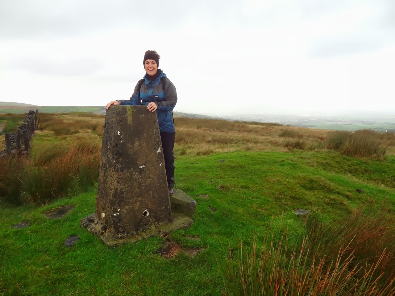
(Thieveley Top 449m)


(View from the top. Burnley in the valley and Pendle Hill beyond.)
The views are really nice from the summit especially across Cliviger and it was a shame that we couldn't see the truncated spurs which were left from the ice age. They are located on the Clivager side and we were not heading that way. Another time.
We did a quick tour of the top, but didn't find the source of the River Irwell and then headed back south east. We followed the Burnley way and just before we left the shelter of the wall for the open moor we decided it was a good time to stop for lunch.

(The view East from the summit. Cant Clough reservoir to the left and the Coal Clough wind farm)
We found a sheltered spot and broke out the sandwiches and hot water. Sheila went quiet and then said, "I've left the tea bags in the boot of the car" Would you believe it. So we ended up with just hot water after all. Although i have to say the yoghurt and honey cake she made was brilliant. We must have cake.
We stopped for about 15 minutes and glad to say it still wasn't raining. We picked up the path (Burnley Way) and headed off to the next top. No name, just marked as 432m on the OS map. At the top the path turns sharp north east down to the A646 road. Our route which was basically straight on and down to the land rover track which runs parallel with Greens Clough. Getting down was quite tough going with lots of ankle twisting ruts and bogs. Care was needed and we were glad to reach the stile just before Hill Top Farm. Once on the landrover track it was easy walking back to re-join the A861 road.

(Heading for the un-named top of 432m)

(Picking our way carefully across to Hill Top Farm in the distance)
The rain was holding off and visibility was good. We had a good view of the Observatory and beyond to Stoodley Pike.

(Todmorden observatory)

(Stoodley Pike)
We were now following the path known as Limers Gate. Plenty of cows were around and plenty of mares and foals. The amount of broken drainage pottery is amazing along the route. How it all got here i don't know or why.
The sky was brightening up with some breaks in the cloud showing patches of blue. The view across Gorpley reservoir was very pleasing and we made a mental note to come back and do a circular walk including the reservoir soon.

(Big cows)

(Mares and foals)

(View from Limers gate path across Gorpley reservoir with Stoodley Pike in the distance)
We soon came to a cross roads sign which was our point to leave the path and head up hill and once again cross the boundary wall and the path heading back to Shawforth.

(The weather is improving from the limers Gate path)
Dropping down onto the Shawforth side of the valley the sky once again turned dark and it looked like we were going to get another soaking, but it held off at least until we made it back to the car. Incredibly within about 2 minutes of getting back to the car the heavens opened.

(Dark over Whitworth)

(Friendly pony in need of a hair cut.)
Oh, we did find the tea bags. Sheila had put them in the inside pocket of her waterproof jacket, in a plastic bag and so had carried them all the way round. Now i could say something here about memory loss but life (mine), is too short.

Mileage - 16.2 km
Time taken 5.5 hours. including stops.

Time taken 5.5 hours. including stops.


