Anyway we eventually got going, breakfasted and sped off to meet fellow hikers from the East Lancs Long Distance Walking Assoc. with some members of West Yorkshire branch at the White House Pub on the Halifax/Littleborough road, the A58.
GR SD968 178.

Bitterly cold with quite a breeze we sat in the car until all were ready to go. It was a surprise to see a pair of shorts being sported by a hardy soul. Eventually the congregation came together, 17 souls and 2 dogs for the group pic.

Off we went south towards Blackstone edge and upon meeting the old Pack horse route or Roman Road as it is sometimes called, we turned east to pass the Aiggin stone. This stone is said to have been a marker for travellers along the route and could possibly be derived from the French Aiguille meaning a needle or eagle.

We picked up the Rishworth drain and followed this around Rishworth Moor before heading down to the dam head of Baitings Reservoir.

Rishworth Drain

Grey Stone Height. A non OS trig point, not shown on OS 25,000 maps. Maybe this was one of many used during the construction of the Dam.

Baitings Reservoir Dam Head

I didn’t take a photograph because i thought it disrespectful to the owners to do so without permission.
The path along the north bank of the reservoir was followed until just prior to the junction with the road we stopped for a coffee etc.
The weather was now quite warm and the breeze had fizzled out. It was now quite a warm pleasant day.
Layering was being reduced.
Whilst at rest Bob told us that there was quite a steep incline coming up next in the name of Manshead End at 404 metres.

On the way up Manshead End
As inclines go we found this one was ok and soon reached the Official trig point. This is a nice spot with good views all round. Off to the North West we could see one of the points of interest, Stoodley Pike which we would get to soon.
View NW from Manshead End

Trig point on Mashead End
Our route headed North over Great Manshead Hill until we joined the Calderdale way. At this point we could see the track around Cove Hill and onto Withens Clough Reservoir. For now we took the path down to New Road and crossed the B6138 where the path had a “Private Road” sign on it.This path takes you into beautiful Trimming Dale and just prior to the New Footbridge we stopped for Lunch in the pleasant sunshine. Temperature now at 14 degrees C.

Trimming Dale

New Footbridge in Trimming Dale

Very Nice houses in Upper Cragg Vale from the path along Turley Holes Edge.(Below)


Cragg Vale.
Our next point of interest was Withens Clough Reservoir which we came to after a delightful walk along Turley Holes Edge.Our route was to go over the head of the Dam as we did at Baitings but due to construction work this path is closed and also the reservoir has been significantly drained. We had to walk round the reservoir to reach the path that takes us up to Stoodley Pike and the Viewpoint.

Withens Clough Reservoir, South Side.

Withens Clough Reservoir from the South West end.
The reservoir itself was built between 1891 and 1894 and was made to supply clean water to Morley. After 95 years the waters are now diverted via the Manshead tunnel directly into Baitings Reservoir.


Getting closer now, Stoodley Pike.
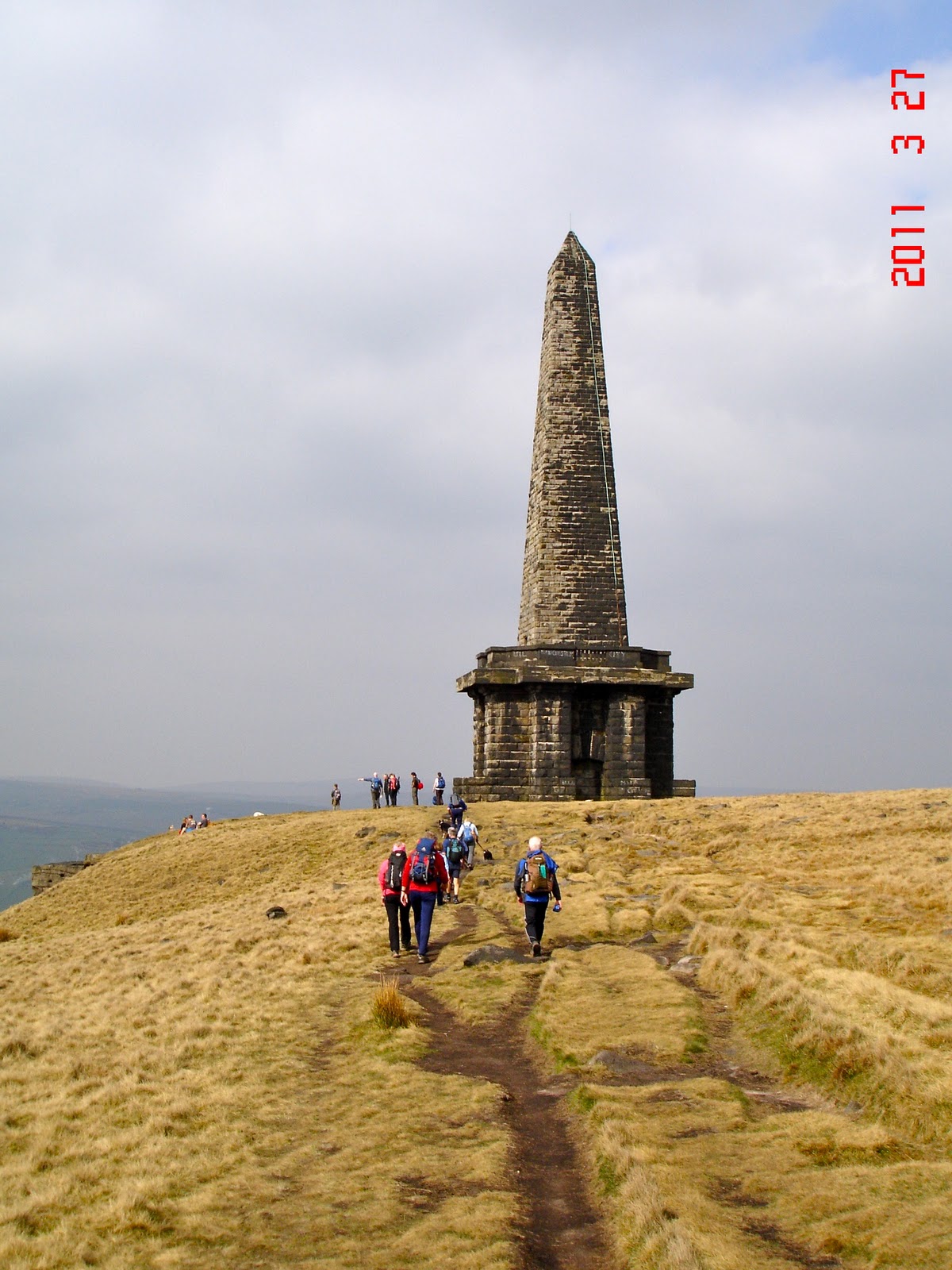
At last, the Monument is reached.
Stoodley Pike is 400m (1300ft high) where you find the Monument which is 121ft high. Designed by James Green and built in 1856 at the end of the Crimean War.
The monument that is there now replaced an earlier one, completed in 1815 commemorating the defeat of Napoleon after the battle of Waterloo, but this collapsed in 1854 after it had been struck by lightening and then years of weathering finished it off.
There is also evidence of mans earlier building on this site way before the first structure related here.
After a 10 minute brew stop we set off marching again south as if being chased by Napoleon himself. Our route was dry and followed the Pennine Way long distance path, fairly flat landscape meant progress was indeed quick.
We passed 3 more reservoirs in a blur, Warlands, White Holme and Blackstone Edge on the way back to the start point.

Warlands Reservoir with Peter leading Point. Sergeant Major Bob must have been at the back at this moment, rallying up the troops for the final push. Sheila and I were definite candidates for back markers.

Weathered rocks near Light Hazels Edge.
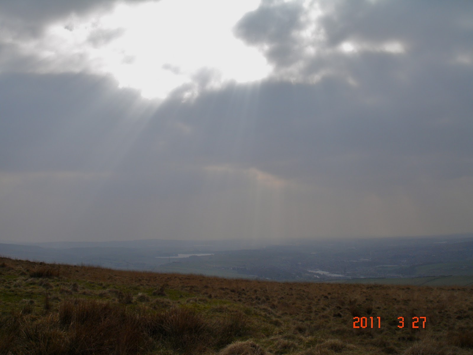
Dark Skies over Littleborough.

The White House, our Start and Finish Point.
Thanks to the LDWA/ East Lancs section for providing a good walk and good company. Thanks to Bob for leading the foray and for getting us to the end still with a sense of humour. We have now put our shoes in the Ice bucket to cool off. Ha.
Route length approx 27.9km or in old money 17.3 miles.
More photo’s can be found here
Oh dear! Well done both for completing it. I detest route marches!
ReplyDeleteJust as an aside, the latest wind turbines are over three time the height of Stoodley Pike and ought to whirl about a bit to catch the gaze (if the wind blows, that is...)
thanks for sharing, but not for me, at that pace I'd have spilt my wine ! cheers Danny
ReplyDeleteAl, Just thankful we didn't have full packs. Walking with a group is a new thing for us and it will take a while to feel comfortable with the pace and things.
ReplyDeleteHowever they are nice people and a good organisation.
Danny, We can't have spilt wine at any pace.
Sorry about your pics problems, i cannot get my head round what it might be.
Haha, you've experienced an LDWA weekend outing. They do tend to bash on, taking no prisoners. You have to be prepared for that! The mid-week strolls are more leisurely.
ReplyDeleteI hope it's as dry in Calderdale in a couple of weeks' time, when we'll enjoy the Calderdale Hike - now that really does take your breath away!
Still I see you had time to take at least 60 pictures, despite the pace!
Hi Martin,
ReplyDeleteYou may well laugh. When you join a group that have obviously done many walks at this kind of pace, it’s quite daunting for a newbie.
We did cope but the Up’s were few. If there had been plenty of up’s then it might have been a different matter.
It’s never been my policy to speed through the countryside unless i had something urgent to do like catch a train. I just don’t understand the logic of it.
I was also taught on my MLT that you walk at the pace of the slowest in the group. Well not this group! Keep up with point or you’ll be peeling spuds lad!
I did take a few fots but i was glad i had the anti-shake on the camera lens. We had a good day even though the system is still in shock.
That was a long walk! But you saw a lot during it, very nice pictures.
ReplyDeleteI agree on the changing of the clocks to summertime - a lot of unnecessary hassle.
Hi Maria,
ReplyDeleteYes, 28K is the most i have walked for quite some time. We were very lucky with the weather. When walking in the sun it reached 17 degrees although most of the day it ranged between 11 and 14. Almost summer. Oh yes it is supposed to be summer now the clocks have changed.
It is a lovely area to walk. Hence the number of photo’s.
Yes, summer - we got a few centimetres of fresh snow last night and temperature is below freezing... Please, send some of that warmer summer weather to us! ;-)
ReplyDeleteIt's a long time since I've walked 28K as a day walk.
We are back to cold and rain again today. Sorry you won’t want this either.
ReplyDeleteSounds daunting that pace. Yet I remember the first day of the 06 TGO a chap quit. He was a LDWA member and into big long walks. Yet add a pack and Scotland scale terrain and he was out of his depth it seems. That route brings back Pennine Way memories. I recall running to Stoodley Pike for cover as the most awful gail blowed people about like rag dolls who did not get to cover soon enough. I heard the roar of the wind coming down the valley and legged it to cover. Pennines can have mean weather.
ReplyDeleteMartin,
ReplyDeleteI think a lot of it was our own psychology. I wasn’t expecting the pace to be so full on for the length of the walk. If i had known beforehand it may have been less of a shock and we could have been mentally prepared.
The group was of mixed ages, so if they can do it so can we. Well thats my thinking anyway. (Might not be Sheila’s).
For me, if it had taken another hour to complete at a slower pace, so that you can look around and take in what you are walking through, it would have been better, but it may get better as we improve our gait. We will see.
The Pennines can have atrocious weather i know.
Hope the heads healing btw.
Interesting!
ReplyDelete