The Vault Regulars

Wednesday, September 29, 2021

MSC Expedition 15W CIGS ETFE Lightweight Folding Solar Charger

Last year when we spent holidays in Greece we suffered from a hurricane. The result of this was 5 days with no water and no electricity. Fortunately I had taken a water filter so we didn't run short of drinking water as we filtered rain. Electricity though was another thing, we really struggled. So when I got home I bought a mobile solar charger. 

I am no expert on solar anything so I asked around and finally bought the 10W panel. It was the same as the above photo but with smaller panels. Unfortunately it didn't work properly with my iPhone, I kept getting a message that this accessory was not compatible.

I contacted MSC, explained the problem and they sent me the 3 panel 15W panel at no extra cost. Now that I am more familiar with the panels I found the problem, which I will explain later.

The specification of the 3 panel charger is:-

  • Copper Indium Gallium Selenide cells (CIGS) Lightweight folding solar charger
  • The CIGS cells are protected by an ETFE plastic coating.
  • Very flexible, compact and robust for Expedition power on the move.
  • Ideal to hang from a rucksack, charging directly into one of the available power banks
  • Works very well with the Qi 10Ah & PD30W Power Banks
  • It has robust sealed seams, ultra-light 320g and very compact for travel
  • The 15W has 6 attachment points for hanging from a rucksack or tent
  • Free power each and every day.
  • 2-year warranty
  • Weight 10w, 210gr. and the 15W 320gr.
  • Easily fits inside a rucksack.

(spec courtesy of MSC website)

This year on our holidays in Greece I used the charger almost every day for a month. Obviously in Greece the sun shines dependably, so if we had problems in Greece then the issue would be worse in UK.

Charging power banks with the solar panels is trouble free and certainly the best piece of kit to use to recharge your phone and other gear.

Charging phones directly, I have tried 2 brands, Apple and Samsung. If like in Greece the sun is constant then charging the iPhone is no problem but if the sky is sunny and cloudy then the output voltage from the charger to the phone will be variable. It seems that the iPhone has very tight parameters regarding charger voltage variance and this can make the phone reject the solar charger as incompatible.

The Samsung seems to accept the voltage variance better than the Apple.

Putting a power bank between the charger and accessory acts as a voltage regulator and that is why I say  the best setup is to use a power bank in UK.

Now that I have used it regularly I am glad I bought it, however if there is a panel available with a built in voltage regulator, I would get that one.

Costs. 10W £80, 15W £109.

Thursday, June 24, 2021

Historical Walk on paths around Delph Reservoir. Bolton.

 Wednesday June 23rd.

The weather in June has been surprisingly good, except today when it's been a bit grey and not very sunny at all. Not great for photographs. 

It took us about 40 minutes from home on a busy motorway to reach our parking spot on Stones Bank Rd at SD699166. A little further up this road is the site of a Victorian Turton Sanitary pipe manufacturers. The old tramway still visible on the ground leading up to Turton Moor. It closed in 1911 and was liquidated as Darwin Sanitary Pipe Co.

Our route today though headed south to Blackburn Rd (A666) A devil of a road. Crossing it with care and taking the footpath upwards towards Turton Heights and our highest point of the day, Cheetham Close Hill.

At a crossing of a multitude of paths, The Witton Weavers Way, The Rotary Way and others, used to stand the farm called Parrs, I *think* the last farmer was James Marsh. Unless you look hard it's difficult to envisage just where it was. 

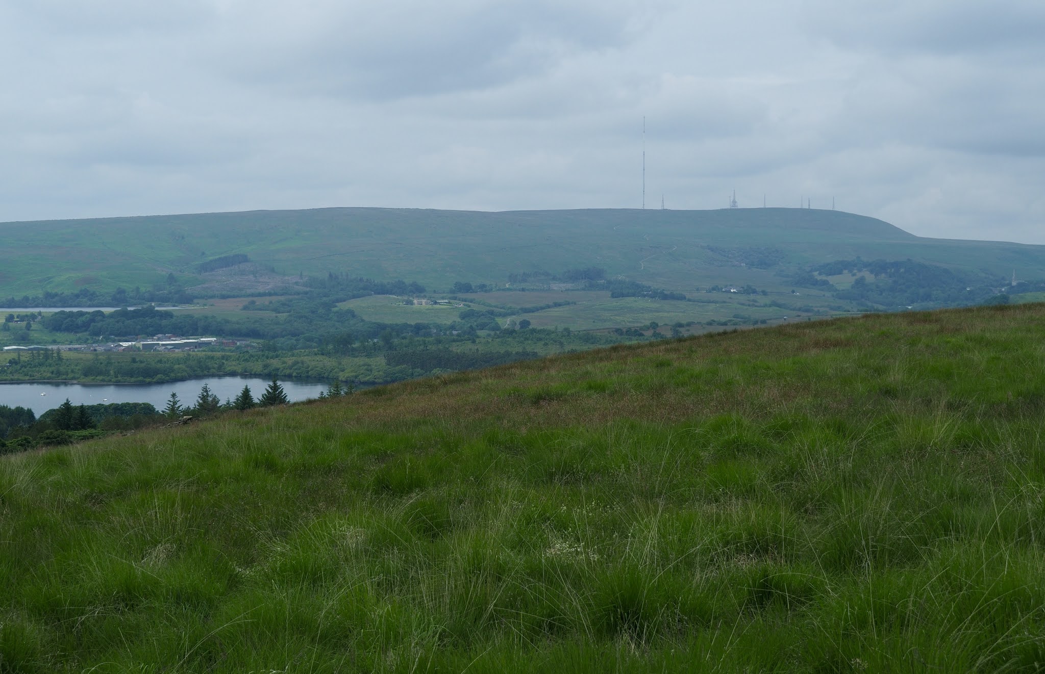
We continued up hill with good views across Delph reservoir to Winter Hill, following the Witton Weavers path until we crested the hill and took the boundary path through deep grass towards a dry stone wall where we had to descend eastward to find a gate through the wall. I don't recommend taking this path as I imagine it would be awful in wet weather. We should have taken the earlier path at SD709165. But this route was new to me and you never stop learning.


A bit of sun at last but will it rain.

We eventually reached the OS trig point on Cheetham Close hill. SD716157, a height of 329 Metres. It's a tall trig point but the OS bracket looks like it has been removed by force. We felt cheated as we couldn't record the number. Maybe that's why its called Cheetham Close.

It's a great 360 view from the top and also there are close to the trig point a couple of stone circles shown on the OS map. We hunted them out and found some broken stones and undulating ground but not what anyone would call stone circles from the Bronze Age. Then we read that the standing stones had been smashed by a farmer from Turton in 1870. The original circle was 61ft diameter. Also a Roman Road ran approximately 200yds away from the circles.


Cheetham Close Trig Point with the bracket missing from the lower front face. ***

The view North West towards Turton Heights.
We returned from the summit back to the wall in the above image. From there we followed the wall left (SW) and picked up the track leading to Horridge's Farm and then down to the Old Dimple Hall which was built in 1688.
Dimple Hall with it's spinning gallery on the left.
Dimple Hall with it's Carolean Style Architecture, or the restoration style. It is now 2 separate houses as opposed to one hall. Built during the reign of King Charles II.

Just beyond the hall a footpath leads through a field and exits on a minor road. Across the road the path leads into a tree covered dell, down some steep wet steps. This short stream path was a delight and very cool considering the high humidity today.

After a couple of hundred yards the path reaches the A666 Blackburn Rd. Across the road a path leads through a car park, across a stile and a field to a gate bringing us out onto a lane. If we had crossed the road and walked right for a few yards we would have come to the lane anyway and kept dry feet. One for the memory bank.

The lane passes a couple of nice York stone houses and a field path leads to Walmsley Unitarian Chapel and Sunday school. The chapel is a lovely building but was locked up. The Sunday school looked as if it was now a house but I could be wrong about that.

The chapel has a good history, built in 1733 but had a congregation gathering pre 1672. In those days the Church of England was the giver of all books and services so Presbyterians had to worship in the dead of night, not in the chapel or their homes. They used a place called Yearnsdale Holmes, a lonely wild spot. A watchman had to be posted to warn them of any potential hostilities. This carried on until the Tolerance act came in 1689, allowing them to worship in the chapel. Those were tough days and it didn't end in 1689 as they still had fights with other clergy.

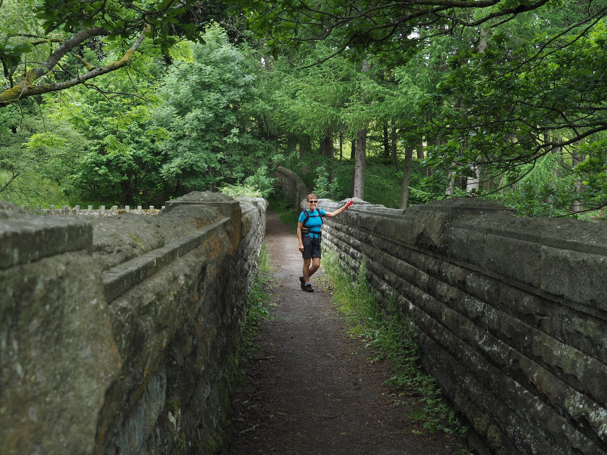
A well built path goes past the side of the Sunday school. It has all the hallmarks of being built by the waterworks. Then the dam wall looms high above you on the right.

Waterworks path and bridge.
The reservoir was completed in 1924 and is 78 acres. It was built to supply domestic and industrial water for locals and to supply clean water to feed the River Irwell via Delph Brook.
The reservoir is home to Delph Sailing Club.
You cannot walk the circumference of the reservoir so we opted to go via the lovely Longworth Clough. Much history can be found in this area.  Drop down from the road past Critchley Fold onto a track which used to be the entrance to Longworth Mill. 

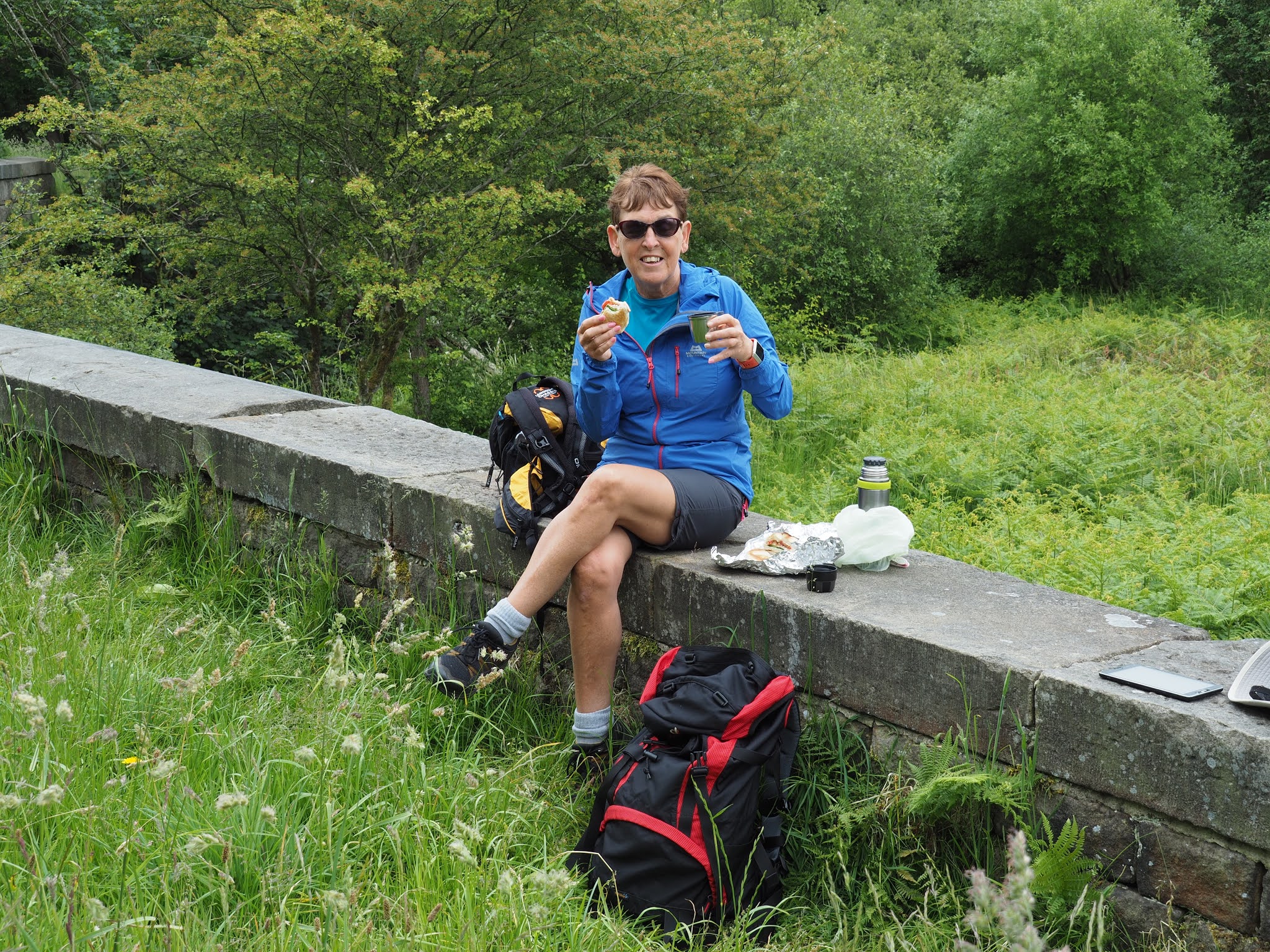
At a footbridge over Eagley Brook we stopped for lunch. A passer-by asked us if we were lost. It was kind of him to ask but we weren't lost. That was the first person we had seen.
The Clough is a lovely walk today but in years past the brook was contaminated with industrial waste from numerous enterprises along it's course. Today there are fish in the brook, lots of wild flowers, trees and many birds. 


The now derelict Spring Side paper works is still to be seen. Covering a huge area. I have read that planning permission has been granted to demolish it and build houses. It will be a lovely place to live.

A small part of the huge complex of buildings that was Spring Side Paper Works.

Paper has been made here since 1834 with water fed via a goit from the ornamental reservoir at Belmont. The mill used a colossal amount of water. 1.5 million gallons per day. 
Past the paper mill the path splits into two. The left branch leads eventually to Belmont. We took the right branch, over a footbridge and up a steep incline out of the Clough to the Longworth Road. Across the road to the right was the site of the now demolished Longworth Hall.

Last views of the Clough.
Winter Hill with rain clouds approaching.
The road walk back to the car was uneventful. We couldn't see the reservoir at all. But a sting in the tail was a steep hill which had our legs complaining.


All in all this is a superb walk. 12km.
***. Information from the OS benchmark listing shows that a brass id bracket was never fitted.


Friday, June 11, 2021

A short backpack in the Duddon Valley. Day3.

Sunday 6th June 2021. 

Another wonderful nights sleep with the doors open. No rain, no midges. Today's walk was only a short hop. Basically just getting back to Seathwaite.

So, I said to Judith that we didn't need to be up and away anytime soon. I suggested 9.00 o'clock, to which came the reply am or pm. 

We had a couple of brews and then more bad news, first the tent pole and now my gas stove. I was sat next to the stove and I heard a drastic reduction in noise. I still had plenty of gas but the regulator made no difference. I let it cool and then found that I couldn't return the 3 legs into the stowed position and the stove head and body was ill fitting. It looked like the plastic part between the body and head had heat deterioration and had slightly melted. Thankfully it was the last time I would need a stove on this trip.

The stove was my 15yr old Coleman F1. (I checked it upon getting home and it was not repairable, so its now in the bin).  Tip, don't buy a stove with *plastic* parts.

Another lovely camp spot.

Once packed and the site checked to make sure there was no sign of our being there we followed the narrow sheep trod on the north side of the reservoir. 

Judith wanted to have a good look at the Dam workings and check out if any OS benchmarks could be found. We checked out the rain gauges and we found a marker stone with the initials BC carved into it. We thought it might be the last resting place of the great Brian Clough, but actually it stands for Barrow Corporation.


A last look down the length of the reservoir.
Barrow Corporation marker. However we never found an OS mark.
Rain Gauge.
The landrover track from the tarn to Seathwaite is in bad condition. Very rutted. 
However the views down the valley never change and are a delight.

At the bottom of the track where it joins the Walna Scar route over to Coniston, we had our last practice of a break. We had become experts at it.
A lady with a lovely border collie stopped for a chat and it turns out she had run the Duddon Valley fell race yesterday and came in last. Fiona, come back and do it again next year and I'm sure you will be further up the field. 

Passing through Turner Hall Campsite and then down to the valley road we met our hosts Tina and Alan walking the opposite way to meet us. So it was back to their's for coffee and lunch.

Judith wanted to get off and do some buying at Booth's in Ulverston but we were staying for a couple of days so sadly we said our goodbyes. We hope you had a good time and liked what you saw of the Duddon Valley and its friendly people.

Repeating what I said at the beginning of day one. This trip wasn't about distance it was about confidence and gear testing. We had a great time and learned quite a bit. And had 2 wonderful camping spots.


Route Day3.

Gear 
Sheila and I used the Montane Grand Tour 55. Although I had used this sack a number of times before I found the stiffness of the shoulder straps and the hip belt a bit of a pain. Maybe it was my body not being used to carrying a sack for the best part of 2 yrs I don't know.
The hip belt pockets are almost useless.
The rest of the sack is excellent but does it need all the bells and whistles, it could be made a lot lighter.

Sleeping gear. I used a Rab Summit and a Karrimor x lite mat with a 3mm closed cell foam under the mat. Sheila feels the cold more than me so used a PHD custom bag with a 3/4 length Neo air with a 3mm foam mat under. All worked fine.

Tent. Kuiu Mountain star 2p. Had an Easton advanced carbon fibre pole section breakage. Luckily I sleeved the break and was able to carry on.

Stove. Coleman F1. Failed on the last brew of the trip. 

Trousers. I used a pair of Columbia silver ridge convertibles and the gusset seam came apart. I have had these a while maybe it was down to wear and tear. Sheila wore Decathlon convertibles and these were fine.

Camp shoes. I was trying a very lightweight pair of water shoes with the drain holes sealed up, but I found that the upper material took a long time to dry. So its back to my trusty  Vivo Barefeet.

Socks. X socks, I find these perfect.

Top. I used a Craft cycling top. I find these to have an extra long body so it doesn't ride up with wearing a rucksack. It also wicks sweat away fantastically well. To complement this when it was breezy I used a Black Diamond Alpine Start. A good combination for me.

Shoes. I used an old pair of Ecco boots and Sheila wore an old pair of Carn trainers. Both work well.

Thanks for reading.


Thursday, June 10, 2021

A short backpack in the Duddon Valley. Day.2

 Saturday 5th June 2021

We all slept well and no rain overnight so we had a dry tent. Wonderful. 

Today was classed as an easy day compared to yesterday so no need to pack away quickly. With the good weather holding the walk down the Duddon river should be a pleasurable experience.

The midges took full advantage of me opening the mesh doors of the tent and it was their breakfast time too. It was a bit of a shock because last evening as the sun went down there were none.

Breakfast was a casual affair before setting off across the intake fields to reach the path parallel with the Duddon. We walked in a downstream direction and Judith had decided to up the pace. 

Judith is leading at pace, not a clue where she is going, but does it matter. No.
Bubbling River Duddon which was quite low considering how wet May was.

Just before Birks bridge with the lovely swimming pools we passed Birks car park which wasn't full but I noticed that the numerous picnic benches which used to be here had gone. Leaving just one. Rather odd.

The pools at the bridge looked very inviting.


Pools at Birks Bridge.
Carrying on downstream we followed the obvious path, then when we came to the first stile with a dog flap we made a mistake. The path goes left and follows the river, which on the ground looks a well used trod. However it leads you/us into a dead end with steep cliffs or a swim. We retraced our step and found the right path back at the stile.

This path leaves the river and climbs above the cliffs passing through a Bluebell wood as shown in the pic below.

The path is a good one now, but drops down quite steeply to Troutal Bridge which we crossed and had a ten minute break. This is a lovely spot and a fantastic place to paddle your hot feet. Maybe next time.

Troutal farm has new tenants, people I haven't yet met. The previous tenants Martin and Sophie whom I had known for many years have now moved to Dumfries. There was no one around the farm so we plodded on along the road for just a short stretch before bearing left just after the cattle grid and heading over Troutal Tongue to Tongue house.

Troutal Bridge
Looking back to Harter Fell from Troutal Tongue.

Tarn Beck flows through the grounds of Tongue House and at a small bridge over the Beck we decided to stop for lunch. As mentioned earlier, we were in no rush, so it turned out to be a good lengthy stop, enjoying the cooling river and the warm sunshine.
Our splendid lunch stop at Tarn Beck with the scrambling outcrops of Throng Close and Tongue House Close in the background.


It was such a lovely day it was difficult to get going again but getting going was part of the plan. We had been practicing these breaks and we were getting very good at it.
Our next path was a steep one leading up to the landrover track below Lead Pike which goes to Seathwaite Tarn.

How green is our valley.

Zoom shot across to Scafell and Scafell Pike.
Seathwaite Tarn just coming into sight. Brim Fell ridge behind.

There is a path on both sides of the tarn with the majority of people using the left bank or the north side mainly. Originally there only used to be one path, on the south side, which was used by the miners pack mules during the old copper extraction days. This path has become a little hard to see on the ground in places but it's a far more interesting path than the north side.

The copper mines were worked in the late 19th century and when the ore was tested they found the first source of Wittichenite in the UK.

Construction of the dam started in 1904 and opened in 1910. It provided water into the Duddon for the use of Barrow.

Numerous ring cairns can be found around it's shores.
Seathwaite Tarn and Dam. At it's deepest it is 85ft and contains only Brown Trout.


The area at the far end of the reservoir is usually very boggy and I had my doubts that it would be walkable but it proved to be ok. Our camp spot for the night was just at the confluence of the reservoir with Tarn Head Beck. 

The late afternoon was still warm and our feet were glad to feel the cooling waters of the beck. Tents up, we had a lazy evening of reading and chatting. It had been a most enjoyable day.

Tea tonight consisted of Bla Band Beef and potato with Bernaise. I can say this was the nicest dehydrated meal I have ever had.

Our route Day 2.


Find it Here

About Me

My other blog. beneathwhosefeet.wordpress.com