The Vault Regulars

Showing posts with label Cumbria. Show all posts

Monday, July 17, 2023

Bank House Moor.

 Monday 17th July 2023.

Bank House Moor is an area to the west of Ulverston Cumbria. 

I was hoping to park the car adjacent to the Poaka Reservoir dam at SD24009 78156 (A) on the photo below, but there is a locked gate across the access road so that put paid to that idea. As it was we found a handy lay-bye on the Moor Rd at SD23942 77971, (B) on the photo below.


The recent weather had been wet, very wet, so it was wonderful that today was clear and bright with only a gentle breeze. We were soon sweating as we headed west along the road, uphill, taking the first right hand turning leading us past Stewner Park Farm and Standish Cote. Here gave us our first view of Poaka Reservoir proper.

Poaka reservoir taken across the garden at Standish Cote.

As the "road" ends there are a number of routes which could have been taken so a quick look at the map was needed. We headed upwards on a dog leg track towards a wind turbine, but it's all too easy here to continue in the wrong direction. We needed to make sure we headed well to the left of the turbine and look for an access gate onto Bank House Moor. As the ground levelled out we spotted the gate.

Through the gate the obvious path takes a route across the moor and drops down to Gargreave. We wanted to go north to the trig point and although there is no path shown on the OS maps there is a quad bike track on the ground which handrails the fence line.


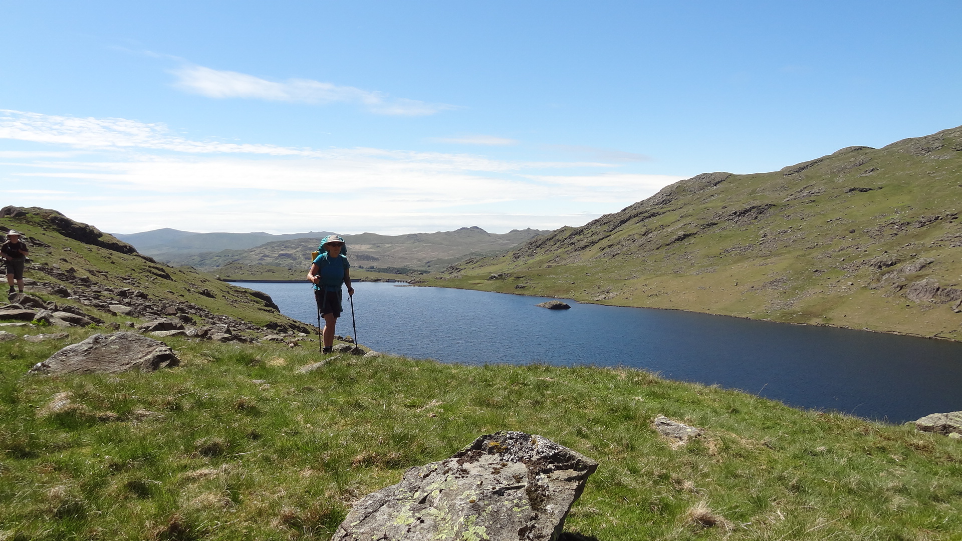
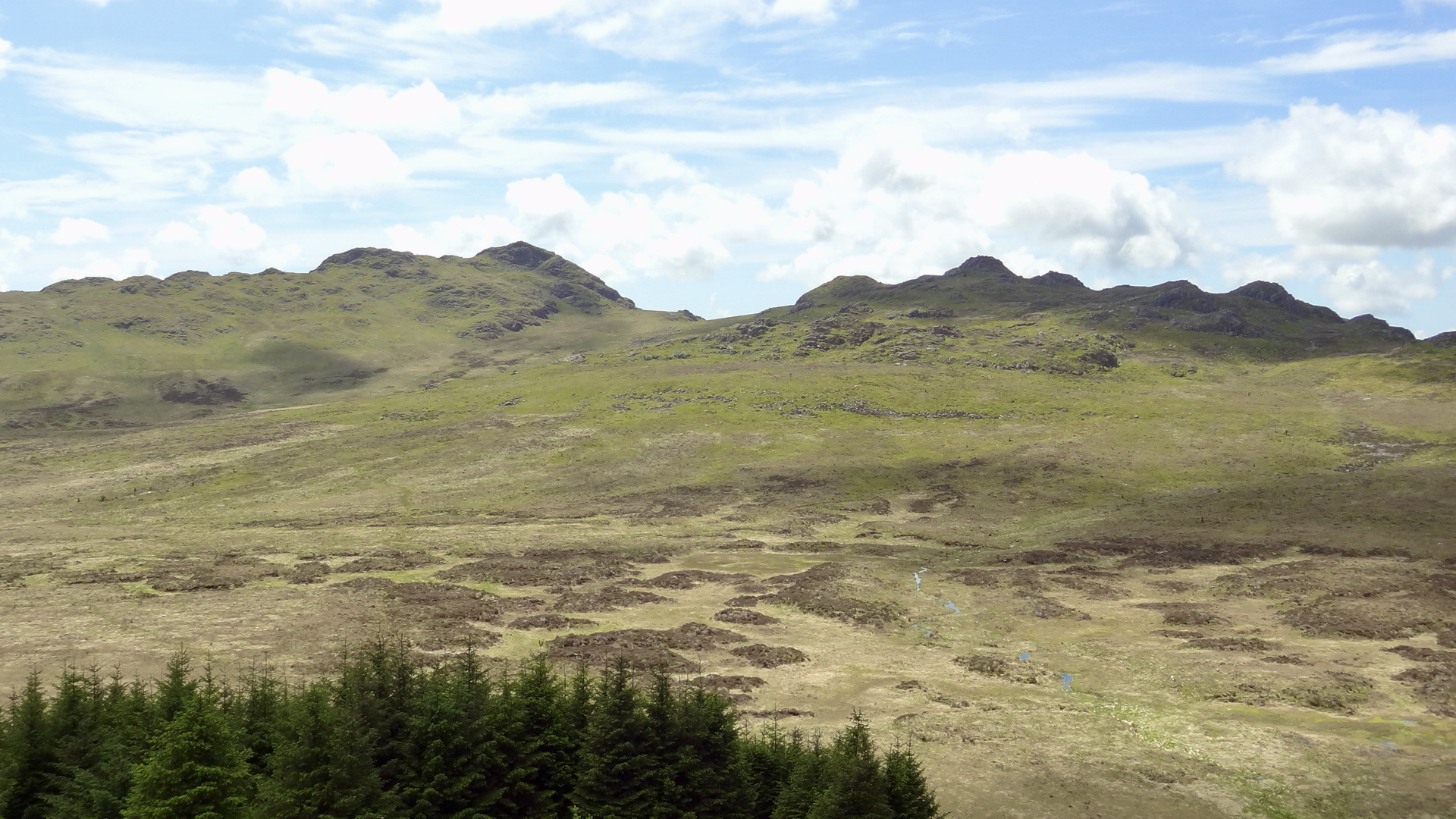
Easy walking through flowering heather, with superb views all around soon had us looking for an obvious path to the summit trig point. We found the path, a sheep trod, thinly winding its way up.

It was so worth it. Stunning views 360 degrees.


After 10 minutes taking in the scene and planning future walks in the area, we carried on northwards again, picking up the quad bike track which led us steeply down to the cross moorland road between Beck Side and Ulverston. This area can get a little boggy after wet weather.

This next section, turning right along the road is pleasant enough and the road is not a busy one. We passed the farm of Harlock where there is a spring which is probably the source of Poaka Beck and looked across to the lovely farmstead at Rathvale. At Horrace, another farm, we headed south and then south west towards Devils Bridge. Here we saw the first of two groups of Duke of Edinburgh hikers, carrying their huge packs! 


Looking up the valley towards Rathvale Farm.

We stopped at Devils Bridge over Rathmoss Beck for a snack and enjoyed a little bit of the Harlock woodland which was dedicated to Julian Milner. I imagine Devils Bridge carried the old road or packhorse route, pre the motor car but now stands adjacent. It is Grade 11 listed and worth a look at if you are ever passing.

Devils Bridge, Pennington.

Further on we had good views down to Pennington Reservoir which looked worthy of a walk round if it is possible. (But not today). Then we left the road and skirted Harlock Reservoir which was well manicured. Again, this is fed from Poaka Beck and where we spotted another large group of young hikers attached to huge rucksacks.

Pennington Reservoir.

Harlock Reservoir

The route leads through Ewe Dale farm with it's self catering accommodation complete with hot tub. It sleeps 6 and is worth a look. Outside the farm intake the path is a little overgrown and where Sheila got badly nettled. I let her go first! I'm not daft. We spotted three birds of prey, species wise I'm not certain, very much like a Sparrow Hawk but the colour of a Kestral. Then across two fields with young Heifers and sheep. One of the heifers was giving Sheila a bit of a panic attack as it looked like it was taking offence at us crossing their field. But we gave them all a wide birth and got through the gate without incident. Phew.

In the field of feisty heifers.

Another pleasant road walk through the small village of Marton with it's now closed for good pub brought us back to the car.

It's a lovely walk and I must thank Conrad, friend and fellow blogger who did this walk in 2022 and who's route I have followed. You can read Conrad's blog post HERE.

Poaka Beck is a very strange name and not one which I can find much about its origin. I guess, and it is purely a guess is that hundreds of years ago when all the surrounding lands were part of the Furness Abbey estates that this area was a wetland. Poaka is a New Zealand name for the Stint wading bird and again I presume that the Abbey residents had the knowledge to name it after them.

If anyone has a better idea of the name then please leave a comment.

Here's the route. 10.5km, 255 metres ascent, 3 hrs casual walking in a clockwise direction.


Friday, June 11, 2021

A short backpack in the Duddon Valley. Day3.

Sunday 6th June 2021. 

Another wonderful nights sleep with the doors open. No rain, no midges. Today's walk was only a short hop. Basically just getting back to Seathwaite.

So, I said to Judith that we didn't need to be up and away anytime soon. I suggested 9.00 o'clock, to which came the reply am or pm. 

We had a couple of brews and then more bad news, first the tent pole and now my gas stove. I was sat next to the stove and I heard a drastic reduction in noise. I still had plenty of gas but the regulator made no difference. I let it cool and then found that I couldn't return the 3 legs into the stowed position and the stove head and body was ill fitting. It looked like the plastic part between the body and head had heat deterioration and had slightly melted. Thankfully it was the last time I would need a stove on this trip.

The stove was my 15yr old Coleman F1. (I checked it upon getting home and it was not repairable, so its now in the bin).  Tip, don't buy a stove with *plastic* parts.

Another lovely camp spot.

Once packed and the site checked to make sure there was no sign of our being there we followed the narrow sheep trod on the north side of the reservoir. 

Judith wanted to have a good look at the Dam workings and check out if any OS benchmarks could be found. We checked out the rain gauges and we found a marker stone with the initials BC carved into it. We thought it might be the last resting place of the great Brian Clough, but actually it stands for Barrow Corporation.


A last look down the length of the reservoir.
Barrow Corporation marker. However we never found an OS mark.
Rain Gauge.
The landrover track from the tarn to Seathwaite is in bad condition. Very rutted. 
However the views down the valley never change and are a delight.

At the bottom of the track where it joins the Walna Scar route over to Coniston, we had our last practice of a break. We had become experts at it.
A lady with a lovely border collie stopped for a chat and it turns out she had run the Duddon Valley fell race yesterday and came in last. Fiona, come back and do it again next year and I'm sure you will be further up the field. 

Passing through Turner Hall Campsite and then down to the valley road we met our hosts Tina and Alan walking the opposite way to meet us. So it was back to their's for coffee and lunch.

Judith wanted to get off and do some buying at Booth's in Ulverston but we were staying for a couple of days so sadly we said our goodbyes. We hope you had a good time and liked what you saw of the Duddon Valley and its friendly people.

Repeating what I said at the beginning of day one. This trip wasn't about distance it was about confidence and gear testing. We had a great time and learned quite a bit. And had 2 wonderful camping spots.


Route Day3.

Gear 
Sheila and I used the Montane Grand Tour 55. Although I had used this sack a number of times before I found the stiffness of the shoulder straps and the hip belt a bit of a pain. Maybe it was my body not being used to carrying a sack for the best part of 2 yrs I don't know.
The hip belt pockets are almost useless.
The rest of the sack is excellent but does it need all the bells and whistles, it could be made a lot lighter.

Sleeping gear. I used a Rab Summit and a Karrimor x lite mat with a 3mm closed cell foam under the mat. Sheila feels the cold more than me so used a PHD custom bag with a 3/4 length Neo air with a 3mm foam mat under. All worked fine.

Tent. Kuiu Mountain star 2p. Had an Easton advanced carbon fibre pole section breakage. Luckily I sleeved the break and was able to carry on.

Stove. Coleman F1. Failed on the last brew of the trip. 

Trousers. I used a pair of Columbia silver ridge convertibles and the gusset seam came apart. I have had these a while maybe it was down to wear and tear. Sheila wore Decathlon convertibles and these were fine.

Camp shoes. I was trying a very lightweight pair of water shoes with the drain holes sealed up, but I found that the upper material took a long time to dry. So its back to my trusty  Vivo Barefeet.

Socks. X socks, I find these perfect.

Top. I used a Craft cycling top. I find these to have an extra long body so it doesn't ride up with wearing a rucksack. It also wicks sweat away fantastically well. To complement this when it was breezy I used a Black Diamond Alpine Start. A good combination for me.

Shoes. I used an old pair of Ecco boots and Sheila wore an old pair of Carn trainers. Both work well.

Thanks for reading.


Thursday, June 10, 2021

A short backpack in the Duddon Valley. Day.2

 Saturday 5th June 2021

We all slept well and no rain overnight so we had a dry tent. Wonderful. 

Today was classed as an easy day compared to yesterday so no need to pack away quickly. With the good weather holding the walk down the Duddon river should be a pleasurable experience.

The midges took full advantage of me opening the mesh doors of the tent and it was their breakfast time too. It was a bit of a shock because last evening as the sun went down there were none.

Breakfast was a casual affair before setting off across the intake fields to reach the path parallel with the Duddon. We walked in a downstream direction and Judith had decided to up the pace. 

Judith is leading at pace, not a clue where she is going, but does it matter. No.
Bubbling River Duddon which was quite low considering how wet May was.

Just before Birks bridge with the lovely swimming pools we passed Birks car park which wasn't full but I noticed that the numerous picnic benches which used to be here had gone. Leaving just one. Rather odd.

The pools at the bridge looked very inviting.


Pools at Birks Bridge.
Carrying on downstream we followed the obvious path, then when we came to the first stile with a dog flap we made a mistake. The path goes left and follows the river, which on the ground looks a well used trod. However it leads you/us into a dead end with steep cliffs or a swim. We retraced our step and found the right path back at the stile.

This path leaves the river and climbs above the cliffs passing through a Bluebell wood as shown in the pic below.

The path is a good one now, but drops down quite steeply to Troutal Bridge which we crossed and had a ten minute break. This is a lovely spot and a fantastic place to paddle your hot feet. Maybe next time.

Troutal farm has new tenants, people I haven't yet met. The previous tenants Martin and Sophie whom I had known for many years have now moved to Dumfries. There was no one around the farm so we plodded on along the road for just a short stretch before bearing left just after the cattle grid and heading over Troutal Tongue to Tongue house.

Troutal Bridge
Looking back to Harter Fell from Troutal Tongue.

Tarn Beck flows through the grounds of Tongue House and at a small bridge over the Beck we decided to stop for lunch. As mentioned earlier, we were in no rush, so it turned out to be a good lengthy stop, enjoying the cooling river and the warm sunshine.
Our splendid lunch stop at Tarn Beck with the scrambling outcrops of Throng Close and Tongue House Close in the background.


It was such a lovely day it was difficult to get going again but getting going was part of the plan. We had been practicing these breaks and we were getting very good at it.
Our next path was a steep one leading up to the landrover track below Lead Pike which goes to Seathwaite Tarn.

How green is our valley.

Zoom shot across to Scafell and Scafell Pike.
Seathwaite Tarn just coming into sight. Brim Fell ridge behind.

There is a path on both sides of the tarn with the majority of people using the left bank or the north side mainly. Originally there only used to be one path, on the south side, which was used by the miners pack mules during the old copper extraction days. This path has become a little hard to see on the ground in places but it's a far more interesting path than the north side.

The copper mines were worked in the late 19th century and when the ore was tested they found the first source of Wittichenite in the UK.

Construction of the dam started in 1904 and opened in 1910. It provided water into the Duddon for the use of Barrow.

Numerous ring cairns can be found around it's shores.
Seathwaite Tarn and Dam. At it's deepest it is 85ft and contains only Brown Trout.


The area at the far end of the reservoir is usually very boggy and I had my doubts that it would be walkable but it proved to be ok. Our camp spot for the night was just at the confluence of the reservoir with Tarn Head Beck. 

The late afternoon was still warm and our feet were glad to feel the cooling waters of the beck. Tents up, we had a lazy evening of reading and chatting. It had been a most enjoyable day.

Tea tonight consisted of Bla Band Beef and potato with Bernaise. I can say this was the nicest dehydrated meal I have ever had.

Our route Day 2.


Wednesday, June 9, 2021

A short backpack in the Duddon Valley. Day.1

 Friday 4th June 2021

Sheila and I met Judith AKA Well 'Ard and fellow blogger of Around the hills, at a lay-by on the A590 leading into Cumbria. After arriving at our destination an hour later we parked the cars at our friends house in Seathwaite Duddon Valley and enjoyed a hot drink and a chat before finally setting off.

Our rucksacks seemed very heavy after such a long layoff from backpacking and also optimising our kit again needed doing. Judith wanted to test out some gear and check on her fitness prior to going on the TGO Challenge again in a couple of weeks. It will be her 12th time.

My plan for this trip was not to do long distances or numerous tops because the last thing we wanted on our first trip out was a pulled muscle or worse.

The weather was superb, calm and sunny and in the high teens temperature wise (C) which for me was a real treat as it usually rains when I head to Cumbria. 

Once through the farm of Wallowbarrow with its camping barn we had our first gradient up. Even though the climb is not huge by any stretch, it still seemed hard work and had me wondering if I had made a mistake in choosing Harter Fell to summit with a full pack.

At the watershed we had a brief chat with a guy who was running to Keswick. Wow!

The scenery between the lonely farmhouses of Stonethwaite and Grassguards was beautiful  and gave us a brief glimpse of our camp spot for Saturday night up at Seathwaite tarn.


The sun shines on hidden Seathwaite Tarn within the Glacial hanging valley. (centre)
Usually the track from Grassguards to Harter Fell is quite boggy but today it was dry. This is a route which I have done many times and I should be able to do it blindfolded. However much of the forstry on the lower slopes has been felled and the mess of the felling is everywhere. I spotted 2 gate posts and thought that is where the path goes but alas it wasn't to be. So we trudged through the debris of the felling picking up the trail higher up.

For my sins I picked up a slight sprain of my ankle which hurt quite a bit at the time but it eased up as i walked it off.

The ascent of Harter Fell was tough going in the heat of the day with very little breeze and we stopped regularly to get our breath back. Sheila said her legs were shaking and I said that it wasn't just my legs that were shaking.

Green Crags from the slopes of Harter Fell.
The summit of Harter was quiet, just a small family group enjoying a picnic and the sun. The 360 deg panorama was fantastic. The Scafell range looked so close.

The Scafell Range
Bowfell (Centre) Esk Pike (Left) Long Top (Right)
Trig Point OS Bracket, Harter Fell.


A late lunch was had at the summit. We carried water up to the top as I knew there was none to be found around the summit. Water is awful heavy to carry up hill. 
A few more minutes taking photos and posing around the trig point then we were away.


The summit of Harter can be awkward route finding in the mist but today it was easy. We headed NE towards Demming Crags with the large body of Hardknott looming ahead. There is quite a drop down from the summit until the path levels out, but it was great to be going downhill. A few of the small becks had water in so I was hopeful that our camp spot would be the same.
Heading for Hardknott.
To our right, more forestry had been felled. As we approached Hardknott Pass and Peathill Crag our path look a sharp turn ESE and followed the forestry fell line down towards the Duddon Valley. Our downward route was part of the old Roman Road fell Hardknott Fort to Ambleside. Not much remains of the road today.

Our legs and bodies were quite weary now and I was glad that we were close to our camping spot for the night. I had pre arranged with the farmer about pitching our 2 tents on his land and we were given permission. He doesn't usually allow any camping.

Judith and I checked out the water supply and although it wasn't a cascade it was running and good enough to collect. That done and after a short sit down it was time to put up the tents.

Would you believe it! As I erected the Kuiu Mountain Star 2p tent one of the carbon fibre pole sections cracked and broke. I tried repositioning the tube but it broke again. Luckily I always carry 2 spare pole sleeves and so with a bit of faffing I managed to get the pole strong enough to support the tent. ***

Tea was Chicken Biryani for Sheila and a Spag Bol for me. Both from Summit to eat.
Then we realised we had forgotten the green tea bags. So it was just coffee on this trip and lemon and ginger tea for breakfast.
What are you doing taking a photo of me?
Our lovely camp spot at the head of the Duddon Valley.
Although it was a nice evening we didn't get a good sunset, which was a bit of a shame. 
I had a bit of an anxiety moment for 5-10 minutes which wasn't nice but I think it was brought on by being de-hydrated and tired. 

Then as the sun went behind the ridge the temperature dropped fast. It didn't take us long to get in the tent and drop off to sleep leaving the tent doors rolled back all night. Judith probably read Private Eye until doing the same.
A tiring but gloriously rewarding day.

Todays Route Map

*** email sent to Kuiu Warranty. 
Kuiu replied very quickly and full of apologies.
After a few checks they have posted me a new set of CF poles.
Fantastic customer services.
Thanks Kuiu


One broken carbon fibre pole section.


Find it Here

About Me

My other blog. beneathwhosefeet.wordpress.com