The Vault Regulars

Friday, September 30, 2016

'uddersfield to Marsden - along the Narrow Canal.

Thursday 29th September 2016
Walking with Terry

After the debacle we had with public transport a couple of weeks ago when we went to Adlington we took some Librium and set off again for Manchester by bus. From home its only 8 miles but it took us 1 hour 10 minutes. How folk do this on a regular basis commuting to work is beyond me and i think i would be seeking help from a psychiatrist.

Anyway we got to the re-vamped Victoria train station, and what a nice job they have made of it btw, in good time to get tickets to 'uddersfield and a coffee from the tax dodgers, you know who i mean.

On time and direct we were in 'uddersfield by 10.30am. It must have been 10 degrees colder  than Manchester, everyone dressed for winter and it was spitting with rain and blowing a hooley.

 Huddersfield's wonderful railway station with added water feature.
Heading south or down hill, the town was quite busy and although i had promised myself a bacon butty upon arrival, i wasn't going to queue up for it, and Gregg's was packed to the door.
The wind was bitterly cold and once out of the protection of the buildings it was almost blowing us over. 
We reached the narrow canal at lock 3, adjacent to the Kirklees College. The clouds were getting darker and no sooner had i taken the photo below did the heavens open. With blue sky around we took shelter under a tree rather than don waterproofs and as it happened this was to become the theme of the day. Only on one wide open area did we get caught out.
 Kirklees College with a rain shower approaching.
 Approaching the Longroyd railway viaduct. Opened in 1899. Clouds looking ominous.
 The Brittania fabric mill. 
Still operational and the weaving looms could be heard through the open windows. 

 Milnsbridge with the new-ish canal side apartments.
Just passed this point there was a huge Police presence, lots of vans and the regional marine unit. What looked like forensic units, all masked up. I didn't take photographs for obvious reasons and we guessed that maybe a body had been found in the river Calder, but that might be just our imaginations.
The Calder passes under the canal and since our last visit here a new path had been installed down to the weir which is quite impressive.


 Appleyard Bridge and locks.
 Going dark again as we approach Titanic Mill, now apartments.
 Dad, what are these two looking at.
 The section of canal from Linthwaite to Slaithwaite, (pronounced Slowit) is sheer delightful to walk but today quite a few sections were very low on water.
 The smell of cooking was too much to resist and tummies were rumblin', so we popped into the Lock 22 cafe and had FEB (full English Breakfast) with coffee. Wonderful, very friendly cafe and good value.
 Terry was eyeing up the Empire brewery and wondered if they had any free samples. The barrels outside were empty. There used to be a floating tea room along this section but it's not here today. We wondered if the Bakery cafe next to the Brewery had seen it off. Shame because it was a nice experience to have tea on the boat.
 A bit of blue sky followed us for a while and the sun made an appearance for us to enjoy. In the centre of the above photo is a solar powered flow meter, so they must get quite a bit of sun here. You don't see these meters very often.
 A fine walk up to Sparth reservoirs brought us to within distance of the train line to Marsden where we saw our train passing by. We had missed it by about 10 minutes and so would have to wait another hour.

 Going up the Marsden flight of locks.
 Getting to the station and having to wait 50 minutes for the train we did the only thing left to do and that was to visit the Railway Pub. Now we wasn't looking forward to this because last time it was a keg pub with no real ale but surprise surprise, they had 5 or 6 real ales on. Say no more, what time is that train.
Inside the railway Pub at Marsden. Outside it was horrible, gale force winds and spitting rain, we might be here some time.
We did just over 12km.

Sunday, September 18, 2016

Heads in the Trough - just.

Today's visit to the Trough of Bowland was a follow up to our previous visit to the Lune Valley last month.
Then we did a beautiful river walk, so this time we headed up hill to the trig point on Whit Moor at 361 metres.
Parking was easy and free at Claughton Village Hall. It looked unloved and in need of TLC.
Crossing over the busy and fast A683 can be a bit precarious as the 40 speed limit is flouted by motorbikes doing double that. Care MUST be taken.

 Opposite the pub an old corbeled lane rises gradually following Claughton Beck where a number of waterfalls can be found.Today the water level was low but i would have loved to have been here during last weeks storms. The lane was showing signs of water degredation.

This area is shooting country, Pheasant, Partridge, Grouse and Ducks and most of it belongs to Claughton Hall, the home of the Oyston's.
We passed the Hall, although we couldn't see it from our path but as you rise up the moor the views open up to the east in spectacular fashion. Today the view was restricted by low cumulus clouds but on a clear day Yorkshire's renowned three peaks fill the scene.

Three Peaks in the cloud.
At SD573658 we had a little meander, Sheila was map reading, she told me i could say that, we carried on going west instead of turning south and up hill. It was only a short meander, maybe 200 yds before we cottoned on we had gone wrong.
Back on the right track there were hundreds of pheasant chicks all marching up hill with us. Never before have we seen so many.

At the top of the rise the path had been washed away, some temporary repairs done to allow quad bike access. This is where the old quarry workings are. There is an old overhead cableway with buckets on wire. From here they used to transport shale and clay down to the brick works at Claughton. Now disused the equipment is still in situ but rusting away.

Still the birds followed us, almost to Moorcock Hall farm. This is a fine building, recently renovated i would guess, and the dogs which were thankfully caged let their owners know of our presence.

Pheasant on the path
We now had fantastic views along the Lune valley and the sun shone where we were,  but the three peaks were rapidly disappearing into the gloom. At a picnic site with information board about the wind farm on the moor to the south, we checked the map again to make sure we didn't miss the change of direction required to visit the trig point on Whit Moor.

Sheila decided a sand castle was in order
There are 8 turbines in total and today with only a gentle breeze they were only just turning. The track is a good one all the way over the moor to the Roeburndale Road but we weren't going all the way. Once through a gate a quad bike track on the left and then a single footpath points the way to the trig point which came into view with a couple of hundred yards to spare.

A fantastic 360 degree viewpoint is the reward.

We stopped to enjoy our surroundings. Total silence, even the slow turning turbines couldn't be heard. Not even a Skylark broke the peace. No people.
After 15 minutes, coffee and sandwich eaten we made our way back to the picnic tables.
Morecombe Bay, Heysham Powerstation, Silverdale and the Cumbrian Coast relatively clear from this position.


A very heavy compass just in case we got lost.

The farm road down towards Caton was easy and although tarmac, was not unpleasant. Around every corner the views of the River Lune and it's flood plain opened out.

We took the footpath leading to Annas Ghyll Farm, following the signs which lead you around the farm rather than through it. The farm looked tidy and a lady looked up from her gardening and waved.

The path from the farm to Caton Green road is not worn but it's a straight line and easy to follow using a couple of stiles. To the south the sun was strong and difficult to make out the surrounding hills through the glare. To the east the Yorkshire Dales looked like they may be starting to clear. Whernside's top just appearing out of the cloud.

The road walk back to Claughton and the car was mostly on the back road rather than the A683, it's quiet  and pleasant enough.

 Walking down to Caton
 Sheila says this looks like something which i cannot possibly print.
 Up to Annas Ghyll Farm
 The farm comes into view with Whernside disappearing again in the background.
 Sheila has Stile.

 The Lune Valley from Caton
 Knotts Wood
The brickworks. Not sure what FM 1609 stands for, maybe a reader will tell.

The route was 13.5km.
All photo's taken with iphone 6.


Friday, September 16, 2016

Adlington to Wigan Wallgate.

Thursday 15th September 2016.

A good weather forecast managed to get Terry and myself on public transport to Adlington. A small town on the way to Chorley. As the crow flies Adlington is just about 18 miles away from home but it took us 2 1/2 hours on bus and train before we alighted in said town.
A rush hour bus into Manchester was anything but rush and works on the railway put paid to a fast transit.
 Adlington Station

The plan was to get breakfast before setting off walking. There is a great cafe at the White Bear Marina, but now it was almost lunch time.
 White Bear Marina Cafe, the last time i was here it was raining quite hard on a walk with Martin B in February 2015


 Terry had gone past breakfast and only had a coffee but i was starving and managed a BLT and coffee.
The day was not as good as forecast, which was wall to wall sunshine, but was warm, cloudy and very hazy, not great for photography and walking brought on instant sweat with the high humidity.
Just as we got onto the canal towpath we said good morning to Queen Victoria who's been doing a roofing job here for quite a few years now.

Queen Vic up on the roof above the red van.

The canal is the Leeds and Liverpool which is 127 miles long and built between 1770 and 1816. It has 91 locks and the Wigan flight which was on our route today has 23 locks and i'm told by Terry who has done this in a narrow boat that it is jolly hard work or words to that effect.
It's a wide canal and was built to take 14 ft wide beam boats.

The first mile was a real noisy walk with lots of dogs barking from what i can only assume to be a kennels located somewhere to the west around Adlington Hall Farm.
The towpath was pretty quiet for such a nice day with only a few bikes and hardly any walkers. We more or less had it to ourselves until we hit Wigan top lock.
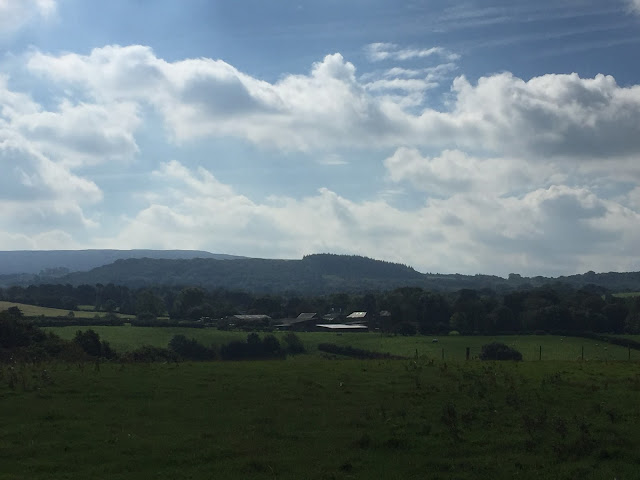
The scenery is predominantly rural, lots of ploughed fields, grass being cut and that aroma you get when grass cutting, filled our nostrils. Not good for the hay fever sufferer.

The towpath edges were being cut and as you can see from the above photo most of the cuttings were ending up in the canal.

We disturbed a Buzzard from a tree about 10ft in front of us, scared us to death as it escaped the branches and flew low across the canal. A big bird when in flight and so close. No Heron's today which was a surprise as the canal was teaming with fish of all sizes. Chub were close to the surface in large schools and a Jack Pike was seen basking.

On the OS map there is a moat marked at SD589107 which sparked some interest and my photo didn't do any justice to it so i havn't included it.(the photo below is from Wiganworld)
The Moat is an ancient monument dating from the 12th Century and surrounded Arley Hall. A  later house built on the site has a date stone of 1327 but this is considered fiction. The moat is 20 metres wide and 1.5 metres deep and fed from the canal nowadays.
Arley Hall moat.

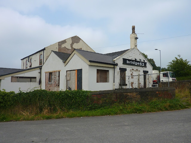
At Red Rock Bridge i did intend to leave the towpath for a look at the old disused railway but we must have been talking about the moat and it completely slipped my mind. It was a good 10 minutes on and seeing Bridge 63 pub, that i remembered it and i wasn't going back.
The pub was looking sad, boarded up and fenced off. It did look like it may be being renovated, so fingers crossed.
A castellated wall brought us adjacent to Haigh Hall Park on the opposite bank. It looked quiet.
Approaching Wigan Top Lock more Buzzards were seen and heard and i was hoping to get a photo this time but it wasn't to be.


The largest wild rhubarb i have ever seen.

A Grebe with chick on it's back having a great time.

 Approaching Wigan Top Lock
Looking down the lock from the top. Unfortunately you don't get a good view from anywhere of the whole 23 lock flight. A drone camera is needed and i don't have one. 


The canal turns 90 degrees west and the Kirkless Hall Inn just happened to be open. At this point we decided that we had to put back into the body some refreshment., 
A really nice pint of Wainwright didn't last long but we only had the one.

We left the towpath here at Henhurst Bridge to walk to Wallgate railway station but on reflection we should have carried on to Wigan Pier and then headed off to the station. But that's hindsight.
As it was, we managed to jump on a train with 30 seconds to spare and thankfully there were no works on the return leg to slow us down.

Wigan Station.
Todays route.

As an aside.
I downloaded OS maps onto my iphone. It costs £20 per year but you get the whole of the UK at 1:25000 scale. You can record or plan routes, show your current location, pause as required, save and export the route and more. It is also updated regularly.
I used it on this walk and i am very impressed with it and importantly, the little amount of battery life that it uses. My Satmap active 10 might be taking a backseat from now on.
I can recommend it.


Find it Here

About Me

My other blog. beneathwhosefeet.wordpress.com