Tuesday 30th January 2024.
We took advantage of a forecast good weather day to walk an area which we had never been to before. I picked a circular route and I admit it turned out tougher than I had envisaged when I originally planned the route a couple of weeks ago.
We parked up at the southern end of Ashworth Road at SD 852123, adjacent to a road bridge over Cheesden Brook.
Walking back along the route a 100 metres, the track we wanted entered a wooded area through where a signed pointed out that there was a danger of steep cliffs.

The path up to the top of the escarpment was not that steep but quite slippery. It led onto farm land with a permissible path skirting Dobb wood. Good views were had towards the outskirts of Bury and further on the skyscrapers of Manchester City centre.

We followed the path until at a cross road of paths we found a stile taking us back into the woods. Our path took us down hill to a footbridge over the brook. We saw our first person of the day here. He was a bush crafter and was heading to a makeshift shelter a hundred metres further on. He was staying here for the night and gave us some interesting facts about the area.
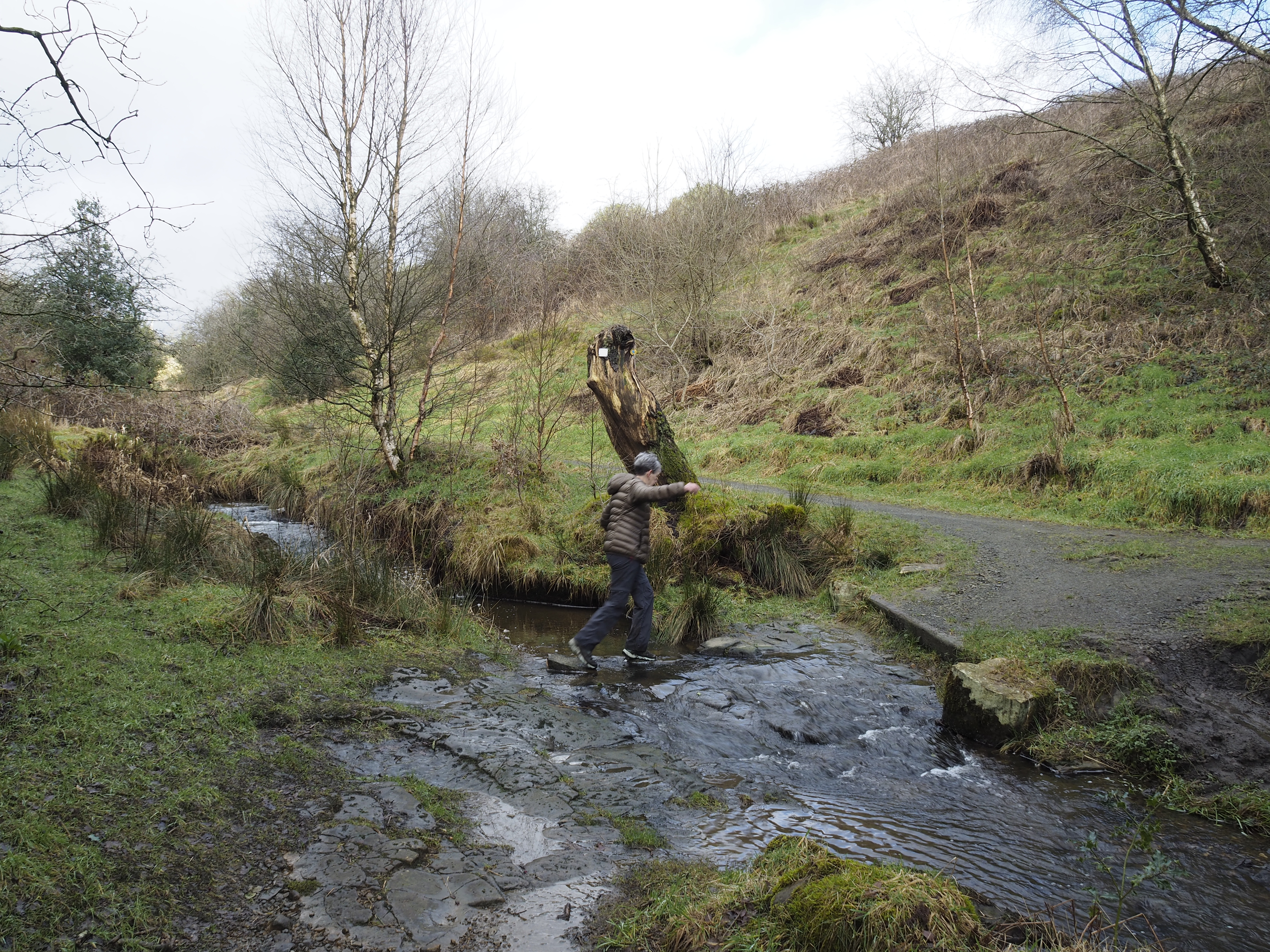
We wished him well and carried on to a point where we had to cross Cheesden Brook.
The brook was swollen with all the resent rain and although it could have been waded if absolutely necessary, we were not prepared for it. No over trousers, no gaiters, no walking poles and so decided to go back to the bridge and find a route on the other side of the brook. After a bit of searching and bramble tripping we did find a route which put us nicely back on track with dry feet.

Footbridge over Cheesden Brook

Cheesden Brook, a little too deep to cross today.
The path climbed back up to the escarpment edge with great views down to the brook, the drop was around 120 metres. Eventually we came to habitation in the form of property converted from what used to be an old dye works at Kershaw Bridge. There were far more buildings here than what survives today.
Prior to being a dye works, the buildings which now are few was built as a fustian mill by Thomas Allanson in 1780. By 1840 the buildings were a dye works until being sold to the Whitehead family and converted to cotton production.

Entrance to the now demolished Kershaw Bridge dye works.

Ancient track. Probably made around 1780

Kershaw Bridge over Cheesden Brook.

Mill stone located near Kershaw Bridge.
The area around Kershaw Bridge looked very interesting and worthy of a revisit in the future.

Cheesden Brook.

Kershaw Bridge from the north bank.
The weather was holding out but black clouds loomed from the north west. One minute we had sun and the next we thought it was going to rain. Fortunately we didn't get rain.
From the north side of the bridge we headed up a good track where we were startled by a mountain biker who came behind us at a fair pace. There was an apology for making us jump and no harm done.
At the junction with a minor road we turned left until we came to the entrance way to Green Gate Hill Farm.

Cheesden Brook.
Sheila crossing an unnamed tributary of the brook.

The next section is one of those sections that you wish you hadn't planned and there was no alternative once we had got started.
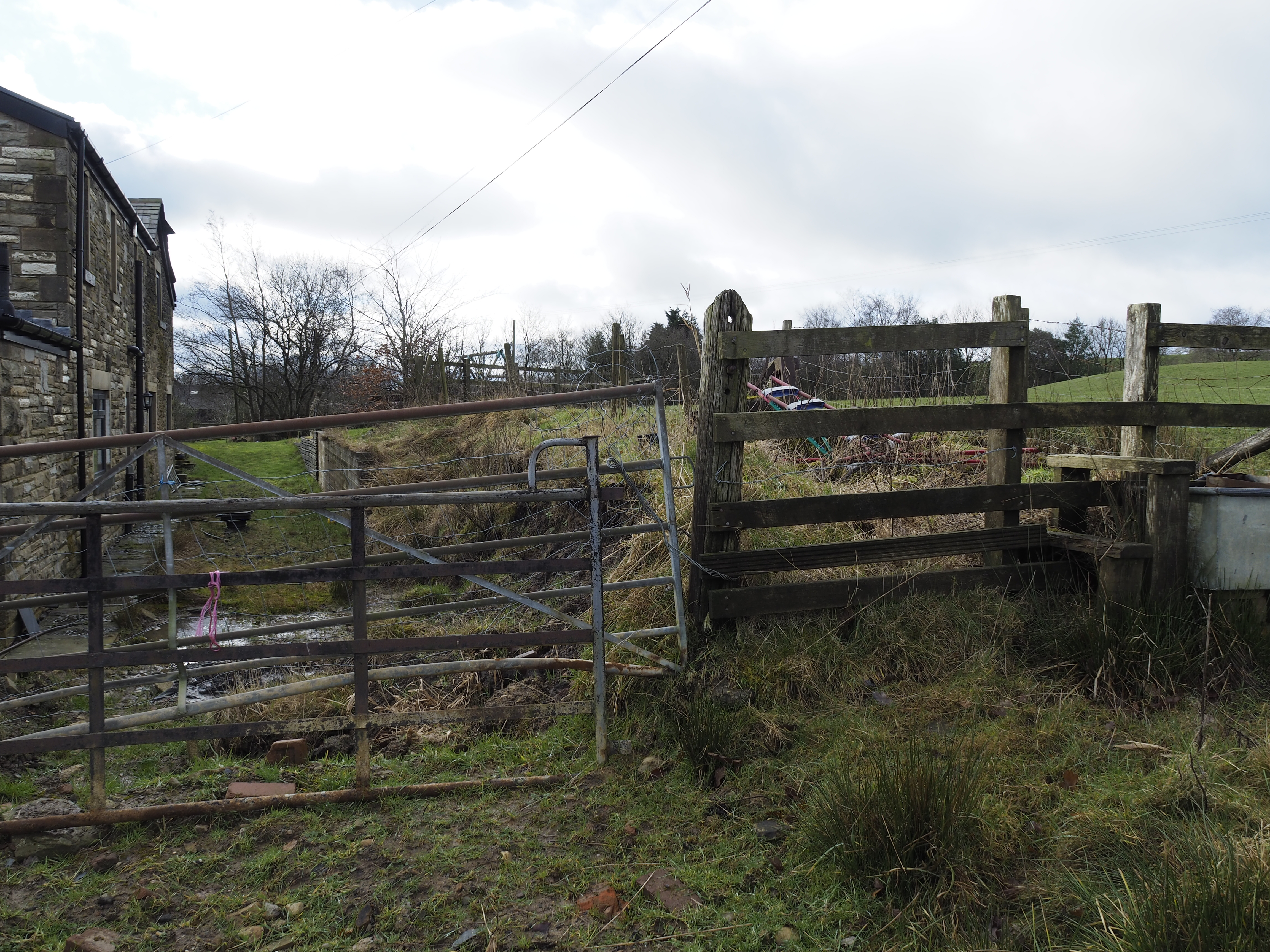
We checked the map as we were going through a farm and wanted to make sure we were on the right "path". To the left of the buildings the map showed the route, but this looked like we were crossing a lawn, there were no other footprints and no diversion signs. We did our best not to cause damage as the ground was very wet. A tall double gate was in front of us and a high bank on the opposite side to the house. An old stile appeared at the top of the bank but looked like it hadn't been used for years. With difficulty we ascended the double gate and got onto the bank and over the stile.
Now where do we go from here? It wasn't obvious. Down hill to a stream looked a quagmire. Check the map. The path shows this side of the stream. Another double gate, no stile. We had to climb the gates and headed east towards a wooded gully. We came to a narrow path, it could be a footpath or could be a sheep path, anyway we found a crossing over another stream with a kind of stile on the other side. I checked the map and it looked good. We got the impression rightly or wrongly that the owners were not enamoured by walkers. It would be section we would try and avoid next time.
It looks easier in the photo than it actually was.

No stile, couldn't open the gates. No indication that the path went this way.

The stream and stile on the other side. We did get wet feet on this one.
The path on the other side led us to Lee Holme farm and it was supposed to be a bridleway. A good gate takes us to the north side of the building and again no signs leading you through the yard. We didn't go through a high cattle gate just past the farm house because we thought it just led to a holding pen. As it happened we should have gone through it and avoided 100 metres of deep cut mud fest. Regaining the right path and another mud fest we hand railed a small beck on our left which brought us down to a newly fitted footbridge across Mill Croft Brook.

Just beyond this new bridge the mud fest ended for a while. The gorge became more picturesque and there is much history here. Much more than I have time for in this blog post. However, just round the corner from this bridge we passed a modern curved bridge and the remains of an old mill.
The mill turns out to be what is left of Coal Bank Mill.


What remains of Coal Bank Mill.


Coal Bank Mill after the fire of 1916.

Old York stone cart tracks leading to the mill from School Lane.
It was a good path down to school lane and lovely views following the brook. Looking at the water courses with deposits of iron oxide I guess there were also coal mines here too.
Turning left and sharp right before the bridge over Naden Brook we walked through smart high gates. A new house was being built and the path skirted the left boundary leading to another mill and waterfall. It was lovely here. The mill was the remains of Ashworth Mill.

Ashworth family mill. Remains of.

Waterfall adjacent to the mill. (Man made for the mill)
There is a water wheel here but on this occasion we didn't search for it.

Just beyond the mill the os map is wrong. It shows a path heading upwards through the trees and dropping down through Carr Wood. This path does not exist. The path follows the course of the brook and I have shown the route on the maps at the end of the post.
The route is a lovely one with many falls, twist and turns etc. A fine stretch.
Here are photo's of the walk down this bucolic gorge.


At the end of the gorge the path enters a park home site which took us a little by surprise as the path on the map carries on until it reaches the main road towards Bury. This path doesn't exist in reality.
So through the park we went and so back to the car.

Looking back from where we had come.
Through the little side gate and to the end of the home on the left.


Our route. 9km. 3hrs. (seemed longer due to the mud and the back tracking).
A worthy route if very muddy in places. I can't wait to go back to investigate all the old mills and industrial revolution sites.


