The Vault Regulars

Friday, May 17, 2024

Marmot Pre-Cip 2024 waterproof jacket review.

16th May 2024

For years and years I've wanted a Marmot Pre-Cip but could never justify getting one as I have a wardrobe full of jackets. But, in time jackets wear out and so when three of mine went to the re-cycle bin I bought a Marmot Pre-Cip with my own money after good recommendations from my wife. 

She has had an original Pre-Cip for some years and raves about it. I have read many reviews about it as over the years it became a bit of an iconic jacket. I recall Chris Townsend giving it a good review in TGO Magazine many years ago.

It isn't used for backpacking because it simply isn't strong enough around the shoulders to take all the abrasion a backpack creates, no matter what the ultra lightweights say. But for day walks and as a general waterproof then it's been perfect for her and I wanted a lightweight waterproof so it was a no brainer really, considering the price of £60.


It's a simple waterproof, no frills and very lightweight. Packable into it's own pocket. The hood can be rolled away into the collar. Sleeves have the usual velcro adjusters at the cuff, the hem has draw cord tighteners, a zip rain shield, 2 mesh hip pockets, pit zips and not much else. It does feel very nice, tactile I suppose.

Size wise it is slightly larger than "normal" sizing due to being designed for layering with an insulated jacket. There is plenty of room for layering and also the sleeves are a little longer than std which I don't mind at all and your arms stay protected when reaching high. I find the sleeves a little too narrow if I want to pull the sleeves over a thicker pair of gloves. I hate narrow sleeves.

The weight of my Large is 322gr. The jacket is made in Myanmar, the original Pre-Cip was made in China.

With 2.5 layer 100% nylon material and NanoPro Eco coating, whatever that is, it is said to be very breathable and absolutely wind and waterproof. That's the marketing bumf anyway. 

All excited and ready to try the jacket out I waited for a rainy day and then went for a short walk, about 2 1/2 hrs. It wasn't lashing down or fine horizontal stuff and not torrential, just typical Manchester summer weather.

I walked about 12km with only a few up's and downs. Temperature was 8 degrees C, I din't take a daypack and I was in no rush. I wore a capilene base layer and a polyester fleece and then the jacket.

First time I cinched the hood the tensioning cord pulled out from its secure seam completely. Not a good start, now I will have to find a way to fix it back in.

I din't stop during my walk and never checked the inside of the jacket. When I got home and unzipped the jacket the inside was wet through and my fleece was wet as well. So it doesn't breath very well if at all and I can only suggest that it isn't waterproof to any degree enough for a days hiking.

The next time I went out in the rain Sheila came with me with her Pre-Cip and guess what! My jacket and top were wet through and Sheilas was dry as a bone. 

So what is the difference. The country of manufacture has changed from China to Myanmar. I guess the spec. hasn't changed but where abouts in the spec. does the new jacket lie? Is it at the top end or the lower end? I can only guess it has been a cost cutting exercise and now we have a lower spec jacket. I am not privy to this sort of information but its obviously not as good as the original Pre-Cip. Or the DWR isn't up to the job.

I'm a bit disappointed to say the least as I will now have to find another "Waterproof Breathable" lightweight jacket that will keep me dry for longer.

Can I recommend it? Absolutely not. 

Any suggestions at all for an alternative jacket? as marketing bumf is no indication of how good a jacket is in reality. Thanks. 


Wednesday, May 15, 2024

Whita Hill Circular, Langholm,

 Thursday 9th May 2024.

Whita hill is another prominent height surrounding the village of Langholm. On it's top is a white sandstone monumental needle built to commemorate Major General Sir John Malcolm. There is also a communication mast. Both these objects can be seen for miles around.

Our walk is also number 8 on the Langholm walks list and is classified as MODERATE.

The weather forecast said it would be a cloudy day but it was clear blue sky, no breeze and warming up. A perfect walking day.

Walking past Kilngreen Carpark a fair was being set up for a long weekend. There was the usual caravans and facetiously I said to Sheila "I wonder if they will be allowed to sleep over on the carpark"?

Anyway, across Saw Mill Bridge we went, aptly named from the old (yes you have guessed it) saw mill which used to be on the West Bank of the Ewes river. It used to be water driven as a leat was taken from the river further up stream. The mill or where the mill was is now part of the Baccleuch Estate. The leat long gone.

Before reaching a nice lodge house, turn right and follow a good track rising gradually. When a bungalow is reached take a look right for good views of the days target top. Take a right and follow the path which again has great views and is a pleasure to follow. 

Whita Hill

Soon a gate is reached across the track, go through it and continue on the track to the end of the wall, turn right and look for a galvanised modern kissing gate, don't be tempted to take the steep grassy route straight down to the road.

Go through the gate and follow the left hand fence line all the way round until a LRT (Land Rover track) is reached. Follow this down to a gate and join the main A7 road. 


Go right over the road bridge, known as High Mill Bridge, taking care as this is a main highway. As the road bends right, cross over the road and pick up the good path on the other side which heads in a northerly direction.

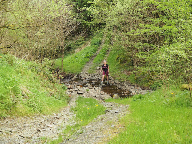
Follow this track on level ground all the way until you cross a small burn by a culverted bridge. Follow the path round to the right and a little higher up the path opens out and a path drops off to the left where a ford is crossed. Take the ford and take the onward rising path. On the left the area is known as Target Burn.

Target Burn.

Target burn was a rifle range which was used during both world wars. The OS names it Far Whitshiels Cleuch. At the top of the rise, the path bears right and follows the line of a stone dyke on the left, it was a bit indistinct, overgrown and boggy when we passed here but a stile is soon reached on the left and crossed over into open countryside. 

The views now are stunning.

The route upwards basically follows the fence line. The ground is wet in places, not much of a path but the views get better.


Many ewes with new born lambs kept us company. One lamb in particular was incredibly friendly and came right up to us for a few minutes. Luckily when we got on our way it didn't follow us but bleated for mum.

A sandy track was followed to a galvanised gate. The route doesn't go through the gate but turns left, follows the fence line until gaining the moorland road between Langholm and Newcastleton. 

Across the road we took advantage of a bench for lunch. We started to loose the blue sky and the temperature was taking a dip so onwards and upwards.

Comb Hill (with the mast), and Wisp Hill

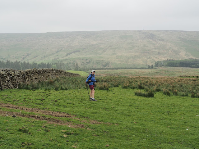
Moorland road with Tarrona Hill in the background.

A little further up the road we came to a fine memorial.

The memorial is to Hugh Macdiarmid who was born Christopher Murray Grieve on 11th August 1892. He was a co-founder of the SNP. The poet was educated in Langholm and is buried there.


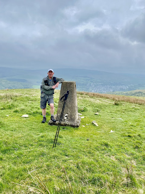
A good track leaves the moorland road all the way to the top of Whita Hill where there is a trig point at 280 metres and a obelisk monument to commemorate the life of Sir John Malcolm of Burnfoot, Langholm.

John Malcolm joined the East India Company at 13 yrs old. Becoming a cadet in Madras he saw active duty against Tipu Sahib, the Sultan of Mysore.

Apart from this monument on Whita Hill there are also monuments in Bombay and Westminster Abbey.

Track up to the monument of Whita Hill.

Trig point with a view.

The John Malcolm Obelisk

If anyone reading this has any idea what this represents, please let me know.

What happened to the blue sky?

Tinnis Hill in the gloom

We were losing the light and the far distant views. After taking a few photos we headed off down hill to find the Whita Well. 

It's quite a steep drop off the top and care is needed in wet weather. Today we were fine and soon came to the cairn and well of the Common Riding.

The wells water is pure and can be tried with the chained up metal cup attached which we did.

Whita well.
A hundred yards further on through a host of gorse bushes is a stile on a green lane leading straight down to Langholm High Street.


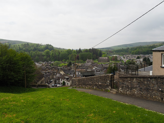
Almost back into the village

Our route, clockwise from the boot. 8KM 3hrs including stops.


Saturday, May 11, 2024

Langholm 5 tops circular.

 8th May 2024. 

We arrived in Langholm Scotland, pronounced “Lang um” by locals, yesterday afternoon. A very pleasant day weather wise but the drive up was very busy considering it was the day after a bank holiday. 

The main car park in the village was quiet and also "Free" which was nice to see, you can also leave your vehicle overnight but you cannot sleep in it overnight or have BBQ's cooking etc. After a short break we set off to do a couple of short walks around the village just to get our bearings. We were staying in the Eskdale Hotel for 3 nights. Spoiling ourselves. 

I didn’t sleep well, I had a bit of a sore throat and i kept Sheila awake with my coughing. But, a walk was planned and that was what we were here to do, and so it was, after a good Scottish breakfast we set off. 

The day was much overcast with a bit of a chilly breeze as we gained height but it wasn’t raining and the tops were clearing slowly. 

Our walk today was picked from the splendid brochure of 14 Waymarked Walks. It was number 9 headed Calfield Rig and Mid Hill and was classed as STRENUOUS.

We didn't do the walk exactly the same as the brochure suggests, we actually went up to Mid Hill first. 

Leaving the Eskdale Hotel or the Village Car Park for that matter, we crossed Town Bridge which Telford had worked on as an apprentice stonemason. Carry on alongside the B7068 road, crossing the junction and then turn left at Eskdaill Street. Walk along the right hand side of the street until the end of what look like 1970 council flats and before the older terraced houses. Turn right here and look for the staircase at the edge of the woodland.

At the top of the staircase you join a wide track, bearing right and in front of a renavated lodge type house go left and follow it alongside some modern houses to a junction of 3 paths. We took the middle one which is heading eastward and uphill.

Views of Langholm and the surrounding hills start to open up as you exit the green lane into open countryside. It was surprising to us just how much of a bowl Langholm sits in because you don't realise that from walking around the village.


Grey overcast view looking across to Langholm and Whita Hill in the background.

From here the path is clear until you come to a "Shed" type building on the hillside where the track goes to the left of it and gains height. A path is not a necessity as you just keep going up hill. There were cows on the hill but they were no bother.
We soon gained our first top which is Meikleholm Hill at 262 Metres. 

The sky looked ominously dark over to the north to Bauchle Hill and Hog Fell but to the south it was light and clear and we were hopeful our route would be fine.
Sheila on Meikleholm Hill. Not sure what the concrete slab was for.

Our next Top of the day Mid Hill. (Can you spot the trig point)

Dropping down off Meikleholm Hill you soon come to wall line with a galvanised gate. Go through the gate and ascend the hill staying on the right side of the rising fence. 
Mid Hill has commanding views and a great place to picnic on a sunny day. Today it was a bit chilly and not a place to stay too long. Mid Hill is 327 Metres and supports an OS Trig Point number BM10244.


Mid Hill Trig Point


Another drop down and a climb up to Black Knowe at 326 Metres. We had read that from here you can see the Solway Firth and the hills of Northern Lakeland. But not today. Those black clouds were closing in.


Views from Black Knowe

Having a walk around the top of Black Knowe we saw a new construction which looks very out of place here in the Glen of Craig Burn. No idea what it could be. 
Later we found out that it was Scotlands first legal Cannabis farm. How did that monstrosity get planning permission in such a remote green belt landscape. I hear that it was all done very quickly and there were no local objections. I find that a bit worrying as well as a bit surprising that there wasn't one objection? When I looked at Langholm news this article came on the timeline. Here. Seems a real co-incidence or maybe my imagination.


Scotlands "First" legal Cannabis farm. What with wind farms taking over the hills there doesn't seem to be much care about the hills here, just a few making lots of dosh.

Anyway, back to the nicer things. We retraced our steps back to the fence line where there is a stile giving access south to Craighope Head 315 metres. This is a top but hardly worth a mention apart from the views over the forestry. The views are probably more expansive on a good day.

View from Craighope Head westward to the Craig Wind Farm. Skies clearing a bit.

At this point it is easy to make a mistake if you don't know the area and you are just using the information on the way marked information sheets. 
Like any other hike it is important that you can read a map and compass and carry one. In bad weather as well as in fine.

 The obvious route that your eye and brain tell you to take is the path which goes  across to Naze Hill. But we need to follow the fence line heading in a south west direction and at the corner of the fence head uphill to the left on pathless terrain and head along the ridge to Calfield Rig at 319 metres. Some sheep tracks can be found which lead generally to the top.

It is a steady plod to the top with good view opening up to the south where there was also our first glimpse of blue sky. A boggy bit of terrain was crossed and we came across a cuckoo flower.
Cuckoo Flower

View to Calfield Rig 319 metres with Lea Gill on the left.

Almost at the top.

From Calfield Rig, our last top of the day, yet another fence line is followed down hill towards a Walled field. This area was particularly muddy today and the gate was tied up in such a way that it was easier to climb the gate. We followed the wall round to the right going down hill to where it joins a LRT on the left. This is a very pleasant track and leads all the way to Becks Farm.

Having climbed the gate, (Just out of shot), we followed the wall down hill to a LRT just to the left of Sheilas shoulder.

LRT to Becks Farm.
Mint Sauce anyone?
A delightful spot. Becks Farm with Naze Hill behind.

A minor road was followed from here until we reached to junction with the B7068 where we turned right and over the River Wauchope Bridge. Beyond the bridge a path bears left and continues on a beautiful route following Wauchope Water in the gorge with its waterfalls and pools. It is known as Gaskells Walk. It can be a bit slippery so care should be taken as in some points there is quite a steep drop down to the water.

Wauchope Water Bridge.

In the mature woodland of Gaskells Walk. A delightful last couple of Km's.


Gaskells walk brings you out back in the village at a church with a playground. A short walk over the pedestrian bridge leads back to the main road and the car park or the Eskade Hotel in our case.

We ended our walk with a coffee and cake in First Bites and we can recommend this place highly.

Our route, Anti-clockwise. 12 km, 4 hrs. With stops and photographs. 

We are all different in health and fitness standards and what is Strenuous to some is a doddle to others. Personally I wouldn't say this was a strenuous walk I would say it would be Taxing depending on the weather. It is rolling hills not crags and there are no rocky sections.

Dogs must be on a lead as there is stock everywhere.

Map required:- OS Explorer number 323 Eskdale and Castle O'er Forest.


Saturday, May 4, 2024

Glasgow. Day 2.

Wednesday April 24th.

Another glorious morning, weather wise.

We set off for Queen Street Railway station to have a look around. The route went via Buchanan Street and Georges Square. Such wonderful buildings and gardens. We were admiring the architecture in the square when we were stopped by a local and asked if we spoke English. This was because we were obvious tourists as locals tend to look down heading to work whereas we were looking up and taking pictures. We spoke for about 30 minutes, reminiscing about old Glasgow, about Manchester United and he was on his way to Dubai to help his daughter out who was caught up in the terrible flooding there. We could have chatted longer but we sadly had to move on.

Queen street station was quiet even with the morning rush, we didn't stay too long as it isn't as elaborate as Central.

Our plan for today was to go to Glasgow Cathedral and to the Necropolis which we had seen in numerous documentaries and films on TV. We made our way past the Town Hall, another stunning building, past the University buildings until we came across many more murals which had to be photographed. We even had to wait at some of them until a crowd of Australian Tourists had finished admiring the art work.

Then it was uphill along High Street, aptly named, directly to the Cathedral and the oldest house still surviving in Glasgow.

The Cathedral doesn't charge to enter unlike the counterparts in England. It didn't let us down, just a fabulous place to visit. It is the oldest Cathedral on mainland Scotland and it is the oldest building in Glasgow. This Cathedral and St. Magnus in Orkney are the only two medieval Cathedrals in Scotland to escape the destruction during the reformation period.

The Cathedral is dedicated to St Mungo the patron saint of Glasgow, it dates from 1136 but the current building is mainly 13th Century. The tomb of St. Mungo is still in the lower part of the Cathedral and can be visited.


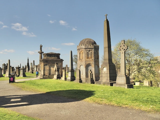
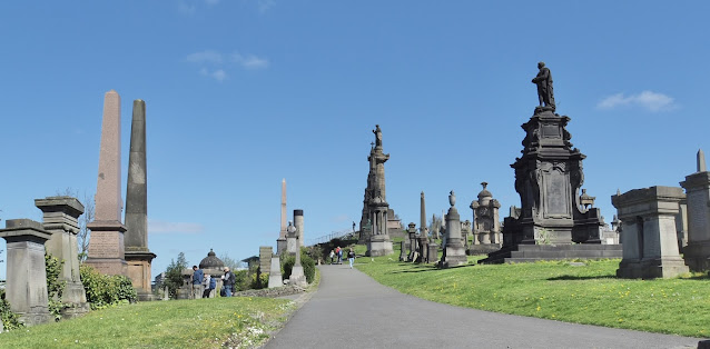
From the Cathedral it is only a short walk across the Bridge of Sighs into the Necropolis where some of the biggest grave architecture can be found, showing just what a rich city Glasgow was. There are 50,000 internments here and it is possible to get on a guided tour of the cemetery. We just wandered around at leisure. Not every grave has a stone and not every grave has a name. There are approx. 3500 major monuments. The cemetery was declared "Full" in1851.

Names of the more famous are John Knox, John Henry Alexander, Charles Tennant and the author of the famous "Wee Willie Winkie" William Miller. There's a whole list on Wikipedia if anyone wishes to read the whole list.

There is also a small Jewish Cemetery just outside of the Christian site. It was restored in 2015 and contains 57 burials.


The Jewish Burial ground.


We found a nice spot with a view for lunch before chatting to a couple from Miami who were complaining that it was too hot here! What! 

From here we walked the short distance to the oldest house which was again free entry. We were given a brief introduction the history of the building by a guide and then we wandered around on our own.

It's a fascinating building. I don't know why it was rendered because it wasn't originally. If I had noticed earlier I would have asked the guide.***


Provand's Lordships Manse was built in 1471. It has recently re-opened to the public after a £1.6 million refurb. It is said to be the oldest medieval building in Glasgow but there is an argument that Easterhouse Proven Hall is 10 yrs older. It owes its building to the Bishop of Glasgow Dr Andrew Muirhead who's coat of arms are on the side of the building.

The rear of the building which is a walled garden grew herbs and plants for medicines for the hospital nearby. Now the gardens are a quiet area where you can go and sit and contemplate life.

Inside, the building is mainly furnished with 17th century furniture and many royal portraits hang on the walls. It has had a number of building changes over the years from clergy housing to shops and even a public house. 

A 15th century latch

A Bonnie Picture.

A young Mary Queen of Scots.

Dick Dastardly or his correct name Lord Darnley

A beautifully engineered 15th century Door latch and handle.

Everyone who walked into this room, jumped. It was so real.
The Herb Garden
They must have been small in the 15th century. Sheila is only 5ft 2inches.

Chair from 1657.
Pub days.
*** I have since found out that the rendering was applied due to damp penetrating the old brickwork.
Here are two old photo's of what it was built like. 


That concluded our time in Glasgow. It has been a wonderful trip and there is no doubt that we will return next year as there is so much to see. To be honest Glasgow has been a real eye opener and credit has to go to the local people and the planning and development committees who have a done a great job. 


Find it Here

About Me

My other blog. beneathwhosefeet.wordpress.com