The Vault Regulars

Tuesday, October 30, 2018

Blorenge, a fine hill walk.


I’m keeping this short and sweet so hopefully blogger will accept it.

A lovely day hike with lots of industrial archeology from the mining industry.Tramroads, railways, quarries, ponds and much more. Millions of years ago the area was under water and there’s still evidence of sea bed in the stones strewn everywhere. The paths are good and scenery stunning. But boys was it flipping cold. 5 layers on today.

Monday, October 29, 2018

Monmouthshire canal and disused railway line.

Monday 29th October 2018

Sorry that the images are not in sequence, blogger is not playing ball.


We needed some supplies and also to recee where the Bear Hotel was in Crickhowell. We are due to meet friends here tomorrow night.
Crickhowell is a lovely village with cobbled streets and tiny alleyways. There are plenty of shops and also a castle to have a look at. There’s not much left of it but it’s srill interesting.
The town suffered very badly during storm Callum this year and they are still recovering and repairing the damage.

Walk wise, we drove and parked up in Govilon next to the disused railway line. This used to be the Abergavenny to Merthyr line until it became part of the larger London, North Western Railway. The line was closed like many were in 1958.

We only stayed on the line past Govilon station where we diverted onto the Monmouthshire and Brecon canal, which is still in use leisurely today. It’s a fine canal walk with stunning views.
Just past Gilwern we had to ask if we could get back onto the old railway line. This was because there is a massive new road structure cutting through the valleys and all the os maps are out of date. As it happens a new footbridge has been built across the highway and it gave us access to the minor roads that lead to Gilwern halt. Phew, it was a steep climb.

Many original buildings have been privatised and the old station is still there. Even though it was closed so long ago it is easy to imagine how it all looked.

A Buzzard kept us entertained on our walk back to the car, flying low over our heads and using the trackway like a runway. It was great to watch such a big bird close up.

Sunday, October 28, 2018

Sunday 28th October 2018. Gilwern


Part 3 of the lakes trip has taken a back seat, so.........Gilwern Hill.
It started out calm but a crisp day and we needed to be well wrapped up from the off. 
Great views across to Sugar Loaf and further round to Abergavenny and in the opposite direction across to the Brecon Beacons. 

After a short road walk we hit the fell side steeply and it wasn’t long before my insulation layer came off. At this time of year the bracken had died off and it did all it could to trip us up. On the other hand the yellow Broom was starting to appear and the Bilberry too. 

A large quarry came into view and I believe if you have time to look you can find fossils of trilobites. We worked our way around to the left of the quarry and found a track (one of many unmarked) which was heading in the right direction for the top of Gilwern Hill. 

Once we levelled out the wind was icy cold and it certainly wasn’t a place to linger around. The very large cairn came into view and we quickly reached it. 

It’s a fine viewpoint, a few pictures taken, a brief look at the map to name the other mountains and we set off again. 

Now we headed for the mast on Carreg Gwyir. In front of the mast there were many mountain ponies. Sheila’s not a fan of mountain horses after our tent and kit was almost demolished by over friendly types when we did the Coast to Coast. 

There’s quite a few high boundary stones to be found and we photographed a couple of them.

A good 4x4 track leads south from the mast and meets a minor road. On the map a pub icon is shown so we headed off to it. It looked shut so disappointedly we retraced our path and carried on south, picking up part of the Iron Mountain Trail. It looks a very interesting walk and one to make a note of.

Just beyond the boundary line we got a good view down into Blaenavon and a number of small lakes. The Pontipool to Blaenavon railway weaved its way down the valley. 

We retraced our path, heading for a quarry building to get out of the wind and have some lunch. It was a hovel but at least it was shelter. Half way back down to the minor road a lad on a trials bike waited for us to descend. We chatted for 5 or 10 minutes and then went our separate ways. 

We checked the map and decided to return to base via a good path which circles the east side of Carreg Gywir. This is a terrific route with wonderful views down the valley to Govilon and beyond. It’s a very steep valley with lots of industrial archeology. 

Our next objective was also clear today.

Back at base I had a real headache which I put down to the fierce wind and icy blasts. 
We had now got our bearings of the area, this was our first visit here.


Sent from my iPhone

Wednesday, October 24, 2018

A jolly trip into Cumbria Pt.2.

 The rain became heavier and it woke me up in the early hours. I could hear the stream which ran through the campsite. I stuck my head out of the tent and could see the fast moving water, much higher than it was yesterday, but it had not burst over. However, there were large pools of standing water further down the site but it didn't look anything to worry about. I went back to sleep.
 The next time we woke it was calm, well in respect to the rain anyway. The pools we saw earlier had now all but disappeared and the stream was normal again. The difference was the wind, it had picked up a lot.
 During breakfast we decided it would be silly to pack up and walk out of the valley, a valley we had never done any previous walks in, except when I had walked through last year.
So we stayed another day.

 Grizedale is a busy spot, especially on weekends. There are an abundance of walking and biking routes here and fairly well marked out, however it’s still quite easy to become mislaid as there are just so many tracks going in different directions.
 We did a route which went up to Carron Crag, the best viewpoint in the forest and it was worth it. The wind was howling and the gusting could easily blow you over on the exposed top. The fells of Coniston, now close to us were stunning with the clear crisp air picking out the details.
Our future route over the fells into Seathwaite stood out clearly. The Walna Scar is well named. These days the route is now restricted but previously you could drive 4 x 4 vehicles over it, and that made it a bit of a motorway.
 Sculpture near Carron Crag Summit.
 Wow, thats what you call fungi.
  
 Radar fungi? No. Fly Agaric.

 Carron Crag Top. Holding on tight.

Having had some time walking the high tracks on the west side of the forest we made our way down to the visitor centre. The route down was fantastic, brimming with fungi everywhere you looked. We could have spent hours just searching them out.

The visitor centre is a nice spot, relatively new i am guessing, with mountain bike hire and Go Ape adventures. The cafe though is very disappointing, terrible sandwiches, unhelpful staff, dirty cups and cutlery. Not a place to recommend. Unlike the Eagles Head pub.
We checked if we could book a table for Sunday evening but we were told that Sunday Lunch is busy and the kitchen closed at 5 o'clock. Most people leave the area obviously late afternoon.
However, the landlord asked what time was we thinking of eating and i said "6". He said "if we wanted the sirloin beef roast then he would get two dinners prepared prior to the kitchen closing and save them until we came in". How good was that. It turned out the dinners were beautiful.

Evening meal in the Eagles Head 

Sunday evening was clear and the temperature dropped rapidly. The sun went down behind the hills and we hit the sack early. Our sleeping bag are rated as 5 degrees C i think and it wasn't long before the down booties and TNF insulated jacket were put on. Sheila's phone said it was 0C.
 We both slept ok and in the early morning light we stuck our heads out of the tent to find a white world and a hard tent. It didn't last too long, the sun gradually moved across the field, the frost melted away and the day warmed up. It must have dropped a couple of degrees below freezing during the night though because the water in my water bottle had ice in it.

Cold night and cold morning.

 It didn't take long for the tent to dry out with a little help from my sponge wiper. Then we were away at 10.30 for Coniston. Its not a particularly difficult walk so it didn't matter about the late start.

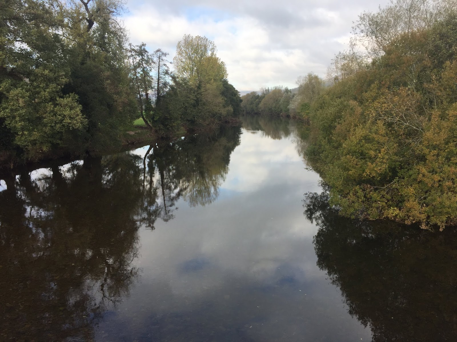
We picked a nice route through Hall Wood which is roughly parallel with the valley road and leads back to the visitor centre. We didn't call in again. Then up through the forestry to the north of Carron Crag. Dropping down to Bank Ground on the east side of Coniston Water.

 On reaching the watershed the wind was incredibly strong. It took us a while to find a sheltered spot for a snack. This was obviously windy alley as many large trees had been blown over from previous storms, but the downed root ball provided good shelter.

On route to Coniston. Break time.

 The sky was changing by the minute, dark and ominous cumulonimbus clouds billowing around the fells. Then there would be a burst of sunlight highlighting the white washed buildings of Coniston village.
Then the fells would disappear again as if the clouds were curtains on a stage.

 Once down off the fell side we walked along the road into Coniston where we spotted a well kept OS benchmark, we headed for the cafe Meadowdore, not surprising i was shocked again at the price. Two small breakfast with toast and two coffee's £23. Am i being unkind here or is that ridiculous.

Sheila got a message on her phone that a "yellow weather warning had been issued".

Now regular readers of this blog know i'm not a fan of Coniston Campsite. In fact that's part of the reason we had an extra day in Satterthwaite, so that the hordes would have hopefully left the site by Sunday afternoon before we got there.

Sheila suggested we should book in at the Youth Hostel so she gave them a ring. "Sorry we are booked up solid for the next 2 weeks and that also includes all the camping pitches" the chap said. What happened to "we will not turn away any travellers on foot"? So the hostel was out.

A few BandB's come up on Google but they were quite expensive in our opinion. Then the Waterhead hotel came up with a 2 day deal with breakfast that we thought was reasonable, so booked it. Why not we thought, we are on holiday. Ha.

We enjoyed our stay there and although the hotel is a little tired in parts it has just been taken over by a new company who are going to do a full refurb. I guess when its done the prices will shoot up too.

On our "free day" we did the tourist route up to the copper mines museum next to the hostel. The hostel is looking a bit sad to be honest. I've walked past the museum many many times but always on route to somewhere else, so i was pleased that we decided to stop here and have a look around for once.
Its a fascinating place with lots of memorabilia and explanation boards. Much old equipment can still be seen and examined. We thought it was great.


Then we made our way up the open fell side to Crowberry Haws and onto the Bell where the wind was so strong. Anyone venturing up onto the higher fells was taking a big risk this day.
 I love the views from the Bell, it's a grand place to sit and spot all the old miners routes along the fell sides, so clear and you can imagine what it must have been like when the mines were in full swing. The noise of the hammers and grinders, the water wheels, the furnaces, the smoke and the many voices.
 We couldn't stay up top too long due to the wind so we retreated along Church Becks south west bank back into the village, taking some photo's of the waterfalls as we went.

 The Bell
 Some quarries from the Bell viewpoint
 Waterfall on Church Beck
Back at the Waterside Hotel. Aptly named.
 After a very windy day it was good to have a comfy bed for the night. Sheila checks the forecast and it seems its going to be a peach of a day tomorrow. Bring on that breakfast.

Most photo's taken with iphone 8.
Pt3 to follow.

Saturday, October 20, 2018

A jolly trip into Cumbria. Part1.

We quickly got our gear together and got the hell out of Dodge while we still could. It had been such a long time since we had backpacked we struggled to find the exact kit we wanted. However we were off.
Train from home to Grange over Sands cost £9 each and dropped us at the station around 11.00 ish.
From Lancaster the rain had started and the hills were nowhere to be seen due to low mist. I was feeling a bit low, remembering the time I did a similar trip in 2017 when the weather was horrible and I had to change route. I really had hoped for good weather this time.
Full wet weather gear was donned at the station but we were only walking a short distance to a cafe for a coffee due to the fact that no refreshments were available on the train.

Our first milestone was the top of Hampsfell via Eggleslack Wood and was achieved without wearing waterproofs. The rain abated and the mist started to lift, we enjoyed the abundance of fungi on show. Having climbed up the wet steps of the Hospice on Hampsfell summit I lost my footing coming down and clobbered my wrist hard. Thankfully I hadn’t broken it but it remained sore for a few days. Over the coming days i noticed how poor the sole of my Ecco boots were on wet rock.
 The Hospice on Hampsfell top.

 Cartmel village

We quickly found our way down to Cartmel for lunch, walking through an inquisitive herd of cows on the way. It’s so expensive in Cartmel we wished we had just bought a sandwich from the shop in Grange. I should have remembered from last time. The place was dead, we only saw 6 people unlike previously in the summer time.
The footpath across the race course was open and it was a pleasant walk eventually joining a minor road to How Borrow.
From the trig point the views are fantastic in all directions and although the breeze had picked up and was a bit chilly we stayed awhile. After about 10 minutes a solo day hiker was making his way up so we descended leaving him to the peace. This was the first walker we had seen.
How Barrow with the Coniston fells in the background.

We were heading for Bigland horse riding stables where I had pre arranged to camp overnight. The route from the trig point to Bigland is a lovely walk through rolling agricultural land and forestry.
As we dropped down to cross a minor road at Grassgarth I felt a bit light headed and shaky. I had no idea why.
I knew it wasn’t far now to our stopping point so I said nothing to Sheila. We got to the stables and introduced ourselves. The paddock was a bit rough but the compensation of being able to use the lounge and showers and electricity made up for it.
We got the tent up and then what ever was causing my nausea came back with a vengeance. Sheila noticed I was white and shaking and I felt very close to fainting. I slept for a little while and then made the effort to get to the lounge for a sit down and had something to eat.
Pitch at Bigland equine centre.
Returning to the tent I just tried to sleep. It was dark when I awoke and it was around 9.30 pm. I was still feeling rough and took some settlers to help with the nausea. In my head I started to think about plan b and plan c etc. Nothing was clear cut, I wasn’t thinking straight.
Before I eventually dosed off I told Sheila that if I feel this bad in the morning we need to make a decision what to do.
It was a long night.
Next morning we had breakfast and I felt a little better. The day was a decent one weather wise and I had an inner determination to do the walk because it was this next stage I missed last time, due to the torrential rain. I said to Sheila that we should walk as far as Newby Bridge and make a decision there if to carry on or not.

The nameless tarn or reservoir as its marked on the map.
The Swan Hotel at Newby Bridge.

We slowly set off down hill and picked up our path across Low Brow Edge and into the woods called Bishops Allotment. The map here shows a dog leg path at SD 3617 8449 which we tried to find but it doesn’t exist, the path going NE just continues on.
Ten minutes later we were passing a small reservoir, nameless on the 1:25,000 map, we noticed a nice spot to camp and made a note of it.

Onward down a green lane and then a minor road we soon arrived at the Swan Inn, Newby Bridge. We sat down with a very reasonably priced coffee and discussed how I felt and what decision to make.
We are carrying on I said. I missed this bit last year and I am determined to do it now. I wasn’t feeling any worse so hopefully I can only improve as the day goes on.

We took the path left over the railway bridge which goes through Wintering Park and leads to Finsthwaite with its beautiful church and quiet village. Then around lovely High Dam picking up a path leadening eventually to Crosslands. I’d seen some of this route on Alistairs blog www.alsoutdoorworld.blogspot.com  and also on Conrad’s blog www.conradwalks.blogspot.com. It didn’t disappoint, it was a delightful walk and I was feeling much better too.
The sun came out which also brought out quite a few walkers and bikers. The views across to the Coniston mountains was just fantastic. I was so pleased to be here.
Just before reaching Crosslands we managed to be in the middle of a “shoot”. Many guys carrying shotguns and Pheasant for the pot. In the confusion we meandered off track but it didn’t make much difference to us, our path rejoined the route a little further on but it wasn't a public right of way.

The Church at Finsthwaite

 High Dam
 I think we are on this map.

Heading for Crosslands.

Reaching Rusland church the sun was warm and a low wall provided a good spot to have a late lunch.  A couple of visitors came up to have a look in the church, we said hello but were ignored. This became quite a feature of this whole walk, many people we said greetings to either ignored us or just grunted. We found the rudeness very strange. I said to Sheila how amazing it was that we have become invisible.
A good track leads from the Church road to Force Mills where we could hear the power of the water way before reaching the falls. A stiff march up the road soon brought us to Bowkerstead Farm and our overnight stop at the campsite.
Considering it was a Friday night we were surprised and pleased to find the site quiet. Having chosen a pitch with a bit of height just in case the forecasted rain appeared we showered and headed for the Eagles Head pub.

                                Evening meal booked at the Eagles Head, and it was superb.

The pub has new management, the prices have been reduced and there was a good atmosphere. We found the food, the service and staff to be excellent. We wish Gary well for the future.

As predicted it was now raining hard, just like it was the last time i was here. I was thankful that we had pitched slightly higher than the general height of the field and also that i was feeling a lot better than last night. It poured all night and we drifted off to sleep listening to the rain drumming on the fly sheet.
What could be better.

Thursday, October 4, 2018

Off to Cumbria

Having returned home from Greece and done some repairs in the house I still haven’t sorted my photos out to post on the blog.
However, Sheila’s sister and OH are here and are looking after Dorothy which has given us an opportunity to go for a hike.
Finding our gear has been a bit hit and miss after all this time and my rucksack definately is not light.
All I can tell you about the trip is this.
We get the train to Grange over sands tomorrow (Friday). Go up Hampsfell and across to Bigland tarn via Cartmel and the coastal ridge.
We camp overnight at the stables and then head off via Newby Bridge and High Dam to the campsite at Satterthwaite. This part of our walk was missed when I did this in 2017 due to the awful weather I had, so I’m really looking forward to this bit.
From Satterthwaite we head over the top to Coniston and the next day up and over the Walna Scar to Seathwaite where we will camp at Turner Hall and visit friends and probably volunteer to do a few jobs.
Depending on how long we stay in Seathwaite will determine which route we go next, we will head to Windermere to get the train home. It will either be up and along all the Coniston tops and down to Elterwater or Back over the Walna and through Grizedale to Far Sawrey.
We have to be back in Manchester a week on Wednesday at the latest. Fingers crossed for good weather.

Find it Here

About Me

My other blog. beneathwhosefeet.wordpress.com