The Vault Regulars

Showing posts with label Walk Cheshire. Show all posts

Tuesday, April 15, 2014

Bollington Circular walk

Wednesday 9th April 2014.

Another early start for me, a bus and a tram to Timperley towers, the home of Martin, todays guide and organiser and our chauffeur to Bollington Cheshire.
Along with JJ, we 3 eventually met up with Allan and John from the LDWA plodders section. I say eventually because the traffic was crawling and the others were in the wrong car park in Bollington.
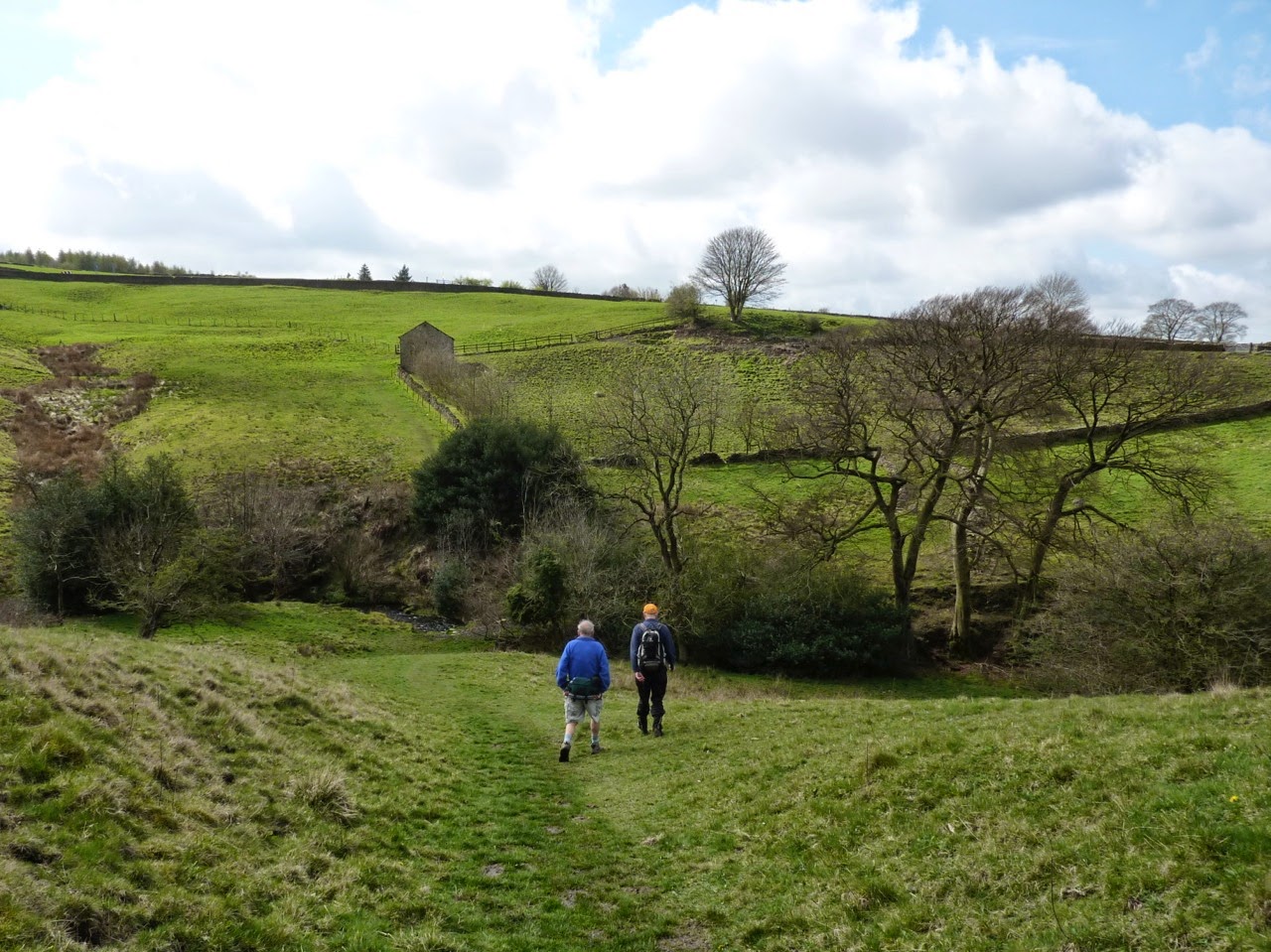
 We started walking at around 10.50 am through a municipal park where preparations looked on going for a cricket match. It was a warm day, very pleasant.
On the way up hill to our first high point White Nancy, we passed under a really high aqueduct which held the Macclesfield canal. Quite a construction.
Once into open countryside John decided that he would show us his latest skill of backwards skiing.
Quite a steep and wet slope brought out the best of John as his practice runs gained momentum and his shorts gained military colours.
Martin offered John some advice about needing new shoes only to find out that they were in fact absolutely brand new. Mmm.

White Nancy is a monument built at the end of the battle of Waterloo in 1815.
 Here John is practicing backwards skiing whilst all the “P” takers are laughing.
White Nancy

It’s quite a fine ridge with stunning views over rolling hills. Quite a breeze on top almost had me donning a windproof but as it was quite warm i resisted.
The next top was an un-named trig point along the Saddle of Kerridge at 313M. (Great name that).
Then another slippery decent down towards the Cat and Fiddle road.
A brew stop was called for and the Aye’s had the majority. A grassy bank in the lee of the wind was found where Martin produced the infamous fudge brownies.
 Un-named trig point 313 metres.

Brew stop, a must have every 2 hours in case we fall asleep.
Over the Cat and Fiddle road the path was another up and became part of the Gritstone trail. The trail has been on my to do list for ages and i admit that it is indeed in fine country. More and more it looked like the Yorkshire Dales landscape. (Except of course it is in posh Cheshire).

Carrying on following the trail it wasn’t long before Teggs Nose came into view. Strange name. Tegg’s nose is a hill within a country park. It was once a working quarry where the stone was used to build the small surrounding villages, mills and reservoirs.
Some historical quarry plant has been preserved and is available for kids and bigger kids to play on. Another decision was taken here to utilise the stone benches and have lunch. Numerous dog walkers past us and numerous dogs tried to pinch our lunches. Yes, and another piece of fudge brownie was supplied.


The views on the steep way down from Tegg’s nose are quite spectacular. Across the Macclesfield forest with the reservoirs around Langley village and of course the dominant feature of Shuttlingsloe.
Great crested Grebe, Tuffted Ducks, Mallard and Canada Geeese could all be seen as we crossed the dams and the sound of Chiffchaffs everywhere.
Parking must be an issue for the residents here as a not too polite sign was passed.
 View across Mac Forest and the top of Shuttlingsloe
 Reservoirs around Langley
 Crossing Tegg’s Nose and Bottoms reservoirs.
 No Parking along Bottoms reservoir.
 Heading through Langley village some  folk had memories of Tarfside for some reason. It must be St Dunstans. We passed an old mill which now was in a poor state and had once been a part of the silk printing, dyeing and finishing trade. The beautiful Langley Hall was passed with a build date of 1696 displayed on a cartouche above the doorway. The hall is now apartments.
 Langley Hall Cartouche.
 Through the village and back into open country we had a brief boggy section where some took the high road and some splodged through. JJ and i had dry feet. Views still extensive as we crossed beside the Macclefield golf course to meet up with the Macclesfield canal.
It wasn’t too long before that magical 2 hours came up again and so with a plan in mind Martin headed for a known bench. Only to find out that the reserved sign had been removed and replaced by a lady and a young lad. Very inconsiderate we thought as we had to sit down on the canal side.
We watched a Heron for a little while only to realise that it was eyeing up day old Mallard chicks. The Mallard was not at all happy and it looked to us as though she only had one chick left.

At one point the tow path crosses over to the opposite bank and a good example of a horse crossing bridge was examined.
The horse which would have been towing the narrow boat in years gone bye didn’t have to be untied to reach the opposite bank as the design of the bridge allowed the rope to traverse without getting stuck. Clever stuff.

All too soon Bollington was upon us and a steep drop from the aqueduct we went under at the start of the walk was negotiated. It had  been a grand day. Good weather and good company.
Thanks Martin for organising it, and other blog postings will be found on both Martins and JJ’s blogs at some point.

Just under 6 hours hence the 3 stops for sustenance. 575 metres of "Up” and 19km in length.

Map not stolen from Martin, but still not from Satmap yet.

Thursday, March 7, 2013

Culcheth Plodders walk

 This walk is Martins last of the 4 un reconnoitred walks that he kindly put together for the Plodders section of the East Lancs long distance walking club.

 The walk started and finished in Culcheth near Warrington from the car park of the Culcheth Linear Park.
The trail was once a branch of the railway line, pre Beeching, which connected Glazebrook with Wigan via Lowton. The park was formed in 1974 after the line was closed in 1964. It was originally opened in 1878 to carry freight.
Now it’s used for recreation and the bird life along the route is plentiful.

Not that this owl moved much.

 There were 8 of us today and also 2 dogs. The weather forecast was for showers. We had been quite lucky with Martins walks and i only remember donning waterproofs on one short section of the Dolphinholme walk we did a few weeks ago. 
 It was spitting whilst we chatted, waiting for the off at 10.30 but it abated thankfully.

 Heading off north along the old trackbed, the bird song was a delight. Then i spotted a Jay and what i thought was a Nuthatch, but i could have been mistaken. It might have been a Tree Creeper. (Please don’t ask how i could mistake the two).


Leaving the flat train line at a sign for Kenyon Lane, we crossed a heavily ploughed field. The soil here was just as hard as concrete and must have taken plenty of horse power to till it.

 Crossing more fields and hedgerows and the main railway line from Manchester to Liverpool we came to the obstacle of the East Lancs Road. Basically, for those not aware of this road, it is in fact just an A road but vehicles are many and speeds equal those of motorway proportions. Crossing these 2 lanes on foot is taking your life in your hands. We found the adjacent footpath, waited and then en masse dashed across. I didn’t get a photograph!

 A short walk through the outskirts of a Lowton housing estate and across some football fields brought us back onto the disused railway line and to a short tea break where Martin had route options to discuss. We had to decide which way we wanted to walk around Pennington Flash, a haven for water fowl. It was decided that the anti-clockwise direction would bring us better views and so that was that.
 A few views of The Flash


M and F Tufted Ducks.
 The path is well used around The Flash and soon we were at the car park with its visitor centre and ablutions. From here we quickly joined the Leeds to Liverpool canal and continued along it for some time. Lunch was taken mid way, adjacent to King St bridge where we met a chap on a bike with a ladder in his rucksack. This caused a bit of excitement as we guessed what he was doing. Mobile window cleaner?  No, it turned out he was repairing the signage on the cycle way that can be seen in the photo below.
Lunch stop imminent
 A short distance from here the Leeds Liverpool canal changes to the Bridgewater canal which we followed as far as Marsland Green. Numerous old mills were passed and photographed depicting this areas heritage with the cotton spinning industry.


  At Great Fold Bridge we turned South heading once more to cross the East Lancs road. 
Men were hard at work in the fields, tilling and mowing. It was good to see an MF135 going strong. Equipped with a folding 2 post rops and mower.

MF135. Perkins 3 cyl. 2.5L diesel with Flat Top Fenders.
John Deere 2140. 82hp 4 cyl turbo diesel. With reversible rotating plough.

 Passing through a farm at Crompton House we encountered 3 dogs of the big, scary,  noisy variety. Thankfully they were tethered to truck wheels and so we had plenty of room to pass. The commotion brought out the owner who tried to pacify them but without much success. 
 The east Lancs was even busier than earlier as we dashed for life across it. 

 Our path led us to Netherbarrow Farm and Windy Bank Farm before crossing again the railway. 
We passed a pub called the Chat Moss. 

Famous over the years for the thousands of hikers,plodders who have stopped in the field adjacent for a “Chat” hence the name. It’s been known for chatters to spend that long in one spot that “Moss” has started to form.

 The true reason for the pubs name will be apparent upon reading Martins blog post on this walk. Where, so i am assured there is quite a bit of history going back to the formation of the first commercial railway line. Over to you Martin.

Allmost back to our start/end point we crossed a field with strange vegetables. We guessed overgrown cabbages but we could be wrong.
 Back at the car park and still no rain. We had been very lucky. There was quite a chill in the air and it was with very cold hands that i tried to undo my shoe laces to change into driving shoes.
 A most pleasant day in good company.

Distance walked 21.1km with a massive 61m of ascent. Almost noise bleed territory.

Thanks Martin for the route and the Plodders for a pleasant day out.
Click here for the link to the photo slideshow.

Saturday, February 9, 2013

A Cheshire day walk from Frodsham

 Today i set off before the sun or the birds were up. My journey started with a 6.10am bus trip to Manchester and then a tram to Timperley to meet up with fellow Blogger Martin and his good lady Sue. From there we headed off to Frodsham and the car park on Simon Lane adjacent to the communications masts.
 This walk was the 2nd of Martin's 4 routes he has put together for the LDWA plodders section whilst Reg, the usual guide, is recuperating.
 This was my first walk in Cheshire as far as i could remember so it was quite a shock when Martin handed me the map and said i could lead.  It turned out that the map was a joke following on from my last post about the age of Martin's maps.
 I'm not saying this map was old but Chester was located and it read Castra Deva.

 It was nice to see a good turnout, 10 in all  plus Maude the staffi. The forecast was for a pleasant day. Some wintery showers possible and a strong cold north wind.
Image courtesy of Postcard from Timperley blog. (Thanks Martin)

 From the car park and crossing Simon Lane we joined the Sandstone Trail. A nice walk in it's own right but today we would join and leave it on a number of occasions. Crossing a busy golf course we were warned by a notice board to be aware of golfers. Well we would wouldn't we, being on a golf course. I suppose it was the golfers balls we had to be aware off but it might not be a politically correct statement to put that,being in Cheshire. 
 The sun was low and extremely bright, it caused me a bit of a problem with photo's. Across the golf course the path followed the escarpment and gave good views across the wide plain, the River Mersey and Manchester Ship Canal to a Liverpool skyline and Helsby Hill with it's iron age fort. The Welsh hills being clear today.


 After a brief stop to take in the views we carried on past the hill fort at Woodhouse Hill. 
The day was warming up nicely being sheltered from the wind and we made good progress passing a number of splendid rural properties.
 Just before we joined a road, Martin called a halt for Baggin. (Tea break). The weight of carrying all those chocolate brownies must have been weighing him down. These were special brownies with very soft and sticky chocolate we were told. Yummy they were too.

We had a short spell of road walking through the lovely village of Manley where i spotted the very unusual sight of an Egyptian statue. I was expecting a beach but unfortunately that would be 25,000 miles away.

 Passing a couple of "open" tea rooms and not turning in was a bit disappointing as my stomach was starting to rumble. We walked under the railway line and then took a detour down a wrong road and had to do a reverse turn. Fortunately we hadn't gone too far out of our way. It would be another hour to the planned lunch stop.
 It was good to get back on the trail, passing Eddisbury Lodge and heading into Delamere forest. On reaching the visitor centre it was time for lunch. 
I had bought a freshly made sandwich in Manchester and put it straight into my day sack, but when i opened it up it was completely different to what i had asked for. Oh well i was too hungry to care.
 Today i had Ginger and Lemon tea in the flask and this was also a first. I have it at home but i didn't know what it would taste like after a few hours in a flask. Pleased to say it was very nice.
 Lunch over we joined the Baker Way through Delamere, the colours of the dead grass and ferns was stunning in the bright sun.


 The Baker Way is a good wide track and after crossing the railway we had to swiftly get out of the way of a couple of huge cantering horses. The riders shouting that they were going to turn  our way. 
 Unfortunately the path deteriorated to a muddy squelch for a mile or so until we hit the tarmac at Kingswood.


The cloud cover was increasing and the sun behind the clouds looked wonderful with the rays and colours.


 We joined the Delamere Way beyond Birch Hill. On our left passing the high ramparts of a reservoir at Harrol Edge. What feeds the reservoir we wondered as it was the highest point around? A mystery.
  The masts on Beacon hill were getting closer as we crossed back along the golf course.


On the opposite side of the fence lots of "lost" golf balls were to be had for the local kids. 
 With the sun now in a different direction from this morning the view across the Liverpool skyline was much clearer and better for photography.


Just one more minor hill along the road and back to the car.

What a good day, no waterproofs required and the obvious lengthening of the hours of daylight. The new boots are doing well with around 60 miles on them so far.


 Distance 21.2km with 441m ascent. 

A slideshow of the photo’s can be found with a click here

Martin’s post of the walk can be found here


Find it Here

About Me

My other blog. beneathwhosefeet.wordpress.com