The Vault Regulars

Saturday, March 28, 2020

Northumberland Coast Path Pt.1

The NCP is a medium distance coastal walk of some 100km. It officially starts in Cresswell and ends in Berwick-Upon-Tweed. Because it is a coastal path walk it's easy for folk, depending on time availability to tailor it as needed.

After an illness which has taken over our lives for a year, it was good to be making new ground.
We started in a place called Amble and finished in the village of Belford. The start was our choice but the premature end was due to the Covid 19 lockdown and our enforced return home.

We didn't backpack this trip we used a fixed base, well two fixed bases as it turned out. From these bases we planned routes which could be done with the help of public transport, our own car or just circular walks.

Walk 1. Amble to Alnmouth. March 14th 2020.

If ever there is a place not to start the NCP it has to be Amble. It's a sprawling place, old and forgotten. Remnants of past industry, especially coal can still be seen. It used to be a thriving port but now just a few fishing boats. From the harbour you can get trips to Coquet Island with its lighthouse.

We didn't get a good feeling as we walked through Amble with its small groups of youths smoking weed. The smell drifting around you. It makes me feel sick. We were constantly looking over our shoulders and were pretty pleased to get out of Dodge and onto the main road.
The modernised Harbour at Amble
The road and the path follows the River Coquet upstream as far as Warkworth where it leaves the river, crosses the medieval bridge and heads for the dunes.
Warkworth is a beautiful village and the first thing that pulls you there is the constant view of the Castle. The Castle was closed but we walked around the grounds.
Warkworth Castle
Walking down the hill into the centre, there are many fine houses, a couple of pubs and a few local shops. Lots of property is owned by Coquet holiday homes and that's why villages are dying.

The church of St. Lawrence was open so we had a look inside. It dates back to AD 737. King Ceowulf of Northumbria granted it to the monks of Lindisfarne.
The later Norman tower is leaning quite a bit, a bit like Pisa, and a later steeple has been added.
The leaning tower of Warkworth.
Passed the church reveals the pleasant riverside, well kept and a pleasure to stop on one of the many benches and have a brew. Its a popular spot for locals and visitors alike.
The good thing here to note was that the parking by the river was free and no time restrictions. However the point was made that no accommodation vehicles were aloud. A posh way of saying "no camper vans or caravans."

The medieval bridge is wonderful and so is its arched gate house.

 The River Coquet at Warkworth


We spent quite a bit of time in Warkworth and we wished we had time to stay over night and explore a bit more. Next time.

Across the main road the path leads to another car park, then down across a golf course and here you can decide if you want to keep to the official path or take to the beach. For us the best way is to go with the beach. The beach is expansive and has good views south to Coquet Island and our route ahead to the north.
Its always hard going walking on sand but the atmosphere of being in such a wide open landscape is breathtaking. The smells of the sea, the sound of the birds, it's just paradise.  And so lucky with the weather.

The coast at Warkworth.
The beach was quite empty and it wasn't until we started to approach Alnmouth that numbers of people started to increase. Between us and Alnmouth stands the River Aln. There was no quick way across it. The ferry finished years ago. We headed up to a religious cross we could see on a hillside to our left and decided to take a break with such lovely views.
The cross is well made and its dated AD 684. Not original obviously.

The word Cuthbert can just be made out with 684AD clear below. 
I guess this stone came from the church.

History says that at this point St. Cuthbert agreed to become Bishop of Lindisfarne when petitioned by the king.
To get over to Alnmouth we had to backtrack along a good bridleway until rejoining the official coast path along the road, over the bridge and into Alnmouth town.
St. Cuthbert's old church is still to be seen but roofless.

Our coast walk route in black. The official route is the red diamond linked line.

Tuesday, March 3, 2020

An 80th birthday visit to Duddon Valley.

The Duddon Valley in Cumbria is my second home, or is it my first? I'm not sure really as from the 1980's I have spent so much of my time there.
I have fixed many tractors and excavators for different farmers there and I must have done a good job as they still talk to me. I have house sat and looked after pets, helped with sheep gathering, clipping, bailing, wrapping, dipping, lambing, calving, tree felling, gutter digging, walling, bar tending, fell race marshalling and much more. The friends we have in the valley are genuine people, who work hard and never forget what you have done for them. We love being there.

We were invited to a locals 80th birthday party, a friend we have known for about 30 years. Of course we wanted to go, we wouldn't have missed that for anything.

However the doo was to be held in the Newfield Inn, Seathwaites only pub. Unfortunately the management team had decided to leave the pub and so it was touch and go as to if the event would happen. Fortunately the owners of the pub are also customers and therefore did everything possible to give the octogenarian his party.
The owners of the Newfield Inn John and Gayle, reluctantly now running the pub again. At least for 2020 anyway. Many folk are very pleased.

The pub was closed to the general public but still around 35 local folk turned up and it was a cracking night with music provided by guitarist Paul Rose from Newcastle and famous for playing with lots of well known bands and the wonderful buffet went down well. Thanks Gayle and Dave.
Myself with Paul Rose

It was great to catch up with the locals and find out what was happening in the valley. Chatting about tractors, especially the MF 5713s which will be the next new tractor in the valley and one I will have to brush up on the specs, and the weather of course etc etc. and the campsite which has taken a bit of a hit this year due to the poor management at the pub. Hopefully when the pub opens again in a few weeks time things will pick up.


The weather during the weekend was pretty foul, very windy, snowy squalls, heavy rain showers and sun. All seasons in one day.

It wasn't particularly hiking weather and although I had hoped to do a least one walk up top, due to the trifecta of outdoor evils I decided that caution was preferable to rash bravery and so even though Sunday started well we went for a lower walk.

From the Duddon Valley we could see the snow covered tops of the Crinkles, Bow Fell and the Scafell range, they looked cold and uninviting and clagging over for most of the time.  Locally, there was very little snow except at the very tops but the wind was vicious.

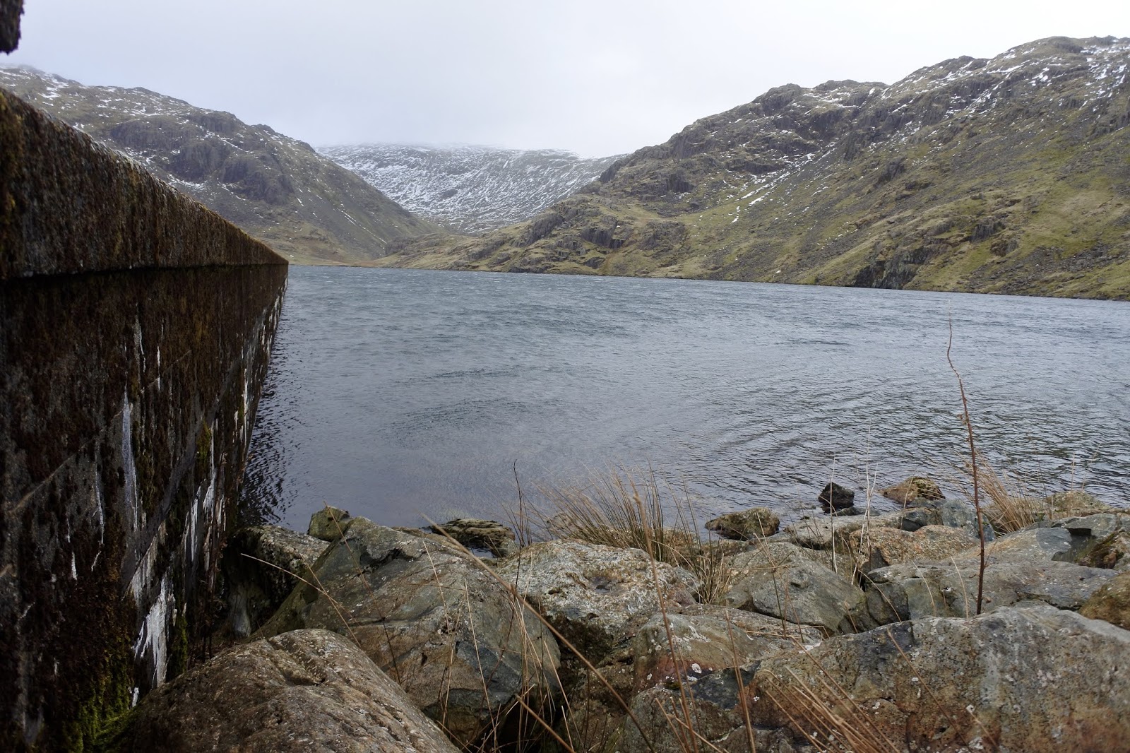
We went up to Seathwaite tarn and across the dam to the north side of the water. It was bitter cold. I stopped on the dam to take a short video which lasted about 1 minute before my fingers were numb.
The reservoir outlet into tarn beck was blowing backwards before re-cycling.

We spotted two people heading up the hillside towards Grey Frier. I didn't envy them today and we returned back down by the tarn road.

Here are some photos of the walk.


 The Park Head Road was in bad shape.
 White Pike Centre, Dow Crag left
Dow Crag right of centre with Grey Friar left of centre.
 The Scafells at the back with Hardknott in the middle ground.
 Harter Fell from Crag Band.

 One of my favourite views of Harter Fell, The foreground area is called Black Allens and I always get a feeling of life here thousands of years ago. I don't know why I feel that way but it happens every time I visit here.
 Seathwaite Tarn from the dam end.
 A Black and White view.
Tarn Beck


Wednesday, January 29, 2020

Topo Aquaventure 2 trail shoe 200km review.

Way back in 2019, well November 24th to be exact, I purchased pair of the Topo trail shoes. (click Here).
It was my first pair of these and reviews were a bit thin on the ground so I took a bit of a chance buying them 'cos they weren't cheap by any stretch of the imagination.

Well the 200km came and just went. Its took me a while but I got there eventually.

Most of the walks I have done in them are short walks with nothing over 15km and not carrying a backpack. I have carried quite a weighty daypack though but I haven't run in them.
The walking has been very mixed and so has the weather. The majority of terrains has been coastal paths, land rover type tracks and canal towpaths. A couple of walks were over moorland with rough tussocks, boggy in parts.

Weather wise, apart from deep snow I have been out in everything but. The performance of the tread pattern has been exceptional except where rocks are smooth and wet. Under these conditions they do slip, but I guess no worse than any other trail shoe would, on any other terrain, excellent.

For me, the important thing was dry feet and I have no complaints here. The eVent liner has been brilliant in keeping my feet dry but they can cause a little damp with condensation. It wasn't a problem though. It's wise to wear a short gaiter with the trail shoes for obvious reasons. Water ingress cannot get out and also small stones and rough or sharp grasses can damage the liner.
On the down side, the shoe has designed into the heel a pair of lugs for attaching Topo gaiter clips. On my shoes the "plastic" around the lug is starting to detach. I haven't even used Topo gaiters so I would expect the heel cup would probably start to pull away with regular use of them.

Photo showing plastic lug (above the red logo) starting to detach.

With the outer having no stitching the shoes are fantastically easy to clean after your hike, they don't stain in peaty ground either and they dry very very fast. They are perfect in this respect.

The laces grip very well and I have had no faffing about having to stop and re-fasten the shoe.

After only a couple of walks I changed the insole for a better quality one, a little firmer. Not the type like Superfeet but just a scholl one. However, I was starting to dislike the amount of room in the toe box. Even though I have wide feet I was finding the support around my toes was lacking and I felt my foot slipping inside the shoe on occasions.

Eventually, I changed the insole again, to a Gel type which reduced the amount of space in the toe box and I found this better but not perfect. In hindsight I wished I had tried a shoe half a size smaller. It might or might not resolve the issue. I haven't come across a half size shoe as yet to try it out.

The heel and top of the foot support is very good and I had no problems here. When walking on gravel tracks you don't feel any stones through the mid sole.

There is some wear showing on the heel cuff material which I must say is disappointing but apart from that no significant wear on the shoe itself, in fact after 200km they don't look very much different from Day 1.

Really unacceptable wear on the heel cuff material for a shoe in this price range and the most disappointing quality in my opinion.. The worst part of the shoe. These are only 2 months old.


above 3 photo's showing very little wear on the heel, toe or outer fabric, excellent.
Although these shoes are not perfect I'm sure I will get quite a few miles out of them. 
I give them 7/10.
Would I buy them again? Well only if the heel cuff material is changed to be more durable, for example on Keen shoes.

Tuesday, December 31, 2019

Llandona, a circular walk with fine views.

This fine circular walk starts at the car park on Llandona beach. The grid reference is SH 56618063. 

From the car park cross the road and onto the beach, turn right, hopefully the tide will be out and you can walk down the beach rather than down the uncomfortable pebbles. 

At the end of the beach there is a wooden footbridge over a stream. Again, it may not be necessary to use it depending on water conditions. This stream used to have a fish weir, but we didn't find it. It went out of use years ago.


Llandona church is only a short distance from here and is worth a visit if you have the time. 

Across the stream and high up on the banking you will see a gate. This is private property. There is a second gate a little further along with wooden steps up to it and sporting a footpath badge.

Through the gate, turn left and follow the edge of the field and through a second field. Once into the third field walk 45 degree right, you can head for the telegraph pole between two houses, into the top corner where there is another gate and steps.

Keep heading right and up the lane. Don't be tempted to keep seaward and go left. The lane goes uphill and at a sharp corner you come to a signpost for the coast path. Here there is a diversion in place even though there is no notice on the post.
The usual route is to keep walking the lane and turn left as you approach a stone house called Pentrellwyn. However, just beyond the cottages there has been a land slip and barriers have been erected.
So follow the coast sign at the corner and the path diversion rejoins the route beyond the landslip.

If you use this blog to walk this route then I will not know when the landslip has been repaired. 
I will rely on folk updating me. Thanks.

A gate gives access to National Trust Property, Bryn Offa. Continue along the track and a steel shed will come into view. On the right is a field with a double steel gate. There is no signage here but go through the gate and turn right, back in the direction you came. Follow the hedgerow and take care as its overgrown with bramble and gorse. Not a path to be caught wearing shorts.

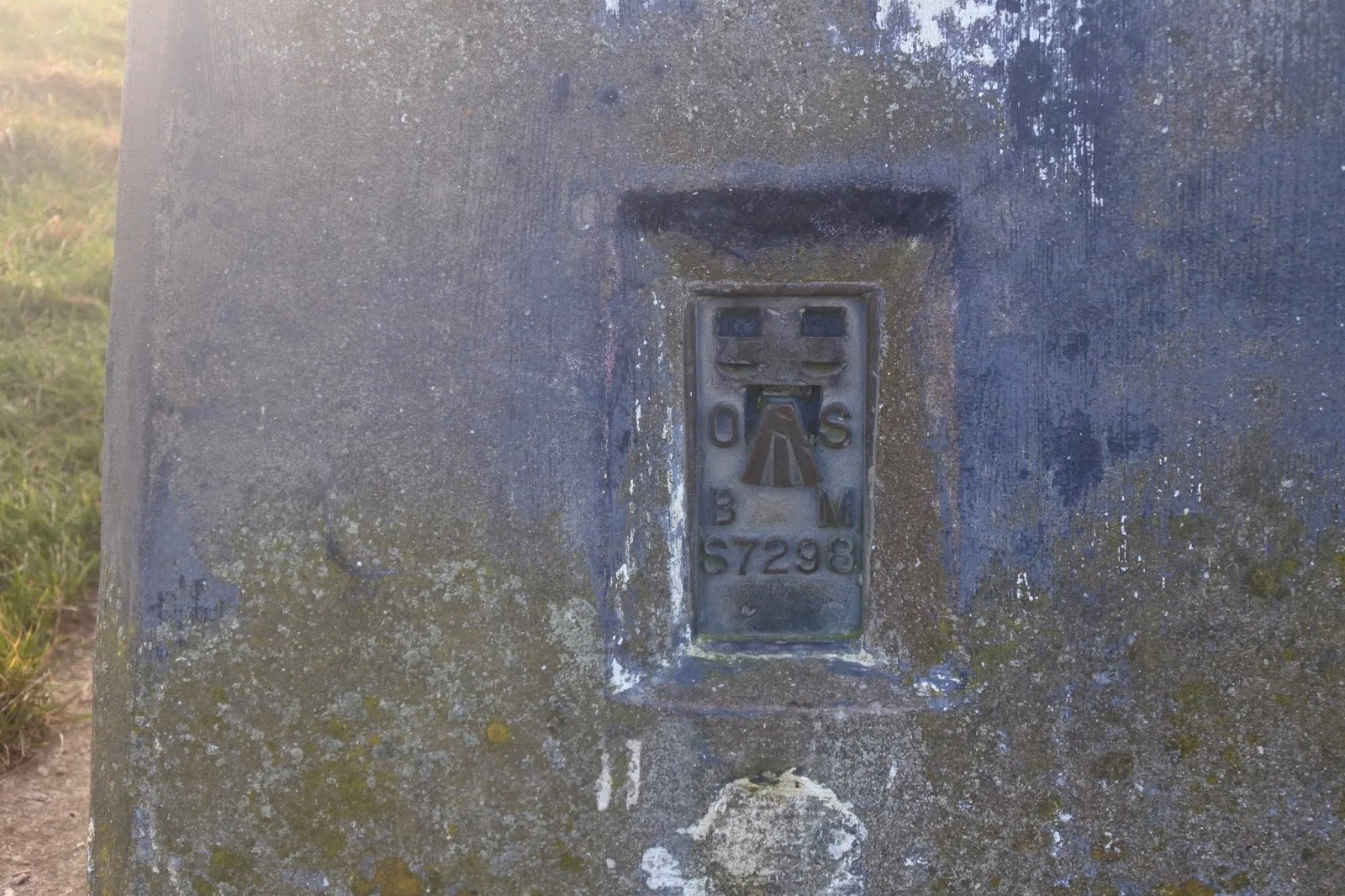
The "path" contours the west side of Bwrdd Arthur, or Arthur's Table. This is 164 metres high and there is evidence of prehistoric times and pre -Roman. When the path terminates at the road, look for the path which runs parallel with the road on the left and then heads uphill to reach the summit with its Trig Point and OS benchmark S7298. Hopefully the weather gives good views as it did for us.


Re-trace your steps back to the road corner. Take the road south, slightly uphill and then after 100 metres take the road right with the mast on your left marked Lon Goch on OS map. Head down the road with fantastic views in front showing you just how much height you gained from the car park.

At a large white stone on the right side marked Castell, carry straight on, on an old green lane. After a few hundred metres the track turns sharp left, at this point keep straight ahead down a narrower path which leads to a stone stairway and a metalled lane.


Turn left here with high hedges on both sides. At Hafod Wen the lane turns into a very wet and muddy path which in many places resembles a stream. Keep on this lane until you are faced by a fence with a small stile. Don't cross the fence but turn right on a good gravel track which leads to a farm Pen Rallt. At the farm follow the path round to the right, ignoring the Chelsea FC banner.
Go through the gate and join the road. Turn right, down hill passed Hafod-y-Rhug. and then at the footpath sign on the left turn down the lane.

It is a good track and when you see an old derelict building in front of you, look for a gate on the left. Go through the gate and once on the other side there are two paths. One on the level and the other, the left hand one goes uphill to some steps. Take the left hand one and follow it until it exits on a road.
Turn right here and follow the road downhill to the beach car park where you started.


Route is written in a clockwise direction from the car park P.
Distance 7.4km and 2hrs 20 mins with stops for photos.


Monday, December 23, 2019

Penmon, a castle, a lighthouse and a Priory and a walk of course.

The castle was just a short outing so I won't bore you with the details of the route. The castle called Castell Aberlleiniog was/is a Motte and Bailey type structure. It must have been a fine structure in its heyday. The motte is still deep and clearly defined although waterless. The castle walls are still visible but stand only a few feet high.
The 360 degree viewpoint would have been fantastic before the trees were allowed to grow too high.
It was built by Hugh d"Avranches between 1066 and 1099. He was the 1st Earl of Chester.


From here we headed off through the small and quiet village of Penmon. A staircase stile led us into what used to be Penmon Deer Park, formed by the Bulkeleys Family from Beaumaris. Today it was full of sheep and cows, not a deer in sight. It was a steady uphill walk following what looked like old Priory walls, far too elaborate and high to be farm fencing and obviously cost a fortune to keep the deer in.
An exposed limestone scar led to an elaborate kissing gate where we joined the Isle of Anglesey Coast path with its fine views across the Irish Sea. We followed the high wall which seemed to have been built on an old dyke. (my guess)
A good path joined a metalled track which we followed for a few hundred yards before realising we were heading in the wrong direction. We were going to the quarry instead of the lighthouse. Turning back we found our mistake, we should have crossed the metalled road instead of following it.
The right path gave us good views as we made our way down to Trwyn Du or Penmon Lighthouse.

There is a cafe but we picked the day it was closed, so no toilets either. It was bitterly cold but not too windy and I bet its a very busy spot in the summer. Plenty of signage told you what you couldn't do in the area so obviously visitors are tolerated rather than invited. If you drive up to the lighthouse then you have to pay a £3 toll to use the road. Reading some opinions about the toll a lot of folk are unhappy about it. We walked so we get there for free.

The lighthouse is in very good nick and very photogenic. It would be great to visit on a very rough day with waves crashing high up the tower.
Penmon Deer Park

Fancy gate out of the park.

 First view of the lighthouse and Puffin Island.


 There was a bell ringing, as you can see it on the right of the picture. First time I've seen a bell on a lighthouse.
Making a splash
Trinity lighthouse keepers cottages.
 The closed cafe. (we will make another visit)
 From the lighthouse the route back follows the toll road past Penmon Priory. We plan another trip to look around the Priory so I will not go into any details on this route.

Just passed the Priory we hit the beach with lots of bird life but not human. Many Oystercatchers and Green and Red shanks noisily finding food on the ebbing tide. I spotted a piece of pot in the muddy sand which I scraped out and found an intact Wm P Hartley Marmalade Jelly pot from around 1900.
That is going home with me.

Wm P Hartley Jelly jar.

Todays Route.


Find it Here

About Me

My other blog. beneathwhosefeet.wordpress.com