Wednesday 16th March 2022
Sheila's 60th Birthday. She had said for years that one day she would like to go up Pendle Hill in Lancashire. I think we must be the only couple who have never been up it.
At 557 metres high and surrounded by flat land, Pendle Hill can be seen for miles around and certainly looks higher than it really is. However the height should not be taken lightly as it can be exceptionally cold at the top with strong winds even on a mild day in the valley. If the weather is poor then good map reading skills are required too.
The weather forecast was not particularly good for the day so decided to do an alternative walk and make a decision later on whether to go up the hill or leave it for another day.
We headed north east out of Barley village and took the track to Lower Black Moss reservoir. There were quite a few Great Crested Grebes fishing but a little too far away to get decent photo's.
At the end of the reservoir the track splits left and right. A sculptor trail can be found in Aitken Wood so we took the right. In a field close to Black Moss Reservoir was the site of a 17 century Witch's House that was excavated in 2012/3. It was re-covered with earth later to stop damage and vandalism.

The sculptor trail is a nice easy stroll on a circular route and all the items can be found without leaving the trail. Here are a few images of what can be seen. There are many more.


At the top of Aiken Wood we noticed a wall stile and a footpath which is not shown on the OS map. The path headed towards a trig point located on Stang Top Moor. Following the path led to a gate with a sign "Not access land". The gate was padlocked. Do we turn back? No, we climbed the gate and went to the trig point. Unusually the TP was painted blue instead of the usual white.


Beyond the trig point we picked up the path which led down hill to White Hough. On passing the outdoor education centre we spotted the OS Benchmark and unusual plate.

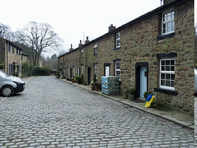
Eventually coming through the lovely village of White Hough and down to Pendle Water we follow the stream along the river bank, passed the old terraced cottages of Narrowgates Mill.

Narrowgates Mill, a water-powered cotton-spinning mill, was built by the Hartley family of Barley in about 1799. A steam engine was added during the first half of the 19th century. The main mill building burnt down in 1867 and was rebuilt in stone rubble as a three-storey, seven-bay long, three-bay deep building. The attached waterwheel house has been demolished, as has a two-storey block and the engine and boiler houses. The stone chimney with its tapering square shaft survives as do two rows of workers' houses to the immediate east. Converted to a private dwelling in mid to late 20th Century.The Lancashire Textile mill survey records the mill as having been demolished in 1969, but part of the complex remains and the chimney is still extant.
Lunch time called which we took in the Pendle Inn pub and decided because the weather forecast was wrong again we would go up Pendle Hill by "The steps route". It's the quickest way up but tough on the thighs.
Walking through Barley Village until we came to the Primitive Methodist Chapel where we found the footpath opposite, alongside the stream. It is a nice easy route to follow all the way up to the gate at Pendle House.
We more or less had the route to ourselves with only another couple a little way in front of us. The steps are steep and tiring and we were glad to get to the top of them.


I replied on your other blog before seeing this - copy:
ReplyDeleteInteresting post. It was over 20 years ago I saw dotterels on that summit. They stop off to feed on that particular vegetation as they return from their winter habitat to go on to Scotland to breed. It is only a few days window when they can be seen there and we were lucky.
That sculpture trail looks interesting, shall have to give it a try one day, thanks.
ReplyDeleteHi Conrad.
ReplyDeleteThe other copy is a different route. I shall write it up with more detail asap on here. You were very lucky to see the Dotterels. I have never seen one.
Hi BC. The sculptor trail is worth doing if you only have a couple of hours to spare or the weather is poor. Your own blog post on the hill is very interesting.
ReplyDelete