Wednesday 28th February 2024
Or so the area board says.
I for one had never considered it to be the gateway but there are certainly lots of nice gates on the walk around the reservoirs and beyond.
It was good to find the car park adjacent to Ogden Reservoir was free and the toilets open from 8am to 8pm also free. Well done Oldham Council.
We set off east along a narrow road passed the old Spring Mill. The mill looked shut but maybe repurposed as a storage facility. I don't think the mill is too old as it isn't on the 1840-1880 OS map and neither is the Ogden Reservoir.
Spring Mill.
A little further along we came across a spring which had been nicely built around. Did it have any relevance to the name? I have since found out that this "spring" is actually part of a culverting system.
We chatted to three local dog walkers who were impressed with Sheila looking at a map. Very professional they said, blind as a bat, I said. We had a good laugh about navigating with the sun and the stars and then we bade farewell.
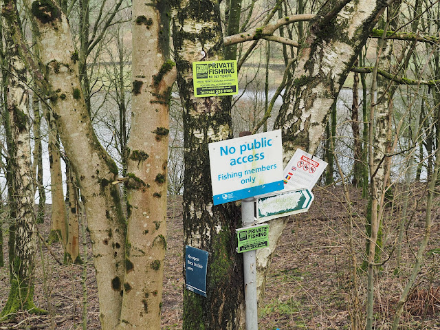
Signage on the trees gave me a bit of an impression I wasn't welcome to advance.
Our only view of Ogden Reservoir was through the woodland. We would have to wait until we got round the other side before getting a full view.
Our first view of Kitcliffe Reservoir.
There are six reservoirs in this area which were built during the late 19th centuries taking advantage of the vast amount of rainfall and sodden moorland. Built to supply power to the mills, six I believe were in this vicinity and also to supply water to Oldham and Manchester. They were built following the Oldham Corporation Gas and water act of 1855. Strangely, the lowest reservoir and nearest to the mills was built last.
- Norman Hill Reservoir
- Hanging Lees Reservoir
- Piethorne Reservoir
- Kitcliffe Reservoir.
- Ogden Reservoir
- Rooden Reservoir (which we didn't walk past today)
A footpath follows Ogden Reservoir boundary wall down to Kitcliffe farm which prior to the reservoirs being built was a Fulling Mill with its own water supply. It may be interesting going down to see if anything remains of the old mill but today it wasn't in the plan.
Carrying on eastwards the large expanse of Piethorne was next. There was a resident fly fisherman which we watched for a few minutes. He didn't seem to have caught anything. Fly fishing has always fascinated me but I've never had a go at it.
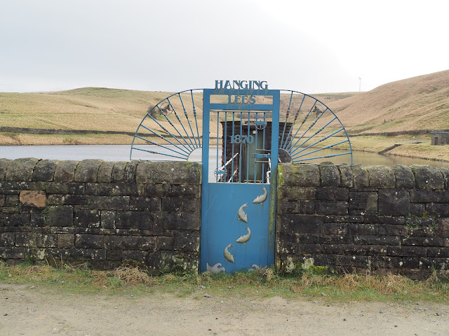
You will notice on the left gate post the OS bench mark. This was the first we had spotted but the OS listing shows a couple that we had missed.
Ornate sluice system.
it was quite a pleasant day. Where was the forecast rain? I wanted it to rain to test out a new walking jacket that I had purchased from Decathlon. The clouds in front of us looked ominous but over the next 10-15 minutes we only had a very light shower.
We got to Hanging Lees reservoir and spotted another bench mark and more ornate gates. Also, but quite a distance away was a pair of Tufted Ducks.
Tufted Ducks.
We couldn't get directly up to Norman Hill Reservoir because there is no public footpath around it, so we had to make do with a photo from behind the boundary wall. Norman Hill was originally a farmstead which disappeared with the building of the reservoir. It must have been a bleak spot in winter years ago.
Norman Hill Reservoir with Holme Moss mast in the distance.
Aeration waterfall from Norman Hill to Piethorne.
Piethorn gets its name from Magpies and Hawthorns of which many were in the area.
Through a gate we steadily made our way up hill passing three more ruined farmsteads, First Roughfield farm with Piethorne off to the right then a little further the farm called Close. Not much is left to see apart from some fragments of stonework if you look hard enough.
What was left at Close farm with Rooden reservoir in the background.
A kestrel searching the ground around Piethorne.
We were on a good path called Tunshall Lane which is an ancient pack horse route with high walls on both sides. Approaching Town Hill we noticed the destruction caused by off road bikes. We was going to go up there but decided it was too muddy and so stayed on the green lane.
Red lichen covering the old walls.
Sheila on Tunshall Lane.
Hillside destruction.
Another shower didn't last long but the wind as we approached the highest point of the lane was bitterly cold. We got a move on. Good views were had looking north towards Littlebourgh, with the M62 motorway bridge in the foreground and Hollingworth Lake in mid ground.
The lane headed off towards Milnrow but we headed down, back towards Ogden Reservoir. On the way we stopped to look within the remains of another farmstead called Rag Hole. This farm was a busy place in the mid 19th century where it grew crops. By the 1940's thinks were changing and the farm was almost derelict.
Above and below, 2 shots of Rag Hole farm.
On the way down to Ogden
The route back to the car was across the dam.
All in all this was a nice walk. Pity it didn't rain as forecast but that the fickle weather we have.
Our route. Anticlockwise from the flag marker.
I


That’s another interesting outing Alan. Well done.
ReplyDeleteJust a short walk as part of the fitness rehabilitation regime.
Delete