Sunday 20th July 2025
The car park at SD38958763 on Fell Foot Brow was quite busy when we arrived. Lots of folk milling around chatting. We managed to park up but the lay bye’s on the road still had plenty of room. It’s a busy spot for some reason. I guess it’s the proximity to the road and the great view of Windermere from the top.
Walking through the car park a short path is used through the woodland, emerging at a gate leading across the road and through another gate to the Gummer How path.
There a notice board that informs you of what is happening in the surrounding area.
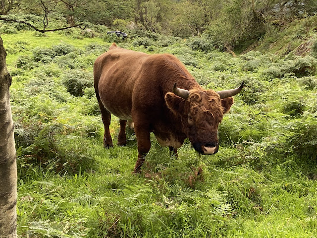
On the way up we encounter a few people on their way down, quite a few young children are stood wondering what to do about these brown and white giant beasts which are blocking the path.
The cows have calf’s and they are lay down all over the place. They are not a bit bothered about the humans and neither are their mums and Dad. Lots of photos are being taken and we join in. The breed has been selected by Defra along with the landowner and Natural England. They are Luing, from Argyle.
The path up to the summit is easy although the direct route involves a little bit of hands on. It’s far from difficult and there are many easy options to both sides.
The view from the top today is stunning. The length of Windermere is visible as are the Coniston Fells and the coast down to Morecombe Bay. We are so lucky with the visibility today.
I hadn’t realised just how large the Town Head House Estate was. Its size clearly appreciated from the cairn atop Gummers How.
We head off in the direction of the small reservoir to the east in a plantation called Birch Fell. The path winds its way down, eventually meeting up with a fence surrounding the reservoir. Care is needed during the descent in bad weather as there are a couple of steep drops.
A stile over the fence allows walkers to get to the reservoir area. We didn’t go over even though it looked enticing.
We followed the fence line south until in 10 minutes it joined up with the path going up Gummer How.
Although this top is easy it’s still worth doing if just for the views alone as it is the highest point in the area.
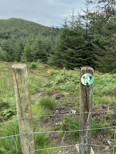
Cannot say I have come across this badge before so if anyone has a name for it please leave a comment.
Birch Plantation Reservoir (Un-named)
Back across the main road and into the woodland we followed the footpath leading to Sow How Lane which we followed through the farm of the same name. Quite a few bikers use this route too although there are lots of gates to open and close.
Through 2 fields of sheep of varying breeds and through 2 gates we left the main track for a footpath heading into the forestry and towards Simpson Ground reservoir. It was soaking wet in the forestry, dark and with lots of wind blown trees.
It started raining and went very dark. It was that fine rain which wets you through. It was time to don waterproofs but because the humidity was so high we decided to delay putting them on. The trees sheltered us to some degree which was very welcome.
One of the many MF tractors at Sow How Farm. Probably having a bit of a service. MF 6180
Looking back at Sow How farm.Entering Astley's Plantation.
Out of the woodland we came to the wall of the reservoir dam. It seemed quite out of place. I managed to scramble up the wall using the fence atop to gain a photo position. I should have known better after my episode in Greece.
Simpson ground reservoir. Getting darker.
Back on track we were almost run over by a utilities vehicle which came around a blind bend going to the reservoir. It was really quite dark now and as we left the shelter of the forestry we had to put on waterproofs. The hills disappeared as the rain swept in. It wasn’t long before our thin lightweight, useless, waterproofs were swamped. Why we ever buy 2 layer waterproofs is beyond me but I always consider that good makes like RAB and MARMOT know what they are designing and they will work. But they don’t. They never do and we waste lots of money.
The rain was now teeming, the ground more and more sodden making the footpaths into rivers. I checked the map and we were heading into more woodland and guessed that it would be better if we stayed on a reasonable track in the open rather than get even wetter in the woods where the humidity was still high. It meant that we would be shortening our planned route but it was no fun.
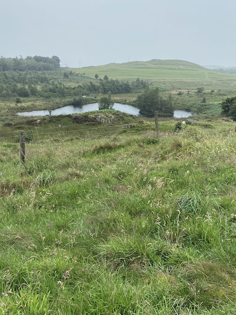
Another small lake came into view near Simpson’s ground allotment but there was a “private” sign on the gate. Approaching Poor House Allotment we were met by 2 drenched mountain bikers on what looked like very expensive bikes. I didn’t get a photo as we were negotiating a gate for them to pass through without alighting.
Private pond on Simpsons Allotment
Rain was still sweeping across the fells, sometimes you could see a hill the next nothing. Sheila had completely lost her bearings at this point and thought we should have been going in a different direction. I checked the map and showed her where we were and where we were heading. Because of the weather it did seem as though we were walking further than we actually were. I’m glad I decided to change our planned route for a shorter one.
When we reached the minor road at Poor House we turned left (north east) heading for Foxfield Farms. The rain eased a little and it was a bit brighter. The narrow road eventually turned into a track and walking was pleasant and easy although with numerous undulations. I noticed 2 logging vehicles tucked away but I managed a photo. I’m not sure of the make or model.
Marshall 802 2WD tractor at Foxfield Farm. Circa 1982/4
The track eventually brought us back into the grounds of Sow How Farm where we took a side track to another lake which we spotted through the trees. Appropriately named Sow How Tarn. We had seen people there earlier and thought it would be a good spot to have a coffee etc. We were quite peckish now.
Unfortunately once again the “private” sign was in abundance, stopping us from going to the waters edge. We found a large tree stump for baggin’ time.
The tarn is not natural but a man made Fishery with a very nice boathouse.
Late lunch spot at Sow How Tarn.Sow How Tarn.No idea.
At the start of the next shower we packed up and headed back towards the farm. Good to see the farmer was a Massey Ferguson fan as there must have been 6 or 7 tractors parked up. I managed a photo of a couple of them.
Once again, instead of entering the woodland, we stayed on the farm road where we reached the minor fell road leading back to the car park.
Somebody must have been looking after us because we had only just taken our boots off and sat in the car finishing what was left of our coffee when the heavens opened. It was a huge downpour and I felt sorry for all the people out, walking Gummers How etc with only lightweight gear, if any, they would have been totally soaked to the skin.
Luckily back at the car.
Route..... 11km 3.5hrs.


Your battling with adverse conditions up there reminds me of my own trips around that terrain. For some reason they always seem to have been hard going. One particularly memorable outing was with Bowland Climber back in December 2014 during my "Geocaching Period.
ReplyDelete"https://conradwalks.blogspot.com/search?q=Simpson+Ground
I will go back and have another read.
DeleteI think that sign is the Forestry Commission (are they called Forestry England now?) walking route sign. I would say 'waymark' but it doesn't seem to indicate a direction! I've certainly seen quite a few of them over the years.
ReplyDeleteFun fact about Gummer's How: when I was around 1 year old I was transported up that hill in a baby carrier on my father's back. At some point in the outing he tripped, went flying and, in the process, catapulted me out of the carrier. There was a collision between my head and a rock and it must have been reasonably dramatic as I can still just about make out the scar on my forehead. (I didn't count that visit to the hill for Marilyn-bagging purposes, and have subsequently been back on foot!)
Thanks Gayle I have now found that sign on the Forestry Commission website. Sometimes it has “Walkers Welcome” written around the edge. Well that’s a new one for me. I may have seen it before but I cannot recall it. So thanks again.
DeleteYour first accent and first flight had us both laughing. I bet there was a few tears from you and some harsh words from your mum. What an introduction to the hills.
Excellent. A great report, and an interesting admission from Gayle. (That could explain a lot!?)
ReplyDeleteThanks Martin. It certainly didn’t hold Gayle back, that’s for sure.
Delete