Thursday 9th May 2024.
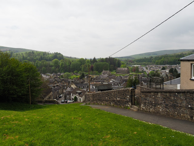
Whita hill is another prominent height surrounding the village of Langholm. On it's top is a white sandstone monumental needle built to commemorate Major General Sir John Malcolm. There is also a communication mast. Both these objects can be seen for miles around.
Our walk is also number 8 on the Langholm walks list and is classified as MODERATE.
The weather forecast said it would be a cloudy day but it was clear blue sky, no breeze and warming up. A perfect walking day.
Walking past Kilngreen Carpark a fair was being set up for a long weekend. There was the usual caravans and facetiously I said to Sheila "I wonder if they will be allowed to sleep over on the carpark"?
Anyway, across Saw Mill Bridge we went, aptly named from the old (yes you have guessed it) saw mill which used to be on the West Bank of the Ewes river. It used to be water driven as a leat was taken from the river further up stream. The mill or where the mill was is now part of the Baccleuch Estate. The leat long gone.
Before reaching a nice lodge house, turn right and follow a good track rising gradually. When a bungalow is reached take a look right for good views of the days target top. Take a right and follow the path which again has great views and is a pleasure to follow.
Soon a gate is reached across the track, go through it and continue on the track to the end of the wall, turn right and look for a galvanised modern kissing gate, don't be tempted to take the steep grassy route straight down to the road.
Go through the gate and follow the left hand fence line all the way round until a LRT (Land Rover track) is reached. Follow this down to a gate and join the main A7 road.
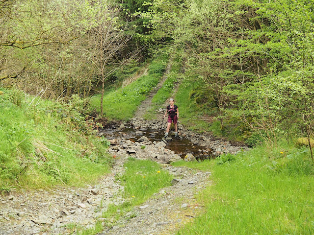
Follow this track on level ground all the way until you cross a small burn by a culverted bridge. Follow the path round to the right and a little higher up the path opens out and a path drops off to the left where a ford is crossed. Take the ford and take the onward rising path. On the left the area is known as Target Burn.
The views now are stunning.
The route upwards basically follows the fence line. The ground is wet in places, not much of a path but the views get better.
Many ewes with new born lambs kept us company. One lamb in particular was incredibly friendly and came right up to us for a few minutes. Luckily when we got on our way it didn't follow us but bleated for mum.
A sandy track was followed to a galvanised gate. The route doesn't go through the gate but turns left, follows the fence line until gaining the moorland road between Langholm and Newcastleton.
Across the road we took advantage of a bench for lunch. We started to loose the blue sky and the temperature was taking a dip so onwards and upwards.
A little further up the road we came to a fine memorial.
The memorial is to Hugh Macdiarmid who was born Christopher Murray Grieve on 11th August 1892. He was a co-founder of the SNP. The poet was educated in Langholm and is buried there.
John Malcolm joined the East India Company at 13 yrs old. Becoming a cadet in Madras he saw active duty against Tipu Sahib, the Sultan of Mysore.
Apart from this monument on Whita Hill there are also monuments in Bombay and Westminster Abbey.
We were losing the light and the far distant views. After taking a few photos we headed off down hill to find the Whita Well.
It's quite a steep drop off the top and care is needed in wet weather. Today we were fine and soon came to the cairn and well of the Common Riding.
The wells water is pure and can be tried with the chained up metal cup attached which we did.


More of this excellent hill walking country. Before I got rid of my caravan I had planned a stay in that area but never got round to it. I suppose I did something else, but there is so much to do and not enough time, and these days so many medical appointments and the like getting in the way.
ReplyDeleteWe will be going back asap but we want to go to Wales for some reason. I can’t think why! Next time we go we will probably backpack the hills as long as it’s not a long dry spell as the hills have little water. I know all about medical appointments Conrad. I seem to be living there at the moment.
ReplyDelete