8th May 2024.
We arrived in Langholm Scotland, pronounced “Lang um” by locals, yesterday afternoon. A very pleasant day weather wise but the drive up was very busy considering it was the day after a bank holiday.
The main car park in the village was quiet and also "Free" which was nice to see, you can also leave your vehicle overnight but you cannot sleep in it overnight or have BBQ's cooking etc. After a short break we set off to do a couple of short walks around the village just to get our bearings. We were staying in the Eskdale Hotel for 3 nights. Spoiling ourselves.
I didn’t sleep well, I had a bit of a sore throat and i kept Sheila awake with my coughing. But, a walk was planned and that was what we were here to do, and so it was, after a good Scottish breakfast we set off.
The day was much overcast with a bit of a chilly breeze as we gained height but it wasn’t raining and the tops were clearing slowly.
Our walk today was picked from the splendid brochure of 14 Waymarked Walks. It was number 9 headed Calfield Rig and Mid Hill and was classed as STRENUOUS.
We didn't do the walk exactly the same as the brochure suggests, we actually went up to Mid Hill first.
Leaving the Eskdale Hotel or the Village Car Park for that matter, we crossed Town Bridge which Telford had worked on as an apprentice stonemason. Carry on alongside the B7068 road, crossing the junction and then turn left at Eskdaill Street. Walk along the right hand side of the street until the end of what look like 1970 council flats and before the older terraced houses. Turn right here and look for the staircase at the edge of the woodland.
At the top of the staircase you join a wide track, bearing right and in front of a renavated lodge type house go left and follow it alongside some modern houses to a junction of 3 paths. We took the middle one which is heading eastward and uphill.
Views of Langholm and the surrounding hills start to open up as you exit the green lane into open countryside. It was surprising to us just how much of a bowl Langholm sits in because you don't realise that from walking around the village.
Grey overcast view looking across to Langholm and Whita Hill in the background.
From here the path is clear until you come to a "Shed" type building on the hillside where the track goes to the left of it and gains height. A path is not a necessity as you just keep going up hill. There were cows on the hill but they were no bother.
We soon gained our first top which is Meikleholm Hill at 262 Metres.
The sky looked ominously dark over to the north to Bauchle Hill and Hog Fell but to the south it was light and clear and we were hopeful our route would be fine.Sheila on Meikleholm Hill. Not sure what the concrete slab was for.
Our next Top of the day Mid Hill. (Can you spot the trig point)
Dropping down off Meikleholm Hill you soon come to wall line with a galvanised gate. Go through the gate and ascend the hill staying on the right side of the rising fence.
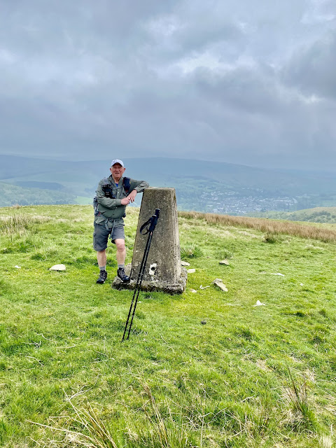
Mid Hill has commanding views and a great place to picnic on a sunny day. Today it was a bit chilly and not a place to stay too long. Mid Hill is 327 Metres and supports an OS Trig Point number BM10244.
Mid Hill Trig Point
Another drop down and a climb up to Black Knowe at 326 Metres. We had read that from here you can see the Solway Firth and the hills of Northern Lakeland. But not today. Those black clouds were closing in.
Views from Black Knowe
Having a walk around the top of Black Knowe we saw a new construction which looks very out of place here in the Glen of Craig Burn. No idea what it could be. Later we found out that it was Scotlands first legal Cannabis farm. How did that monstrosity get planning permission in such a remote green belt landscape. I hear that it was all done very quickly and there were no local objections. I find that a bit worrying as well as a bit surprising that there wasn't one objection? When I looked at Langholm news this article came on the timeline. Here. Seems a real co-incidence or maybe my imagination.
Scotlands "First" legal Cannabis farm. What with wind farms taking over the hills there doesn't seem to be much care about the hills here, just a few making lots of dosh.
Anyway, back to the nicer things. We retraced our steps back to the fence line where there is a stile giving access south to Craighope Head 315 metres. This is a top but hardly worth a mention apart from the views over the forestry. The views are probably more expansive on a good day.

View from
Craighope Head westward to the Craig Wind Farm. Skies clearing a bit.
At this point it is easy to make a mistake if you don't know the area and you are just using the information on the way marked information sheets.
Like any other hike it is important that you can read a map and compass and carry one. In bad weather as well as in fine.
The obvious route that your eye and brain tell you to take is the path which goes across to Naze Hill. But we need to follow the fence line heading in a south west direction and at the corner of the fence head uphill to the left on pathless terrain and head along the ridge to Calfield Rig at 319 metres. Some sheep tracks can be found which lead generally to the top.
It is a steady plod to the top with good view opening up to the south where there was also our first glimpse of blue sky. A boggy bit of terrain was crossed and we came across a cuckoo flower.
Cuckoo Flower
View to Calfield Rig 319 metres with Lea Gill on the left.
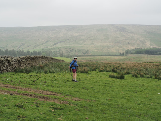
From Calfield Rig, our last top of the day, yet another fence line is followed down hill towards a Walled field. This area was particularly muddy today and the gate was tied up in such a way that it was easier to climb the gate. We followed the wall round to the right going down hill to where it joins a LRT on the left. This is a very pleasant track and leads all the way to Becks Farm.
Having climbed the gate, (Just out of shot), we followed the wall down hill to a LRT just to the left of Sheilas shoulder.
LRT to Becks Farm.
Mint Sauce anyone?
A delightful spot. Becks Farm with Naze Hill behind.
A minor road was followed from here until we reached to junction with the B7068 where we turned right and over the River Wauchope Bridge. Beyond the bridge a path bears left and continues on a beautiful route following Wauchope Water in the gorge with its waterfalls and pools. It is known as Gaskells Walk. It can be a bit slippery so care should be taken as in some points there is quite a steep drop down to the water.
Wauchope Water Bridge.
In the mature woodland of Gaskells Walk. A delightful last couple of Km's.
Gaskells walk brings you out back in the village at a church with a playground. A short walk over the pedestrian bridge leads back to the main road and the car park or the Eskade Hotel in our case.
We ended our walk with a coffee and cake in First Bites and we can recommend this place highly.
Our route, Anti-clockwise. 12 km, 4 hrs. With stops and photographs.
We are all different in health and fitness standards and what is Strenuous to some is a doddle to others. Personally I wouldn't say this was a strenuous walk I would say it would be Taxing depending on the weather. It is rolling hills not crags and there are no rocky sections.
Dogs must be on a lead as there is stock everywhere.
Map required:- OS Explorer number 323 Eskdale and Castle O'er Forest.


That’s a nice stroll Alan, if a bit ‘strenuous!
ReplyDeleteConsidering it was our first hills for sometime I think we did quite well. Lovely area but hardly “strenuous” to people who hike regularly. But not everyone hikes.
ReplyDeleteLook like splendid walking country that we have all probably driven past any times on our way further north.
ReplyDeleteHi Conrad, That is exactly how I got to know Langholm. We would stop there and buy award winning pies from the butchers on High St. when going north. Unfortunately this has now closed down. It may be a result of the Co op taking away business. But they are trying hard to bring visitors to the village and doing a good job. Not too far for you to travel either.
ReplyDelete