Wednesday June 12th 2024
I picked this route out from Walk Highlands (WH) library which I use quite a bit. Here
To extend this "short" walk we decided to walk a section of the West Highland Way South from Tyndrum and then a reverse route back. I will ignore this section for now.
The forum walk is graded as a 2 boot walk. Boggy in parts, pathless with some navigation required and overgrown in summer.
We didn't cross the busy A82 road into Auchtertyre farm but used a walkway located underneath the river bridge which gets you to the other side of the road in safety. Follow the farm road where there are a number of places to park a car if needed.
Walk across the bridge into the Wigwams complex. This is now closed I think, as all the "Cabins" were in poor condition and had numerous pad locks on each of them. From what we saw there is camping for West Highland Way Folk, but don't take my word for it, ring them or email them to be certain.
At the far side of the bridge on the left, a double galvanised gate, which is tied up needs to be entered. Here within a tall bush hides the finger post giving direction. Follow this lane up hill, there is no sign for Disabled Parking as far as we could see but there was a number of half hidden signs saying woodland walks but these are easily missed and are not part of this route.
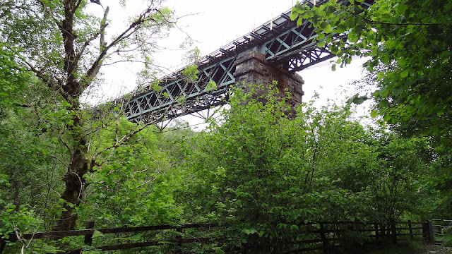
As you gain height you walk under a railway bridge which looks like a relic from the past, but it is still a main line track. Once into open country it becomes difficult to find a path on the ground. We set a compass bearing of NE and headed along the bearing up to 290 metres as per the map provided by WH.
Part way up we came across a wooded boardwalk across a dry burn and then a few stumps in the ground. We followed this sheep trail over a couple of other boardwalks and walked more or less parallel with the evergreen old forestry.
When the forestry gave way to newer deciduous woodland we looked for a stile or access through the fence. At a solar powered electric box beside the fence we found a stile. I checked the map and this was the stile shown on the WH map. Having crossed over there was a sort of track heading downwards. We followed this as best we could but it wasn't easy. It was massively overgrown and soaking wet through. Deep tussock grass with slippery descents.
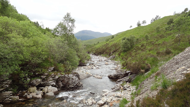
As we arrived as close as we wanted to get to the stream we headed up stream on a non existing path. We never found the picnic bench or footbridge.
Sheila was not a happy bunny. I was in front bashing my way through the jungle with a piece of old fence post I found. It was horrendous. I went slightly higher and I found a bit more access but it wasn't easy and in parts quite dangerous as the gorge was steep in parts.
At a point where we were about to give up we came across a boardwalk. Thankfully we now had a clearer route which led to a dam/water turbine and the footbridge leading upwards to a good farm track.
We sat down in the sun to dry off and have a coffee and sandwich. We wasn't sure whether to laugh or cry. That was horrible. We were also shattered.
The farm track is easy to follow and has good views all round. It passes some very old sheilings. When the path runs alongside the woodland and the gorge again we spotted the picnic table across the river. However the footbridge which is mentioned in the WH description is now fenced off and access has been denied. Please take note!
The track drops down you to the start of the walk.


All sounds familiar, brings back memories of being dragged off by some "friends" to follow an old railway line above Loch Lochy.
ReplyDeleteSheila looks happy in the photo.
I wonder what a walk with one boot would be like? Would you be allowed alternative footwear for the other foot?
Very sharp Conrad. I never gave it a thought at the beginning because I am so used to Walk Highlands grading system. I suppose it depends if the boot was on the other foot! Sheila was happy when we dried out and luckily the sun was with us.
ReplyDeleteFunnily enough I have often wondered what it would be like to walk that old railway line above Lochy.
DeleteJust reviving the old memory a bit more. I now recall we were mountain biking and the track ended in thick brambles and under/overgrowth, virtually impenetrable, and we made a perilous steep descent, unridable, back down to the road. We had strarted from the north east and ended somewhere near the southern end of Loch Lochy.
ReplyDelete