The weather forecast was better for Sunday than Saturday and that’s why we left our higher level route until today.
It was still dark when Sheila opened the curtains and i just pulled the sheets over my head and played dead for a minute or two. It will come light at some point, she said. I just muttered something like, well i will stay here until it does.
Any ways, i got up and checked the puddles in the bomb craters outside our house and it was raining. Not heavy but raining all the same. I thought the forecasters would get it wrong as usual.
Gradually dawn arrived (i don’t know where she'd been but i think she must have had a lie in too), we made progress getting the gear together and breakfast over. Off we went.
We parked up at SD889246. It was grey, misty, nippy but calm. We were the only car around and it was quiet. Strangely quiet. Maybe we are the only one’s up i told Sheila.
Here’s our route for today. We started and finished where it says 397 spot height near the base line. Map Scale 1:50,000

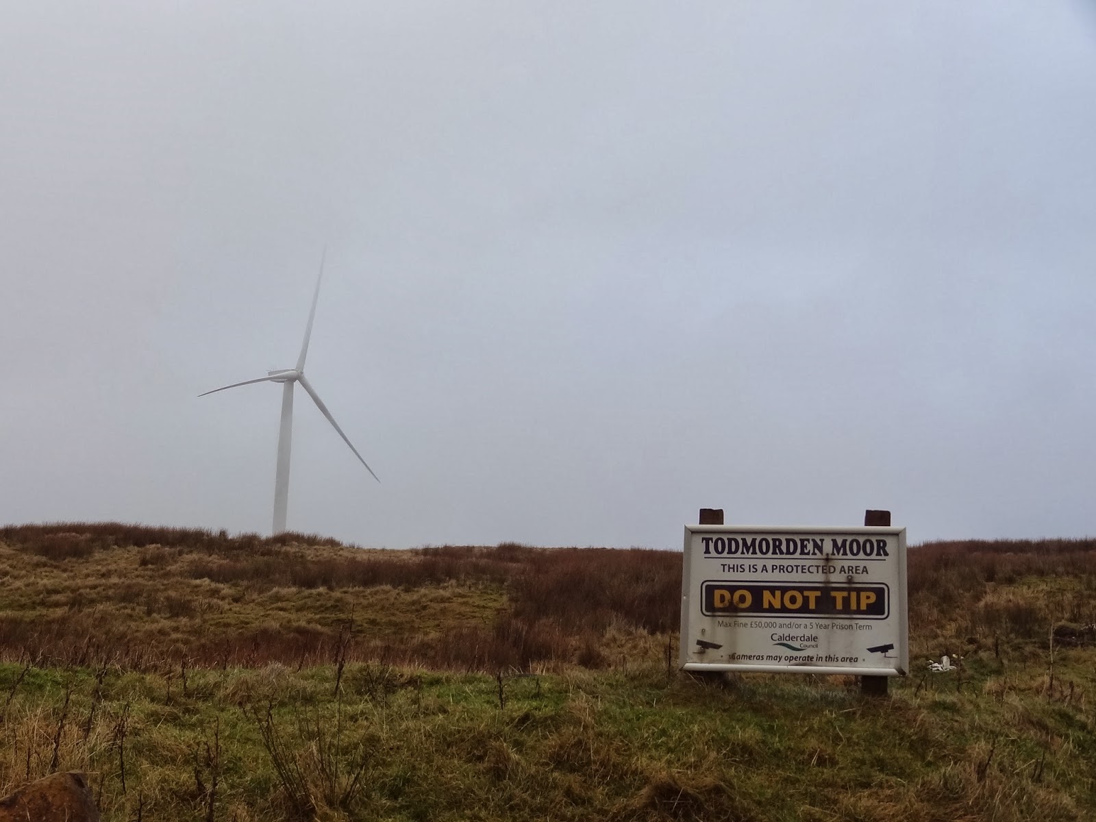
I noticed 2 more turbines had been erected on Todmorden Moor. That was a bit of a shock to the eyes. I now read that 5 of these are to be installed by Coronation Power even though the area is a protected area as the sign below points out.
A few hundred yards on a herd of large horned Highland cows were on the path. Sheila was a bit nervous of them but they were no problem.


The mist had all but gone now and we had a good view down the Calder Valley and across to Stoodley Pike. The heritage rail line passing through Portsmouth, Cornholme and Vale was clear.
I think Stoodley pike is visible from every bit of high ground in Lancashire and Yorkshire. We always seem to see it on our walks.


Chief Map reader and Whitaker Naze in the background

Heading for the reservoir below Dean Farm
This was our first visit to this area so much looking at the map took place. One prolonged spell was just beyond the reservoir as we headed up towards Black Scout. The 2 tracks which go NW towards a footbridge were not easy to locate so basically we just followed the line of the electricity pylons. We didn’t come across a (FB) footbridge but the track following the wall beyond the footbridge was visible on the ground and we followed it steeply to meet up with the wide Black Scout path.
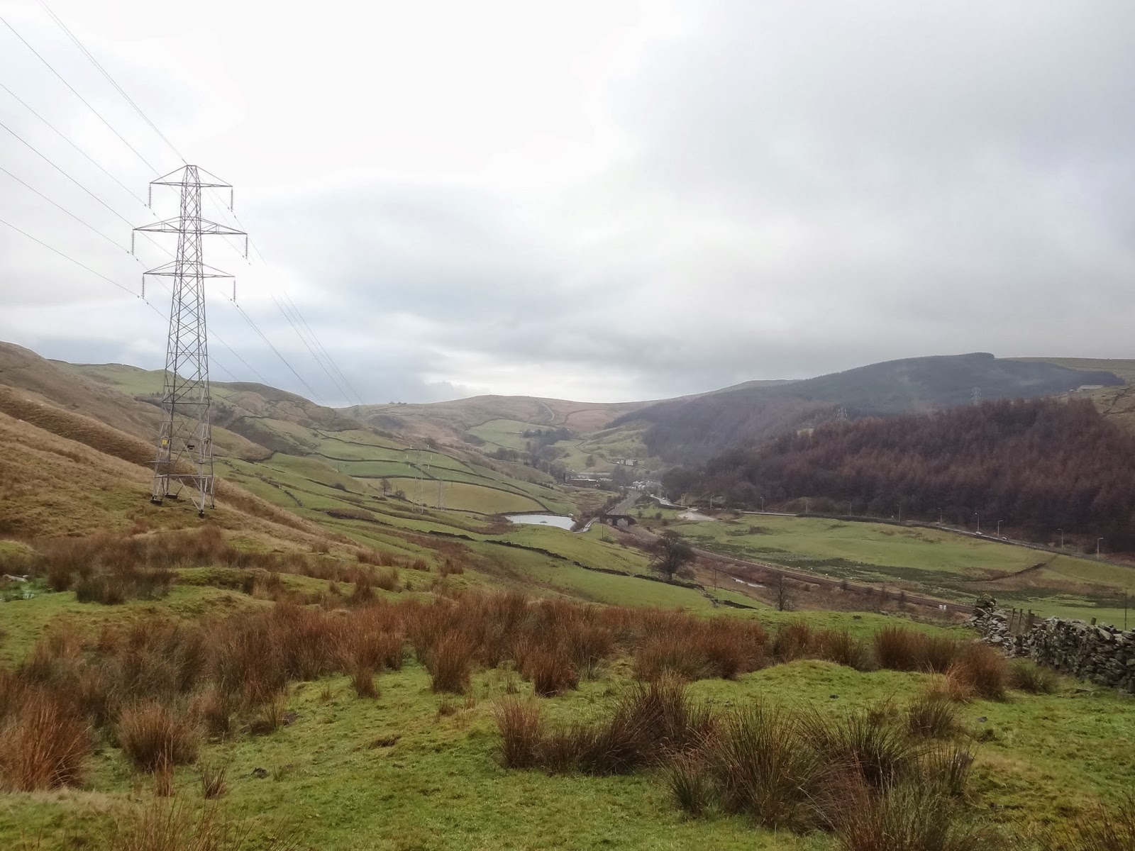
Following the pylon lines.

How green is our valley.
The path up Riddle Scout had us puffing and panting. Not many steep bits have been done for a while and it showed. Two walkers on the Black Scout path passed above us and these turned out to be the only walkers we saw the whole day.

View from the top and the waterfall at Rattan Clough

Black Scout path
We followed the wall for a while until we went under the power lines beyond the Lowe. Here we lost the path for a short distance. The two people we saw earlier were now only a few yards ahead and they said they would follow us as we seemed to know where we were going. We told them we didn’t know as it was our first time here. Picking up the farm track before Green Clough Wood we parted company. We headed SW to meet up again with the Main rd.

Which way?

The only 2 walkers we saw all day

Path heading through Berrils Green Wood.
At the road, we passed a very nice looking Inn with numerous picnic tables. Very enticing as the smell of food wafted around us. We carried on, making a note to come back here and try it one summer afternoon.

The Ram Inn at Holme Chapel
Our route turned south just passed the pub and led underneath the railway line into Buckley wood. I mentioned in passing to Sheila that this was quite a steep pull up to get onto the escarpment. I wasn’t wrong but the views made all the effort worth while. It turned out to be one of those up’s where you never seem to get to the top.

View of Thieveley Scout and the Parish of Cliviger from Dean Scout. The sun actually made an appearance.

Which way is up Sheila?

Bouldsworth Hill in the far distance and Beacon rock in the foreground.

Sheila approaches the trig point. Burnley in the distance.

After a couple of false summits we made it to the trig point of Thieveley Pike. 449M

It was now way past lunch time but it had been our choice not to do the steep bit on a full stomach so at the first bit of dry slab we had our first stop.
It was quite warm up top which was a bit of a surprise and the views excellent. Our route south was part of the Burnley way and very muddy in parts as had been most of the walk to be honest.

The view South east along the Burnley Way

Sun rays over Doals Village

As we dropped lower down the temperature dropped with it. We ended up having to put our shell jackets back on. By the time we reached the car it was indeed chilly and our breath was visible. There must have been a temperature inversion as it wasn’t this cold on the tops.

The last mile through Heald Top Farm. Farm has to be a loose description. Absolute dump is nearer the truth.
So, the route was 11.6 km long and Naismith says it should take a little over 3 hours. Well it took us over 4 1/2 hours. We only had a 15 minute stop but this was unknown territory and therefore many stops to look at the map and to take photo’s accounts for the disprepancy. It’s a grand walk.

Route profile.
Looks like a good varied walk. The photos are great when click to enlarge.
ReplyDeleteThanks Conrad. I'm pleased with the pics, it wasn't until I got back home that I realised I had the quality setting and the image size as low as it went. I forgot to change it back from a previous day.
DeleteIt sure is a nice area, plenty of up's and downs to get the knees working.
That look like nice country Alan. Possibly a few spots for a wild camp or two?
ReplyDeleteHi Dawn, Its very nice country and I will be doing some more of it asap. Some WC spots can definitely be found.
DeleteLooks like a good walk. Over 10k walks both Sat + Sun, lucky you (and it means you have recovered well!).
ReplyDeleteOh, I know the feeling when all you want to do in the morning is to pull the sheets over your head... I experience it almost every morning November - February...
Hi Maria,
DeleteIt has been a good weekend. We had some reasonable weather but its not going to last unfortunately. I'm not an early riser anymore if I don't need to. I had long enough getting up for work everyday at 5.45am..
Hi Alan. Nice wide open country that. Squelching seems to be the norm almost everywhere at present. As Conrad says, the photos are good.
ReplyDeleteThanks Gibson.
ReplyDeleteIt was another glorious sunrise today. Hope you got it too so that you could try out the new camera.
Heald Top Farm....
ReplyDeleteI have a fear of big dogs (well founded)....
Is it dog free going through Heald Top Farm ?
It sure is a mighty big blot on the landscape... shouldn’t Rossendale Council take a look ?
Anon, sorry I cannot remember big dogs, it’s too long ago. If we had been accosted I think I would have flagged it up. Maybe Rossendale council should take a look at the place.
ReplyDeleteI followed your route from Portsmouth past Dean Farm (which seems a bit walker-unfriendly with the right of way through the farmyard shut off) up to Black Scout and onwards, deviating to pass through Green Clough Wood and end in Holme Chapel. I was fascinated by the place marked "FB" on the OS map. I had a good look here. Somebody appears to have placed two flat stones side-by-side across the stream, not that crossing it is any issue. Could the Ordnance Survey consider this to be a footbridge?
ReplyDeleteSorry but I can’t remember the so called footbridge. Much water has gone under it since 2017. Hope you enjoyed it anyway.
DeleteI don’t think we had any problems around Dean Farm otherwise I would have pointed it out in the post. However it is a long while ago and things do change. I might consider re doing this walk and seeing what’s changed. Thanks.
DeleteIntrigued by reports of wild boar, I set out today to pass through Heald Top Farm then onto Todmorden Moor and then down to Cornholme on the path through the largish wood. One thing caught my eye at the farm, which was that the pigs could get out of their pen and wander around.
ReplyDeleteI have no wish to doubt you, but I just wonder if you had seen pigs from the farm that had wandered away a bit rather than wild boar. Frankly, it seems a bit of a push for there to be wild boar in that area.
Somebody asked about dogs. Previously passing through the farm I have seen a small and friendly dog in the farmyard. Today, it was accompanied by a much larger one, which also turned out to be very friendly, thankfully. This time there was also a man in the farmyard, perhaps the farmer, and he was calling the dogs to his side.
Walkers in the area might like to know there is a sandwich shop in Cornholme that also does hot drinks and cooked breakfasts at reasonable prices. It is at the foot of Pudsey Road opposite the old Frostholme Mill. It is open until 2 pm every day except Monday.
Thanks for the heads up and your comments.
Delete