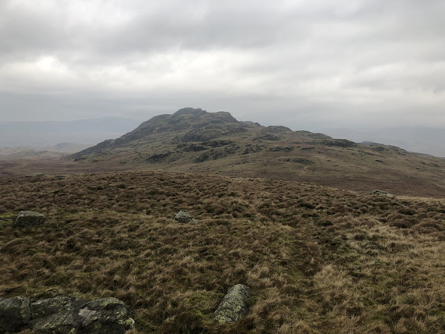
We had done a few jobs at our friends in Seathwaite, Duddon Valley and had a great time all round. It was now our last full day available for doing a walk so decided to do the one top on Birker Fell which i hadn't done and a couple of tops which Sheila hadn't done.
Weather wise it wasn't a bad day, chilly and overcast but calm.
We parked at Windy Gate, an aptly named cattle grid on the Birker Fell road.
There's a wall near the grid which runs roughly north east to south west across the fell, there's no footpath but there are plenty of sheep tracks which make life just a little easier. On the outbound journey we more or less hand railed the wall until we got to Iron Crag, Sheila hadn't done this top.
The views are extensive all along the route, Birker Fell is a huge tract of land and very undulating, an ideal place for beginners to practice compass work.
Just below the summit of Iron Crag there is a gate in the wall, so no need to climb over. The actual top is not the obvious first choice on the right of the gate but the very slightly higher top to the south.
From here we did the very short hop onto Ox Crag.
We returned onto Iron Crag and then noticed a large swimming pool shaped cut out in the ground. It was grown over and why we didn’t notice it when we walked over it, but when you looked down on it from higher up it’s obviously man made. I later asked our friend if he knew about it and he seemed to remember something about it being where peat was cut and used many years ago at High Stonythwaite.
It was only when I got home and downloaded my photographs that I noticed a second one.
The first trench.
The second trench on the left.
A large erratic on Iron Crag blocking our view of Harter Fell.
From the dip between Iron Crag and White How there’s a crag on a bit of higher ground. It’s not named on the map but I guess it’s just a rocky outcrop from its parent White How. We did it anyway. We had to stop at this point as the rain was too heavy for our windproofs and change to full waterproofs. In the few minutes it took to change gear we were quite wet. We watched the surrounding hills disappear. The Scafell group, then Bowfell, Harter Fell, Grey Friar. Its amazing just how fast the scene changed. The camera was put away. The rain eased after about 15 minutes to a light drizzle but the wind had picked up and the views worsened.
View across the Duddon Valley from Great Worm Crag. White Pike and Caw on the left.
Stickle Pike on the right.
Looking out cross the Duddon Estuary with a bit of sun breaking through.
I had planned to go up to Green Crag but decided not to bother. We have done it before so we headed east from White How but stayed on the high ground as best we could. The terrain is a mixture of boggy tussock grass. Easy to come a cropper if your not careful.
View to Green Crag from White How, between the showers.
Zoom view across to Devoke water. taken with iphone 6 hence pixelation.
Leaving Great Worm Crag it was interesting following the cairns which are marked by stars on the map. Not sure if there were prehistoric burials here. Worth checking out. Our last little top was Rough
Crag and beyond here it’s a boggy route back to the cattle grid and the car. We didn’t expect so much rain, but it’s normal on our outings. An hour or so back in Seathwaite the sun came out and blue sky took over. You just wouldn’t believe it was the same day.
Wallowbarrow crag, centre right. Iron Crag at the back.
Our route today which was a little over 8km.


It's not high ground but can be rough as you say and it's almost always quiet. One of the forgotten corners of the Lakes.
ReplyDeleteThanks for sharing Alan, I think on the whole you've probably done OK with the weather this trip.
Cheers
Alistair
Thanks for all your comments Alistair on our little jaunt. I love Birker Fell area it seems quite wild. I know it’s not wilderness but it seems it at times. It does get some wild weather but on a good day the views along the north south ridge line are fantastic.
DeleteYou've just brightened up my breakfast with that trip. All good stuff.
ReplyDeleteThanks Conrad.
DeleteNow that sounds a nice wee walk.
ReplyDeleteIt’s a very quiet area with good views. Ok for a backpack too.
ReplyDeleteTerrific area that. I'm not sure that I've been up Iron Crag - oh no, I shall have to go back!
ReplyDeleteHi Mark, it’s an I know well. Wonderful tops with great views. Worth a re visit.
ReplyDelete